Category:Idukki district
Zur Navigation springen
Zur Suche springen

English: Idukki (Malayalam: ഇടുക്കി ജില്ല, is one among the 14 districts of Kerala state, India. The district headquarters is located at Painavu. The name of the district is derived from the Malayalam word Idukki, meaning "narrow gauge". Idukki has an area of 5,105.22 km2 (1,971.1 sq mi) and is Keralas second largest district. Rugged mountains and forests cover about 97 percent of the total area of the district. Idukki borders the Kerala districts of Pathanamthitta to the south, Kottayam to the southwest, Ernakulam to the northwest, Thrissur to the north and Coimbature, and Dindigul and Theni districts in Tamil Nadu to the east. There are four taluks viz: Devikulam, Udumbanchola, Peermade and Thodupuzha and 65 villages in the district. There is only one Municipal town in the district is Thodupuzha, Munnar is census town.
9°51′0″N 76°56′24″E / 9.85°N 76.94°E
Distrikt in Indien   | |||||
| Medium hochladen | |||||
| Ist ein(e) | |||||
|---|---|---|---|---|---|
| Ort | Kerala, Indien | ||||
| Hauptstadt | |||||
| Datum der Gründung, Erstellung, Entstehung, Erbauung |
| ||||
| Einwohnerzahl |
| ||||
| Fläche |
| ||||
| Höhe über dem Meeresspiegel |
| ||||
| Verschieden von | |||||
| offizielle Website | |||||
 | |||||
Unterkategorien
Es werden 8 von insgesamt 8 Unterkategorien in dieser Kategorie angezeigt:
In Klammern die Anzahl der enthaltenen Kategorien (K), Seiten (S), Dateien (D)
*
Medien in der Kategorie „Idukki district“
Folgende 9 Dateien sind in dieser Kategorie, von 9 insgesamt.
-
 Cheeyappara Waterfalls 01.jpg 3.376 × 6.000; 8,88 MB
-
 Cheeyappara Waterfalls 04.jpg 3.376 × 6.000; 8,19 MB
-
 Early morning in Idukki.jpg 2.048 × 1.365; 142 KB
-
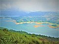 Idukki lake.jpg 2.048 × 1.536; 404 KB
-
 Mannathara padam .jpg 3.120 × 4.160; 3,76 MB
-
 Sengulam Dam - Kerala.jpg 6.000 × 3.376; 7,5 MB
-
 Sengulam Dam.jpg 6.000 × 3.376; 7,88 MB
-
 Specifications description board of Sengulam Dam- Kerala.jpg 6.000 × 3.376; 7,06 MB
-
 Suryanelli 001.jpg 6.000 × 4.000; 19,97 MB


