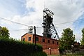
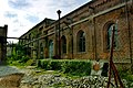
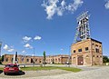
Category:Ignacy Mine in Rybnik
Jump to navigation
Jump to search
| Object location | | View all coordinates using: OpenStreetMap |
|---|
Polski: Rybnik Niewiadom - zespół zabudowy kopalni Ignacy - Hoym, XIX/XX w. Obiekt na Szlaku Zabytków Techniki Województwa Śląskiego
historic buildings complex and mining museum in Rybnik, Silesian Voivodeship, Poland  | |||||
| Upload media | |||||
| Instance of | |||||
|---|---|---|---|---|---|
| Part of |
| ||||
| Location | Niewiadom, Rybnik, Silesian Voivodeship, Poland | ||||
| Street address |
| ||||
| Has part(s) | |||||
| Heritage designation |
| ||||
| Inception |
| ||||
| official website | |||||
 | |||||
Media in category "Ignacy Mine in Rybnik"
The following 91 files are in this category, out of 91 total.
-
 2014 Rybnik, Zabytkowa Kopalnia Ignacy 01.jpg 2,851 × 4,277; 6.65 MB
-
 2014 Rybnik, Zabytkowa Kopalnia Ignacy 02.jpg 4,277 × 2,851; 6.7 MB
-
 2014 Rybnik, Zabytkowa Kopalnia Ignacy 03.jpg 2,556 × 3,990; 5.15 MB
-
 2014 Rybnik, Zabytkowa Kopalnia Ignacy 04.jpg 2,582 × 4,291; 5.42 MB
-
 2014 Rybnik, Zabytkowa Kopalnia Ignacy 05.jpg 2,179 × 3,706; 4.01 MB
-
 2014 Rybnik, Zabytkowa Kopalnia Ignacy 06.jpg 2,248 × 3,643; 3.85 MB
-
 2014 Rybnik, Zabytkowa Kopalnia Ignacy 07.jpg 2,046 × 4,232; 4.75 MB
-
 2014 Rybnik, Zabytkowa Kopalnia Ignacy 08.jpg 2,360 × 4,300; 5.7 MB
-
 2014 Rybnik, Zabytkowa Kopalnia Ignacy 09.jpg 2,706 × 4,225; 6.18 MB
-
 2014 Rybnik, Zabytkowa Kopalnia Ignacy 10.jpg 2,298 × 3,531; 3.81 MB
-
 2014 Rybnik, Zabytkowa Kopalnia Ignacy 11.jpg 2,279 × 3,967; 4.95 MB
-
 2014 Rybnik, Zabytkowa Kopalnia Ignacy 12.jpg 2,019 × 4,117; 5.71 MB
-
 2014 Rybnik, Zabytkowa Kopalnia Ignacy 13.jpg 2,400 × 4,185; 6.01 MB
-
 2014 Rybnik, Zabytkowa Kopalnia Ignacy 14.jpg 2,623 × 4,588; 6.47 MB
-
 2014 Rybnik, Zabytkowa Kopalnia Ignacy 15.jpg 2,485 × 3,684; 5.55 MB
-
 2014 Rybnik, Zabytkowa Kopalnia Ignacy 16.jpg 2,322 × 3,896; 5.7 MB
-
 2022-09 Rybnik - Zabytkowa Kopalnia Ignacy (10).jpg 2,592 × 3,872; 3.68 MB
-
 2022-09 Rybnik - Zabytkowa Kopalnia Ignacy (11).jpg 2,592 × 3,872; 3.85 MB
-
 2022-09 Rybnik - Zabytkowa Kopalnia Ignacy (12).jpg 2,592 × 3,872; 3.93 MB
-
 2022-09 Rybnik - Zabytkowa Kopalnia Ignacy (13).jpg 3,872 × 2,592; 3.86 MB
-
 2022-09 Rybnik - Zabytkowa Kopalnia Ignacy (14).jpg 2,592 × 3,872; 3.4 MB
-
 2022-09 Rybnik - Zabytkowa Kopalnia Ignacy (16).jpg 3,872 × 2,592; 4.25 MB
-
 2022-09 Rybnik - Zabytkowa Kopalnia Ignacy (18).jpg 3,872 × 2,592; 3.8 MB
-
 2022-09 Rybnik - Zabytkowa Kopalnia Ignacy (19).jpg 2,592 × 3,872; 3.76 MB
-
 2022-09 Rybnik - Zabytkowa Kopalnia Ignacy (20).jpg 3,872 × 2,592; 3.94 MB
-
 2022-09 Rybnik - Zabytkowa Kopalnia Ignacy (22).jpg 3,872 × 2,592; 3.49 MB
-
 2022-09 Rybnik - Zabytkowa Kopalnia Ignacy (23).jpg 2,592 × 3,872; 3.23 MB
-
 2022-09 Rybnik - Zabytkowa Kopalnia Ignacy (24).jpg 2,592 × 3,872; 2.33 MB
-
 2022-09 Rybnik - Zabytkowa Kopalnia Ignacy (26).jpg 2,592 × 3,872; 4.14 MB
-
 2022-09 Rybnik - Zabytkowa Kopalnia Ignacy (27).jpg 2,592 × 3,872; 3.27 MB
-
 2022-09 Rybnik - Zabytkowa Kopalnia Ignacy (28).jpg 3,872 × 2,592; 3.58 MB
-
 2022-09 Rybnik - Zabytkowa Kopalnia Ignacy (3).jpg 3,872 × 2,592; 3.57 MB
-
 2022-09 Rybnik - Zabytkowa Kopalnia Ignacy (30).jpg 3,872 × 2,592; 3.71 MB
-
 2022-09 Rybnik - Zabytkowa Kopalnia Ignacy (31).jpg 2,592 × 3,872; 3.93 MB
-
 2022-09 Rybnik - Zabytkowa Kopalnia Ignacy (32).jpg 2,592 × 3,872; 3.87 MB
-
 2022-09 Rybnik - Zabytkowa Kopalnia Ignacy (33).jpg 3,872 × 2,592; 3.54 MB
-
 2022-09 Rybnik - Zabytkowa Kopalnia Ignacy (34).jpg 3,872 × 2,592; 3.02 MB
-
 2022-09 Rybnik - Zabytkowa Kopalnia Ignacy (35).jpg 2,592 × 3,872; 3.75 MB
-
 2022-09 Rybnik - Zabytkowa Kopalnia Ignacy (36).jpg 2,592 × 3,872; 2.84 MB
-
 2022-09 Rybnik - Zabytkowa Kopalnia Ignacy (37).jpg 3,872 × 2,592; 4.14 MB
-
 2022-09 Rybnik - Zabytkowa Kopalnia Ignacy (5).jpg 3,872 × 2,592; 4.08 MB
-
 2022-09 Rybnik - Zabytkowa Kopalnia Ignacy (6).jpg 2,592 × 3,872; 3.52 MB
-
 2022-09 Rybnik - Zabytkowa Kopalnia Ignacy (7).jpg 3,872 × 2,592; 4.03 MB
-
 2022-09 Rybnik - Zabytkowa Kopalnia Ignacy (9).jpg 2,592 × 3,872; 3.83 MB
-
 Bludný balvan, památník, Zabytkowa kopalnia Ignacy, Polsko 2.jpg 6,944 × 9,248; 30.61 MB
-
 Bludný balvan, památník, Zabytkowa kopalnia Ignacy, Polsko 3.jpg 6,944 × 9,248; 29.16 MB
-
 Bludný balvan, památník, Zabytkowa kopalnia Ignacy, Polsko 4.jpg 6,944 × 9,248; 24.71 MB
-
 Budynek maszyny wyciągowej szybu Głowacki - KWK IGNACY-HOYM.jpg 6,000 × 4,000; 16.52 MB
-
 Budynek maszyny wyciągowej szybu Kościuszko - KWK IGNACY-HOYM.jpg 6,000 × 4,000; 20.75 MB
-
 Elektrownia, ob. sprężarkownia - KWK IGNACY-HOYM.jpg 5,681 × 3,787; 15.9 MB
-
 Historical coal mine Hoym-Ignatius (8855330335).jpg 3,216 × 2,136; 4.7 MB
-
 Rybnicka zabytkowa kopalnia . W tle KWK "Jankowice"..JPG 5,038 × 3,359; 12.11 MB
-
 Rybnik Ignacy2011.jpg 729 × 972; 211 KB
-
 Rybnik Niewiadom kopalnia Ignacy tablica.jpg 2,760 × 1,998; 1.47 MB
-
 Rybnik Niewiadom szyb Głowacki.jpg 1,984 × 3,161; 867 KB
-
 Rybnik Niewiadom szyb Kościuszko maszyna wyciągowa.jpg 3,096 × 2,154; 1.15 MB
-
 Rybnik Niewiadom szyb Kościuszko maszyna wyciągowa43.jpg 2,658 × 1,914; 1.01 MB
-
 Rybnik Niewiadom szyb Kościuszko.jpg 2,052 × 3,330; 979 KB
-
 Rybnik Niewiadom wieża ciśnień.jpg 1,680 × 3,294; 780 KB
-
 Rybnik, Ignacy Mine 01.jpg 4,160 × 3,120; 2.5 MB
-
 Rybnik, Ignacy Mine 02.jpg 3,124 × 2,271; 1.02 MB
-
 Rybnik, Ignacy Mine 03.jpg 4,160 × 3,120; 2.52 MB
-
 Rybnik, Ignacy Mine 04.jpg 3,040 × 4,144; 2.1 MB
-
 Rybnik, Ignacy Mine 05.jpg 4,160 × 2,513; 2.35 MB
-
 Rybnik, Ignacy Mine 06.jpg 4,160 × 3,120; 1.93 MB
-
 Rybnik. Kopalnia Ignacy. Parowa maszyna wyciągowa1.JPG 3,648 × 2,736; 1.72 MB
-
 Rybnik. Kopalnia Ignacy. Parowa maszyna wyciągowa2.JPG 3,648 × 2,736; 1.6 MB
-
 Rybnik. Kopalnia Ignacy. Parowa maszyna wyciągowa3.JPG 3,648 × 2,736; 2.03 MB
-
 Rybnik. Kopalnia Ignacy. Widok z wieży wodnej.JPG 3,648 × 2,736; 2.32 MB
-
 Rybnik. Kopalnia Ignacy1.JPG 3,648 × 2,736; 1.96 MB
-
 Rybnik. Kopalnia Ignacy2.JPG 2,736 × 3,648; 1.88 MB
-
 Rybnik. Kopalnia Ignacy3.JPG 3,648 × 2,736; 1.7 MB
-
 Rybnik. Kopalnia Ignacy4.JPG 3,648 × 2,736; 1.42 MB
-
 Stara kopalnia Ignacy.jpg 3,697 × 5,546; 11.3 MB
-
 Szyb "Graf Reden" z 1856 roku . Wystawiony na sprzedaż ..JPG 5,616 × 3,744; 19.9 MB
-
 Szyb Głowacki - KWK IGNACY-HOYM.jpg 3,824 × 5,736; 15.85 MB
-
 Szyb Głowacki.jpg 5,366 × 3,012; 6.93 MB
-
 SZYB Kościuszko z pomnikiem - KWK IGNACY-HOYM.jpg 4,000 × 6,000; 19.79 MB
-
 Wieża ciśnień kopalni Ignacy.jpg 2,918 × 5,198; 11.4 MB
-
 Zabytkowa kopalnia "Ignacy" - przemasban117.JPG 3,456 × 5,184; 14.18 MB
-
 Zabytkowa kopalnia "Ignacy" - przemasban118.JPG 3,456 × 5,184; 10.66 MB
-
 Zabytkowa kopalnia "Ignacy" - przemasban119.JPG 3,456 × 5,184; 15.5 MB
-
 Zabytkowa kopalnia "Ignacy" - przemasban120.JPG 3,456 × 5,184; 7.86 MB
-
 Zabytkowa kopalnia "Ignacy" - przemasban121.JPG 3,456 × 5,184; 7.89 MB
-
 Zabytkowa kopalnia "Ignacy" - przemasban122.JPG 3,456 × 5,184; 9.28 MB
-
 Zabytkowa kopalnia "Ignacy" - przemasban123.JPG 3,456 × 5,184; 11.43 MB
-
 Zabytkowa kopalnia Ignacy na Niewiadomiu - panoramio.jpg 1,536 × 2,048; 641 KB
-
 Zabytkowa kopalnia Ignacy, Rybnik, Slezské vojvodství, Polsko 01.jpg 9,248 × 6,944; 21.31 MB
-
 Zabytkowa kopalnia Ignacy, Rybnik, Slezské vojvodství, Polsko 02.jpg 6,944 × 9,248; 22.39 MB
-
 Zabytkowa kopalnia Ignacy, Rybnik, Slezské vojvodství, Polsko 03.jpg 6,944 × 9,248; 22.02 MB
-
 Zabytkowa kopalnia Ignacy, Rybnik, Slezské vojvodství, Polsko 04.jpg 6,944 × 9,248; 27.78 MB


.jpg)
.jpg)
.jpg)
.jpg)
.jpg)
.jpg)
.jpg)
.jpg)
.jpg)
.jpg)
.jpg)
.jpg)
.jpg)
.jpg)
.jpg)
.jpg)
.jpg)
.jpg)
.jpg)
.jpg)
.jpg)
.jpg)
.jpg)
.jpg)
.jpg)
.jpg)
.jpg)
.jpg)


.jpg)


