Category:Ilhéu de Monchique
Jump to navigation
Jump to search
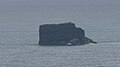
English: Ilhéu do Monchique, the westernmost point of Portugal and Europe (if considered part of Europe, though it sits on the North American Plate, If not, then the Capelinhos Volcano.)
| Object location | | View all coordinates using: OpenStreetMap |
|---|
island in Portugal   | |||||
| Upload media | |||||
| Instance of | |||||
|---|---|---|---|---|---|
| Part of | |||||
| Location | Azores, Portugal | ||||
| Located in or next to body of water | |||||
| Width |
| ||||
| Length |
| ||||
| Population |
| ||||
| Area |
| ||||
 | |||||
Media in category "Ilhéu de Monchique"
The following 3 files are in this category, out of 3 total.
-
 Azores Flores Monchique.jpg 1,113 × 742; 370 KB
-

-
 Monchique islet Azores.jpg 1,216 × 681; 148 KB

