Category:Im Hain (FNa Ruhland)
Jump to navigation
Jump to search
| Object location | | View all coordinates using: OpenStreetMap |
|---|
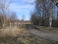
Diese Kategorie umfasst den alten Flurnamen Im Hain in der Gemarkung Ruhland.
Pages in category "Im Hain (FNa Ruhland)"
The following 2 pages are in this category, out of 2 total.
Media in category "Im Hain (FNa Ruhland)"
The following 25 files are in this category, out of 25 total.
-
 Ruhland, Fischerstraße, vom Haingraben westwärts, Winter.jpg 2,272 × 1,704; 761 KB
-
 Ruhland, Im Hain (FNa), Blick vom Hainweg nach Nordnordost.jpg 2,272 × 1,704; 395 KB
-
 Ruhland, Im Hain (FNa), Blick vom Hainweg nach Nordwest.jpg 2,272 × 1,704; 420 KB
-
 Ruhland, Im Hain (FNa), Blick vom Hainweg nach Westen.jpg 2,272 × 1,704; 417 KB
-
 Ruhland, Im Hain (FNa), Winter 01.jpg 2,272 × 1,704; 638 KB
-
 Ruhland, Im Hain (FNa), Winter 02.jpg 2,272 × 1,704; 592 KB
-
 Ruhland, Im Hain (FNa), Winter 03.jpg 2,272 × 1,704; 657 KB
-
 Ruhland, Im Hain (FNa), Winter 04.jpg 2,272 × 1,704; 686 KB
-
 Ruhland, Im Hain (FNa), Winter 05.jpg 2,272 × 1,704; 792 KB
-
 Ruhland, Im Hain (FNa), Winter 06.jpg 2,272 × 1,704; 833 KB
-
 Ruhland, Im Hain (FNa), Winter 07.jpg 2,272 × 1,704; 891 KB
-
 Ruhland, Im Hain (FNa), Winter 08.jpg 2,272 × 1,704; 788 KB
-
 Ruhland, Im Hain (FNa), Winter 09.jpg 2,272 × 1,704; 825 KB
-
 Ruhland, Im Hain (FNa), Winter 10.jpg 2,272 × 1,704; 624 KB
-
 Ruhland, Im Hain (FNa), Winter 11.jpg 2,272 × 1,704; 566 KB
-
 Ruhland, Im Hain (FNa), Winter 12.jpg 2,272 × 1,704; 530 KB
-
 Ruhland, Im Hain (FNa), Winter 13.jpg 2,272 × 1,704; 451 KB
-
 Ruhland, Im Hain (FNa), Winter 14.jpg 2,272 × 1,704; 519 KB
-
 Ruhland, Im Hain (FNa), Winter 15.jpg 2,272 × 1,704; 371 KB
-
 Ruhland, Im Hain (FNa), Winter 16.jpg 2,272 × 1,704; 400 KB
-
 Ruhland, Im Hain (FNa), Winter 17.jpg 2,272 × 1,704; 581 KB
-
 Ruhland, Im Hain (FNa), Winter 18.jpg 2,272 × 1,704; 464 KB
-

-

-


,_Blick_vom_Hainweg_nach_Nordnordost.jpg)
,_Blick_vom_Hainweg_nach_Nordwest.jpg)
,_Blick_vom_Hainweg_nach_Westen.jpg)
,_Winter_01.jpg)
,_Winter_02.jpg)
,_Winter_03.jpg)
,_Winter_04.jpg)
,_Winter_05.jpg)
,_Winter_06.jpg)
,_Winter_07.jpg)
,_Winter_08.jpg)
,_Winter_09.jpg)
,_Winter_10.jpg)
,_Winter_11.jpg)
,_Winter_12.jpg)
,_Winter_13.jpg)
,_Winter_14.jpg)
,_Winter_15.jpg)
,_Winter_16.jpg)
,_Winter_17.jpg)
,_Winter_18.jpg)


