Category:Indian Mound Cemetery (Romney, West Virginia)
Jump to navigation
Jump to search
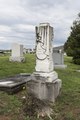
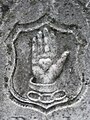
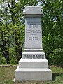
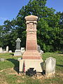
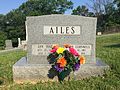
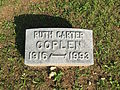
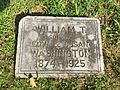
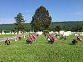
English: Indian Mound Cemetery is a cemetery located along the Northwestern Turnpike (U.S. Route 50) on a promontory of the "Yellow Banks" overlooking the South Branch Potomac River and Mill Creek Mountain in Romney, West Virginia, United States. The cemetery is centered around a Hopewellian mound, known as the Romney Indian Mound. Indian Mound Cemetery is also the site of Fort Pearsall, the First Confederate Memorial, Parsons Bell Tower, and reinterments from Romney's Old Presbyterian Cemetery. The cemetery is currently owned and maintained by the Indian Mound Cemetery Association, Inc.
| Object location | | View all coordinates using: OpenStreetMap |
|---|
cemetery in Hampshire County, West Virginia  | |||||
| Upload media | |||||
| Instance of | |||||
|---|---|---|---|---|---|
| Location |
| ||||
| Inception |
| ||||
 | |||||
Subcategories
This category has the following 5 subcategories, out of 5 total.
Media in category "Indian Mound Cemetery (Romney, West Virginia)"
The following 139 files are in this category, out of 139 total.
-
 Cemetery at edge of Romney1a34276v.jpg 1,024 × 718; 252 KB
-
 Gravesites at the Indian Mound Cemetery in Romney, West Virginia LCCN2015631521.tif 7,360 × 4,912; 206.94 MB
-
 Gravesites at the Indian Mound Cemetery in Romney, West Virginia LCCN2015631522.tif 7,360 × 4,912; 206.94 MB
-
 Gravesites at the Indian Mound Cemetery in Romney, West Virginia LCCN2015631523.tif 4,818 × 7,219; 199.11 MB
-
 Gravesites at the Indian Mound Cemetery in Romney, West Virginia LCCN2015631524.tif 4,912 × 7,360; 206.96 MB
-
 Indian Mound Cemetery Romney WV 2005 09 16 01.jpg 2,048 × 1,536; 1.1 MB
-
 Indian Mound Cemetery Romney WV 2005 09 16 04.jpg 2,048 × 1,536; 1.03 MB
-
 Indian Mound Cemetery Romney WV 2005 09 16 05.jpg 2,048 × 1,536; 937 KB
-
 Indian Mound Cemetery Romney WV 2010 04 25 01.JPG 3,072 × 2,304; 2.96 MB
-
 Indian Mound Cemetery Romney WV 2010 04 25 02.JPG 3,072 × 2,304; 2.3 MB
-
 Indian Mound Cemetery Romney WV 2010 04 25 03.JPG 2,304 × 3,072; 2.82 MB
-
 Indian Mound Cemetery Romney WV 2010 04 25 04.JPG 3,072 × 2,304; 2.13 MB
-
 Indian Mound Cemetery Romney WV 2010 04 25 06.JPG 3,072 × 2,304; 1.5 MB
-
 Indian Mound Cemetery Romney WV 2010 04 25 07.JPG 3,072 × 2,304; 2.74 MB
-
 Indian Mound Cemetery Romney WV 2010 04 25 08.JPG 3,072 × 2,304; 2.34 MB
-
 Indian Mound Cemetery Romney WV 2010 04 25 09.JPG 2,304 × 3,072; 2.94 MB
-
 Indian Mound Cemetery Romney WV 2010 04 25 10.JPG 2,304 × 3,072; 1.9 MB
-
 Indian Mound Cemetery Romney WV 2010 04 25 12.JPG 2,304 × 3,072; 2.81 MB
-
 Indian Mound Cemetery Romney WV 2010 04 25 13.JPG 3,072 × 2,304; 2.58 MB
-
 Indian Mound Cemetery Romney WV 2010 04 25 14.JPG 2,304 × 3,072; 2.94 MB
-
 Indian Mound Cemetery Romney WV 2010 04 25 15.JPG 3,072 × 2,304; 2.84 MB
-
 Indian Mound Cemetery Romney WV 2010 04 25 16.JPG 2,304 × 3,072; 1.94 MB
-
 Indian Mound Cemetery Romney WV 2010 04 25 17.JPG 3,072 × 2,304; 3.34 MB
-
 Indian Mound Cemetery Romney WV 2010 04 25 18.JPG 3,072 × 2,304; 3 MB
-
 Indian Mound Cemetery Romney WV 2010 04 25 19.JPG 3,072 × 2,304; 2.27 MB
-
 Indian Mound Cemetery Romney WV 2010 04 25 20.JPG 3,072 × 2,304; 3.05 MB
-
 Indian Mound Cemetery Romney WV 2010 04 25 21.JPG 2,304 × 3,072; 2.25 MB
-
 Indian Mound Cemetery Romney WV 2010 04 25 22.JPG 3,072 × 2,304; 1.74 MB
-
 Indian Mound Cemetery Romney WV 2010 04 25 23.JPG 2,304 × 3,072; 2.59 MB
-
 Indian Mound Cemetery Romney WV 2010 04 25 24.JPG 3,072 × 2,304; 3.1 MB
-
 Indian Mound Cemetery Romney WV 2010 04 25 30.JPG 3,072 × 2,304; 1.42 MB
-
 Indian Mound Cemetery Romney WV 2013 07 13 01.jpg 3,648 × 2,736; 3.05 MB
-
 Indian Mound Cemetery Romney WV 2013 07 13 02.jpg 3,648 × 2,736; 3.11 MB
-
 Indian Mound Cemetery Romney WV 2013 07 13 03.jpg 3,648 × 2,736; 3.6 MB
-
 Indian Mound Cemetery Romney WV 2013 07 13 04.jpg 3,648 × 2,736; 3.76 MB
-
 Indian Mound Cemetery Romney WV 2013 07 13 05.jpg 3,648 × 2,736; 2.6 MB
-
 Indian Mound Cemetery Romney WV 2013 07 13 06.jpg 2,736 × 3,648; 3.65 MB
-
 Indian Mound Cemetery Romney WV 2013 07 13 07.jpg 2,736 × 3,648; 2.63 MB
-
 Indian Mound Cemetery Romney WV 2013 07 13 08.jpg 2,736 × 3,648; 3.27 MB
-
 Indian Mound Cemetery Romney WV 2013 07 13 09.jpg 2,736 × 3,648; 3.2 MB
-
 Indian Mound Cemetery Romney WV 2013 07 13 10.jpg 2,736 × 3,648; 3.73 MB
-
 Indian Mound Cemetery Romney WV 2013 07 13 11.jpg 2,736 × 3,648; 3.26 MB
-
 Indian Mound Cemetery Romney WV 2013 07 13 12.jpg 3,648 × 2,736; 4.11 MB
-
 Indian Mound Cemetery Romney WV 2013 07 13 13.jpg 3,648 × 2,736; 3.64 MB
-
 Indian Mound Cemetery Romney WV 2013 07 13 14.jpg 2,736 × 3,648; 2.95 MB
-
 Indian Mound Cemetery Romney WV 2013 07 13 15.jpg 3,648 × 2,736; 3.61 MB
-
 Indian Mound Cemetery Romney WV 2013 07 13 16.jpg 3,648 × 2,736; 3.77 MB
-
 Indian Mound Cemetery Romney WV 2013 07 13 17.jpg 2,736 × 3,648; 4.74 MB
-
 Indian Mound Cemetery Romney WV 2013 07 13 18.jpg 2,736 × 3,648; 3.47 MB
-
 Indian Mound Cemetery Romney WV 2013 07 13 19.jpg 3,648 × 2,736; 4.19 MB
-
 Indian Mound Cemetery Romney WV 2013 07 13 20.jpg 2,736 × 3,648; 5.15 MB
-
 Indian Mound Cemetery Romney WV 2013 07 13 21.jpg 3,648 × 2,736; 4.21 MB
-
 Indian Mound Cemetery Romney WV 2013 07 13 22.jpg 3,648 × 2,736; 4.62 MB
-
 Indian Mound Cemetery Romney WV 2013 07 13 23.jpg 3,648 × 2,736; 4.52 MB
-
 Indian Mound Cemetery Romney WV 2013 07 13 24.jpg 3,648 × 2,736; 3.36 MB
-
 Indian Mound Cemetery Romney WV 2013 07 13 25.jpg 2,736 × 3,648; 4.14 MB
-
 Indian Mound Cemetery Romney WV 2013 07 13 26.jpg 2,736 × 3,648; 4.48 MB
-
 Indian Mound Cemetery Romney WV 2013 07 13 27.jpg 2,736 × 3,648; 3.72 MB
-
 Indian Mound Cemetery Romney WV 2013 07 13 28.jpg 2,736 × 3,648; 4.01 MB
-
 Indian Mound Cemetery Romney WV 2013 07 13 29.jpg 2,736 × 3,648; 3.16 MB
-
 Indian Mound Cemetery Romney WV 2013 07 13 30.jpg 2,736 × 3,648; 3.41 MB
-
 Indian Mound Cemetery Romney WV 2013 07 13 31.jpg 2,736 × 3,648; 3.65 MB
-
 Indian Mound Cemetery Romney WV 2013 07 13 32.jpg 3,648 × 2,736; 2.46 MB
-
 Indian Mound Cemetery Romney WV 2013 07 13 33.jpg 2,736 × 3,648; 2.46 MB
-
 Indian Mound Cemetery Romney WV 2013 07 13 34.jpg 2,736 × 3,648; 5.01 MB
-
 Indian Mound Cemetery Romney WV 2013 07 13 35.jpg 2,736 × 3,648; 4.85 MB
-
 Indian Mound Cemetery Romney WV 2013 07 13 36.jpg 2,736 × 3,648; 2.16 MB
-
 Indian Mound Cemetery Romney WV 2013 07 13 37.jpg 2,736 × 3,648; 4.96 MB
-
 Indian Mound Cemetery Romney WV 2013 07 13 38.jpg 2,736 × 3,648; 4.34 MB
-
 Indian Mound Cemetery Romney WV 2013 07 13 39.jpg 3,648 × 2,736; 3.64 MB
-
 Indian Mound Cemetery Romney WV 2013 07 13 40.jpg 2,736 × 3,648; 3.96 MB
-
 Indian Mound Cemetery Romney WV 2013 07 13 41.jpg 3,648 × 2,736; 3.87 MB
-
 Indian Mound Cemetery Romney WV 2013 07 13 42.jpg 3,648 × 2,736; 3.97 MB
-
 Indian Mound Cemetery Romney WV 2013 07 13 43.jpg 3,648 × 2,736; 4.05 MB
-
 Indian Mound Cemetery Romney WV 2013 07 13 44.jpg 3,648 × 2,736; 4.03 MB
-
 Indian Mound Cemetery Romney WV 2013 07 13 45.jpg 2,736 × 3,648; 3.01 MB
-
 Indian Mound Cemetery Romney WV 2013 07 13 46.jpg 3,648 × 2,736; 3.4 MB
-
 Indian Mound Cemetery Romney WV 2013 07 13 47.jpg 3,648 × 2,736; 3.92 MB
-
 Indian Mound Cemetery Romney WV 2013 07 13 48.jpg 3,648 × 2,736; 3.62 MB
-
 Indian Mound Cemetery Romney WV 2013 07 13 49.jpg 3,648 × 2,736; 3.95 MB
-
 Indian Mound Cemetery Romney WV 2013 07 13 50.jpg 3,648 × 2,736; 3.89 MB
-
 Indian Mound Cemetery Romney WV 2013 07 13 51.jpg 2,736 × 3,648; 5.29 MB
-
 Indian Mound Cemetery Romney WV 2013 07 13 52.jpg 3,648 × 2,736; 3.8 MB
-
 Indian Mound Cemetery Romney WV 2013 07 13 53.jpg 3,648 × 2,736; 3.91 MB
-
 Indian Mound Cemetery Romney WV 2013 07 13 54.jpg 3,648 × 2,736; 3.53 MB
-
 Indian Mound Cemetery Romney WV 2013 07 13 55.jpg 3,648 × 2,736; 3.53 MB
-
 Indian Mound Cemetery Romney WV 2013 07 13 56.jpg 3,648 × 2,736; 3.46 MB
-
 Indian Mound Cemetery Romney WV 2013 07 13 57.jpg 2,736 × 3,648; 3.57 MB
-
 Indian Mound Cemetery Romney WV 2013 07 13 58.jpg 2,736 × 3,648; 5.48 MB
-
 Indian Mound Cemetery Romney WV 2015 06 08 01.jpg 2,448 × 3,264; 4.09 MB
-
 Indian Mound Cemetery Romney WV 2015 06 08 02.jpg 2,448 × 3,264; 4.19 MB
-
 Indian Mound Cemetery Romney WV 2015 06 08 03.JPG 3,264 × 2,448; 3.63 MB
-
 Indian Mound Cemetery Romney WV 2015 06 08 04.JPG 3,264 × 2,448; 3.98 MB
-
 Indian Mound Cemetery Romney WV 2015 06 08 05.jpg 2,448 × 3,264; 3.85 MB
-
 Indian Mound Cemetery Romney WV 2015 06 08 06.jpg 2,448 × 3,264; 4.03 MB
-
 Indian Mound Cemetery Romney WV 2015 06 08 07.jpg 2,448 × 3,264; 4.01 MB
-
 Indian Mound Cemetery Romney WV 2015 06 08 08.JPG 3,264 × 2,448; 4.24 MB
-
 Indian Mound Cemetery Romney WV 2015 06 08 09.JPG 3,264 × 2,448; 3.73 MB
-
 Indian Mound Cemetery Romney WV 2015 06 08 10.JPG 3,264 × 2,448; 3.78 MB
-
 Indian Mound Cemetery Romney WV 2015 06 08 11.JPG 3,264 × 2,448; 4.24 MB
-
 Indian Mound Cemetery Romney WV 2015 06 08 12.jpg 2,448 × 3,264; 4.17 MB
-
 Indian Mound Cemetery Romney WV 2015 06 08 13.jpg 2,448 × 3,264; 4.25 MB
-
 Indian Mound Cemetery Romney WV 2015 06 08 14.jpg 2,448 × 3,264; 5.06 MB
-
 Indian Mound Cemetery Romney WV 2015 06 08 15.jpg 3,264 × 2,448; 5.16 MB
-
 Indian Mound Cemetery Romney WV 2015 06 08 16.JPG 3,264 × 2,448; 4.46 MB
-
 Indian Mound Cemetery Romney WV 2015 06 08 17.JPG 3,264 × 2,448; 4.77 MB
-
 Indian Mound Cemetery Romney WV 2015 06 08 18.JPG 3,264 × 2,448; 4.28 MB
-
 Indian Mound Cemetery Romney WV 2015 06 08 19.JPG 3,264 × 2,448; 3.45 MB
-
 Indian Mound Cemetery Romney WV 2015 06 08 20.JPG 3,264 × 2,448; 3.61 MB
-
 Indian Mound Cemetery Romney WV 2015 06 08 21.JPG 3,264 × 2,448; 4.03 MB
-
 Indian Mound Cemetery Romney WV 2015 06 08 22.JPG 3,264 × 2,448; 3.96 MB
-
 Indian Mound Cemetery Romney WV 2015 06 08 23.JPG 3,264 × 2,448; 3.79 MB
-
 Indian Mound Cemetery Romney WV 2015 06 08 24.JPG 3,264 × 2,448; 3.19 MB
-
 Indian Mound Cemetery Romney WV 2015 06 08 25.JPG 3,264 × 2,448; 3.65 MB
-
 Indian Mound Cemetery Romney WV 2015 06 08 26.jpg 2,448 × 3,264; 4.01 MB
-
 Indian Mound Cemetery Romney WV 2015 06 08 27.jpg 2,448 × 3,264; 3.97 MB
-
 Indian Mound Cemetery Romney WV 2015 06 08 28.jpg 2,448 × 3,264; 4.43 MB
-
 Indian Mound Cemetery Romney WV 2015 06 08 29.jpg 2,448 × 3,264; 3.93 MB
-
 Indian Mound Cemetery Romney WV 2015 06 08 30.JPG 3,264 × 2,448; 3.32 MB
-
 Indian Mound Cemetery Romney WV 2015 06 08 31.jpg 2,448 × 3,264; 2.67 MB
-
 Indian Mound Cemetery Romney WV 2015 06 08 32.jpg 2,448 × 3,264; 2.44 MB
-
 Indian Mound Cemetery Romney WV 2015 06 08 33.JPG 3,264 × 2,448; 3.61 MB
-
 Indian Mound Cemetery Romney WV 2015 06 08 34.JPG 3,264 × 2,448; 3.67 MB
-
 Indian Mound Cemetery Romney WV 2015 06 08 35.JPG 3,264 × 2,448; 3.49 MB
-
 Indian Mound Cemetery Romney WV 2015 06 08 36.JPG 3,264 × 2,448; 2.97 MB
-
 Indian Mound Cemetery Romney WV 2015 06 08 37.JPG 3,264 × 2,448; 3.52 MB
-
 Indian Mound Cemetery Romney WV 2015 06 08 38.jpg 2,448 × 3,264; 5.44 MB
-
 Indian Mound Cemetery Romney WV 2015 06 08 39.JPG 3,264 × 2,448; 4.64 MB
-
 Indian Mound Cemetery Romney WV 2015 06 08 40.jpg 2,448 × 3,264; 3.35 MB
-
 Indian Mound Cemetery Romney WV 2015 06 08 41.jpg 2,448 × 3,264; 4.69 MB
-
 Indian Mound Cemetery Romney WV 2015 06 08 42.JPG 3,264 × 2,448; 4.34 MB
-
 Indian Mound Cemetery Romney WV 2015 06 08 43.jpg 2,448 × 3,264; 3.02 MB
-
 Indian Mound Cemetery Romney WV 2015 06 08 45.jpg 2,448 × 3,264; 4.73 MB
-
 Indian Mound Cemetery Romney WV 2015 06 08 46.jpg 2,448 × 3,264; 4.31 MB
-
 Indian Mound Cemetery Romney WV 2015 06 08 47.jpg 2,448 × 3,264; 3.53 MB
-
 IndianMoundCemetery1942RomneyWV.jpg 1,024 × 718; 118 KB
-
 Parsons Bell Tower Romney WV 2005 08 21 01.jpg 1,536 × 2,048; 819 KB
-
 Road out of Romney, West Va.1a34283v.jpg 1,024 × 710; 278 KB
-
 US50LookingWestRomneyWV.jpg 1,024 × 710; 139 KB


