Category:Ingarö
Jump to navigation
Jump to search
English: Media relating to the the island of Ingarö, situated in Värmdö Municipality and the Stockholm archipelago, Sweden
| Object location | | View all coordinates using: OpenStreetMap |
|---|
island in Värmdö Municipality and the Stockholm archipelago, Sweden   | |||||
| Upload media | |||||
| Instance of | |||||
|---|---|---|---|---|---|
| Part of | |||||
| Location | Värmdö Municipality, Stockholm County, Sweden | ||||
| Located in or next to body of water | |||||
| Has part(s) |
| ||||
| Area |
| ||||
| Elevation above sea level |
| ||||
 | |||||
Subcategories
This category has the following 5 subcategories, out of 5 total.
Media in category "Ingarö"
The following 35 files are in this category, out of 35 total.
-
 A lake covered by fog (Unsplash).jpg 5,616 × 3,744; 6.08 MB
-
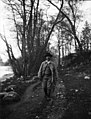
 An old man carefully descending into the Baltic sea (4190349949).jpg 6,201 × 3,902; 3.39 MB
-
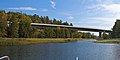
 Björkvik Ingarö Stockholm archipelago.JPG 1,536 × 1,072; 683 KB
-
 Bruno Liljefors & Albert Engström Uppland 1900 001.jpg 2,191 × 3,000; 3.47 MB
-
 Bruno Liljefors Uppland 1900 001.jpg 2,287 × 3,000; 3.83 MB
-
 Bruno Liljefors-photo.jpg 464 × 600; 57 KB
-
 Bäver.jpg 3,003 × 1,546; 927 KB
-

-

-

-

-

-

-

-

-

-
 DIMG 1691 (7980701641).jpg 5,760 × 2,880; 10.94 MB
-
 DIMG 1722 (7980695985).jpg 6,000 × 3,000; 9.98 MB
-
 DIMG 1723 (7980697552).jpg 6,000 × 3,000; 8.6 MB
-
 DIMG 1730 (7980694313).jpg 6,000 × 3,000; 12.69 MB
-
 DIMG 1772 (7980693812).jpg 5,202 × 3,126; 11.78 MB
-
 DIMG 2174 (7983731406).jpg 6,000 × 3,000; 10.69 MB
-
 DIMG 2182 (7983726459).jpg 6,000 × 3,000; 10.72 MB
-
 DIMG 2202 (7983729758).jpg 5,985 × 2,971; 9.73 MB
-
 Egen sommarvilla Exteriör. ArkDes ARKM.1962-101-0463.jpg 2,086 × 3,000; 2.67 MB
-
 Fågelvikshöjden - KMB - 16001000451984.jpg 790 × 527; 306 KB
-
 Gravfält Ingarö.JPG 3,648 × 2,736; 4.11 MB
-
 Ingarö location.png 600 × 700; 364 KB
-
 Ingarö varv.jpg 4,800 × 3,000; 2.03 MB
-
 Island of Ingaro Stockholm Archipelago.svg 417 × 226; 57 KB
-
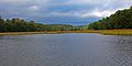
 Kolströmmen1.jpg 2,400 × 1,500; 717 KB
-
 Kolströmmen2.jpg 3,200 × 2,000; 1.86 MB
-
 Kolströmmen3.jpg 3,200 × 2,000; 1.78 MB
-
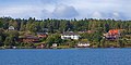
 Saby Ingaro 01 - panoramio.jpg 2,268 × 1,664; 850 KB
-
 Saby Ingaro 06 - panoramio.jpg 2,272 × 1,704; 790 KB
.jpg)
.jpg)


.jpg)
.jpg)
.jpg)
.jpg)
.jpg)
.jpg)
.jpg)
.jpg)


