Category:Ingatestone and Fryerning
Vai alla navigazione
Vai alla ricerca
Italiano: Ingatestone and Fryerning è una parrocchia civile di 4.830 abitanti della contea dell'Essex, in Inghilterra. I suoi centri abitati sono Ingatestone e Fryerning.
civil parish in Essex, England, UK  | |||||
| Carica un file multimediale | |||||
| Istanza di | |||||
|---|---|---|---|---|---|
| Prende il nome da | |||||
| Luogo | Brentwood, Essex, Est dell'Inghilterra, Inghilterra | ||||
| sito web ufficiale | |||||
 | |||||
Sottocategorie
Questa categoria contiene le 6 sottocategorie indicate di seguito, su un totale di 6.
File nella categoria "Ingatestone and Fryerning"
Questa categoria contiene 200 file, indicati di seguito, su un totale di 278.
(pagina precedente) (pagina successiva)-
 A host of golden daffodils - geograph.org.uk - 3912629.jpg 1 500 × 1 119; 884 KB
-
 A host of golden daffodils - geograph.org.uk - 3912642.jpg 1 569 × 1 135; 1,56 MB
-
 A host of golden daffodils - geograph.org.uk - 3912648.jpg 1 500 × 1 077; 1,3 MB
-
 A12 Ingatestone bypass - geograph.org.uk - 3487003.jpg 1 600 × 951; 247 KB
-
 A12 Near Ingatstone - geograph.org.uk - 4962300.jpg 640 × 424; 58 KB
-
 A12 westbound - geograph.org.uk - 4225058.jpg 640 × 453; 43 KB
-
 A12, B1002 Bridge - geograph.org.uk - 3251592.jpg 640 × 430; 52 KB
-
 A12, Fryering Lane Bridge - geograph.org.uk - 3251597.jpg 640 × 430; 55 KB
-
 A12, northbound - geograph.org.uk - 3872979.jpg 640 × 409; 30 KB
-
 Approaching High St - geograph.org.uk - 4962295.jpg 424 × 640; 81 KB
-

-
 Arable Land near Trueloves Lane, Ingatestone - geograph.org.uk - 6129338.jpg 3 648 × 2 736; 3,15 MB
-
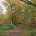 Autumn colours in Mapletree Lane, Fryerning - geograph.org.uk - 4246340.jpg 1 600 × 1 600; 1,5 MB
-
 B1002 bridge over A12 north of Heybridge - geograph.org.uk - 4048669.jpg 1 536 × 1 152; 750 KB
-
 Back Lane Fryerning - geograph.org.uk - 3431008.jpg 640 × 424; 76 KB
-
 Barley field near Little Hyde Farm, Ingatestone - geograph.org.uk - 5428588.jpg 3 648 × 2 255; 2,37 MB
-
 Beggar Hill, Fryerning - geograph.org.uk - 2866903.jpg 640 × 428; 148 KB
-
 Bell Grove, Fryerning - geograph.org.uk - 4246344.jpg 1 600 × 1 067; 1,05 MB
-
 Bend on Ingatestone Road, Mill Green - geograph.org.uk - 6031649.jpg 1 920 × 1 280; 1,34 MB
-
 Bend on the A12 - geograph.org.uk - 3251599.jpg 640 × 387; 56 KB
-
 Beware horses on Green Street - geograph.org.uk - 2602493.jpg 640 × 428; 110 KB
-
 Blackmore Rd at Woodbarns Cottages - geograph.org.uk - 5770453.jpg 640 × 424; 107 KB
-
 Blackmore Road at Portsmoorhall Wood - geograph.org.uk - 5770464.jpg 424 × 640; 107 KB
-
 Blackmore Road by Fryerning Hall - geograph.org.uk - 2602505.jpg 640 × 428; 106 KB
-
 Blackmore Road near Blackmore, Essex - geograph.org.uk - 79301.jpg 640 × 480; 190 KB
-
 Blackmore Road near Fryerning - geograph.org.uk - 6033090.jpg 1 920 × 1 280; 1,45 MB
-
 Blackmore Road near Fryerning - geograph.org.uk - 6033091.jpg 1 920 × 1 280; 1,57 MB
-
 Blackmore Road, Fryerning - geograph.org.uk - 4515839.jpg 640 × 480; 83 KB
-

-
 Blackmore Road, near Fryerning - geograph.org.uk - 4515902.jpg 640 × 480; 110 KB
-
 Blackmore Road, near Fryerning - geograph.org.uk - 4515908.jpg 640 × 480; 104 KB
-
 Blackmore Road, St Leonards - geograph.org.uk - 6033092.jpg 1 920 × 1 280; 1,93 MB
-
 Bluebells by Mapletree Lane - geograph.org.uk - 5770513.jpg 424 × 640; 130 KB
-
 Bollards on Green Street - geograph.org.uk - 4466316.jpg 424 × 640; 71 KB
-
 Boundary Ditch and Hornbeam Pollards - geograph.org.uk - 5770489.jpg 424 × 640; 114 KB
-
 Bridleway by Mill Green Road - geograph.org.uk - 6031685.jpg 1 920 × 1 280; 2,11 MB
-
 Brook Cottage - geograph.org.uk - 4466272.jpg 640 × 436; 95 KB
-
 Brook Cottage, Green Street near Mountnessing, Essex - geograph.org.uk - 3912658.jpg 1 500 × 1 074; 730 KB
-
 Cemetery at St. Mary's Church, Fryerning - geograph.org.uk - 5428569.jpg 3 648 × 2 736; 3,05 MB
-
 Chestnut Blossom - geograph.org.uk - 4962317.jpg 424 × 640; 59 KB
-
 Cottages on Blackmore Road, Fryerning - geograph.org.uk - 6032302.jpg 1 810 × 1 162; 1,11 MB
-
 Curve on A12 near Ingatestone - geograph.org.uk - 3487028.jpg 1 812 × 1 180; 1,09 MB
-
 Ditch near Ingatestone - geograph.org.uk - 5391325.jpg 4 000 × 3 000; 4,58 MB
-
 Dock near Ingatestone Hall - geograph.org.uk - 5330771.jpg 640 × 480; 151 KB
-
 Driveway to Ingatestone Hall - geograph.org.uk - 2481552.jpg 428 × 640; 98 KB
-
 Driveway to Ingatestone Hall - geograph.org.uk - 5330749.jpg 640 × 480; 111 KB
-
 Entrance to sewage works - geograph.org.uk - 1931534.jpg 640 × 426; 94 KB
-
 Farm equipment, Ingatestone - geograph.org.uk - 3166891.jpg 4 608 × 3 072; 3,45 MB
-
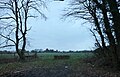
 Field and footpath near The Grove, Fryerning - geograph.org.uk - 5428579.jpg 3 648 × 2 736; 3,13 MB
-
 Field by Blackmore Road, Fryerning - geograph.org.uk - 6032301.jpg 1 829 × 1 179; 1,43 MB
-
 Field near Ingatestone Hall - geograph.org.uk - 5330755.jpg 640 × 480; 60 KB
-
 Field near Ingatestone Hall - geograph.org.uk - 5332102.jpg 640 × 480; 67 KB
-
 Fields and ditches near Margaretting - geograph.org.uk - 4953262.jpg 800 × 334; 65 KB
-
 Fishing Ponds on London Green Belt Way - geograph.org.uk - 6431280.jpg 1 024 × 729; 224 KB
-
 Footbridge Near Handley Barns - geograph.org.uk - 3431084.jpg 424 × 640; 124 KB
-

-
 Footbridge over the River Wid - geograph.org.uk - 2442247.jpg 640 × 425; 91 KB
-
 Footbridge over the River Wid - geograph.org.uk - 5806679.jpg 3 888 × 2 592; 4,67 MB
-
 Footbridge south of Kettles Place - geograph.org.uk - 2441388.jpg 640 × 426; 105 KB
-
 Footbridge to St Mary's - geograph.org.uk - 2481437.jpg 428 × 640; 82 KB
-
 Footpath by the A12 - geograph.org.uk - 3082836.jpg 429 × 640; 86 KB
-
 Footpath From Ingatestone Hall - geograph.org.uk - 2481455.jpg 640 × 428; 83 KB
-
 Footpath near Heybridge - geograph.org.uk - 2441377.jpg 640 × 426; 60 KB
-
 Footpath Near Mill Green - geograph.org.uk - 3431057.jpg 424 × 640; 62 KB
-
 Footpath Nearing St Mary's - geograph.org.uk - 3430963.jpg 424 × 640; 100 KB
-
 Footpath through Arable Land, Ingatestone - geograph.org.uk - 6143165.jpg 3 648 × 2 255; 2,31 MB
-
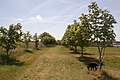
 Footpath through Small Orchard, nr Brook Cottage, Fryerning - geograph.org.uk - 6129341.jpg 3 648 × 2 736; 4,13 MB
-
 Footpath to Dodd's Farm - geograph.org.uk - 3082831.jpg 429 × 640; 105 KB
-
 Footpath to Hall Lane - geograph.org.uk - 3369124.jpg 424 × 640; 79 KB
-
 Footpath to Handley Barns - geograph.org.uk - 3431076.jpg 640 × 424; 81 KB
-
 Footpath to Ingatestone - geograph.org.uk - 2481500.jpg 640 × 428; 64 KB
-
 Footpath to Ingatestone Hall - geograph.org.uk - 2441356.jpg 640 × 426; 89 KB
-
 Footpath to Ingatestone Hall - geograph.org.uk - 5395490.jpg 4 000 × 3 000; 4,69 MB
-
 Footpath to Ingatestone Hall - geograph.org.uk - 5400067.jpg 4 000 × 3 000; 4,74 MB
-
 Footpath to Ivy Barns lane - geograph.org.uk - 3431108.jpg 640 × 424; 59 KB
-
 Footpath to Kettles Place - geograph.org.uk - 5391318.jpg 4 000 × 3 000; 4,94 MB
-
 Footpath to Kettles Place - geograph.org.uk - 5391319.jpg 4 000 × 3 000; 4,55 MB
-
 Footpath to Mountnessing Windmill - geograph.org.uk - 5391320.jpg 4 000 × 3 000; 4,56 MB
-
 Footpath to The Limes - geograph.org.uk - 3369064.jpg 424 × 640; 98 KB
-
 Forestry road - Fryerning Wood, Essex - geograph.org.uk - 79303.jpg 640 × 480; 158 KB
-
 Fryering Lane Bridge, A12 - geograph.org.uk - 2675892.jpg 640 × 430; 68 KB
-
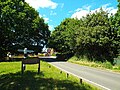
 Fryerning Lane - geograph.org.uk - 2047779.jpg 2 000 × 3 008; 1,21 MB
-
 Fryerning Lane, Ingatestone - geograph.org.uk - 4515784.jpg 640 × 480; 88 KB
-
 Fryerning Lane, near Ingatestone - geograph.org.uk - 4515795.jpg 640 × 480; 125 KB
-
 Fryerning Pond - geograph.org.uk - 6030232.jpg 1 882 × 1 222; 1,79 MB
-
 Fryerning Wood boundary with Mapletree Lane - geograph.org.uk - 3696140.jpg 3 648 × 2 736; 4,47 MB
-
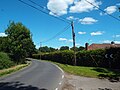
 Fryerning, Essex - geograph.org.uk - 4515814.jpg 640 × 480; 136 KB
-
 Fryerning, Essex - geograph.org.uk - 4515817.jpg 640 × 480; 103 KB
-
 Fryerning, Essex - geograph.org.uk - 4515822.jpg 640 × 480; 97 KB
-
 Fryerning, St. Mary's Church - geograph.org.uk - 6260205.jpg 6 152 × 4 100; 7,11 MB
-

-

-

-

-
 Fryerning, St. Mary's Church, Brick tower 1 - geograph.org.uk - 6260208.jpg 6 638 × 4 425; 6,23 MB
-
 Fryerning, St. Mary's Church, Brick tower 2 - geograph.org.uk - 6260237.jpg 7 480 × 4 987; 6,97 MB
-
 Fryerning, St. Mary's Church, Brick tower 3 - geograph.org.uk - 6260239.jpg 6 425 × 4 284; 5,87 MB
-

-
 Fryerning, St. Mary's Church, South western aspect - geograph.org.uk - 6260223.jpg 6 596 × 4 397; 6,98 MB
-
 Fryerning, St. Mary's Church, South western aspect - geograph.org.uk - 6260227.jpg 6 767 × 4 512; 7,51 MB
-
 Fryerning, St. Mary's Church, The brick tower - geograph.org.uk - 6260232.jpg 4 081 × 6 121; 5,09 MB
-
 Gate at Entrance to Stoney Lodge - geograph.org.uk - 6431135.jpg 1 024 × 653; 188 KB
-
 Gospel Hall, Mill Green, Essex - geograph.org.uk - 2040320.jpg 639 × 462; 79 KB
-
 Great Eastern main line at Ingatestone - geograph.org.uk - 4515733.jpg 640 × 480; 112 KB
-
 Green Street - geograph.org.uk - 6312603.jpg 1 024 × 768; 373 KB
-
 Green Street by Brook Cottage - geograph.org.uk - 3057737.jpg 640 × 480; 137 KB
-
 Green Street Farm - geograph.org.uk - 4466285.jpg 640 × 424; 77 KB
-
 Green Street, Fryerning - geograph.org.uk - 6129340.jpg 3 648 × 2 736; 4,37 MB
-

-

-
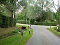
 Hall Lane at Ingatestone Hall junction - geograph.org.uk - 5330913.jpg 640 × 480; 106 KB
-
-
 Hall Lane Ingatestone - geograph.org.uk - 3369110.jpg 640 × 424; 84 KB
-
 Hall Lane, Ingatestone and Fryerning - geograph.org.uk - 5330912.jpg 640 × 480; 124 KB
-
 Hall Lane, Ingatestone and Fryerning - geograph.org.uk - 5330963.jpg 640 × 480; 140 KB
-
 Hall Lane, Ingatestone and Fryerning - geograph.org.uk - 5333035.jpg 640 × 480; 129 KB
-
 Harvesting machinery - geograph.org.uk - 3057696.jpg 640 × 480; 111 KB
-
 Heading for Shenfield - geograph.org.uk - 3369094.jpg 640 × 424; 82 KB
-
 High Street Ingatestone - geograph.org.uk - 4962308.jpg 424 × 640; 85 KB
-
 Hornbeam in Ingatestone Rd - geograph.org.uk - 3431140.jpg 424 × 640; 133 KB
-
 House by Millgreen Common - geograph.org.uk - 6030214.jpg 1 280 × 1 920; 1,49 MB
-
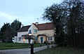
 House on Blackmore Road, Fryerning - geograph.org.uk - 6030234.jpg 1 650 × 1 004; 812 KB
-
 House on Blackmore Road, Fryerning - geograph.org.uk - 6032300.jpg 1 868 × 1 196; 982 KB
-
 House on Mill Green Road, Fryerning - geograph.org.uk - 6030231.jpg 1 920 × 1 280; 1,43 MB
-
 Houses on Fryerning Lane, Ingatestone - geograph.org.uk - 6030001.jpg 1 865 × 1 242; 978 KB
-
 Ingatestone Hall - geograph.org.uk - 2441365.jpg 425 × 640; 79 KB
-
 Ingatestone Hall - geograph.org.uk - 2481493.jpg 640 × 435; 84 KB
-
 Ingatestone Hall - geograph.org.uk - 4578042.jpg 3 678 × 2 456; 4,66 MB
-
 Ingatestone Hall - geograph.org.uk - 5393095.jpg 4 000 × 3 000; 4,84 MB
-
 Ingatestone Hall clock tower - geograph.org.uk - 4577803.jpg 2 452 × 1 639; 2,4 MB
-
 Ingatestone Hall clock tower - geograph.org.uk - 4577837.jpg 3 885 × 2 554; 5,22 MB
-
 Ingatestone Hall Drive - geograph.org.uk - 2481564.jpg 640 × 428; 97 KB
-
 Ingatestone Hall Essex - geograph.org.uk - 3085383.jpg 1 024 × 768; 266 KB
-
 Ingatestone Hall Essex - geograph.org.uk - 3085444.jpg 1 024 × 761; 193 KB
-
 Ingatestone Hall Essex - geograph.org.uk - 3085457.jpg 1 024 × 756; 176 KB
-
 Ingatestone Hall Essex - geograph.org.uk - 3085491.jpg 1 024 × 759; 197 KB
-
 Ingatestone Hall Essex - geograph.org.uk - 3085507.jpg 1 024 × 747; 140 KB
-
 Ingatestone Hall Essex - geograph.org.uk - 3085533.jpg 1 024 × 759; 170 KB
-
 Ingatestone Hall from "the new shrubbery" - geograph.org.uk - 4577884.jpg 3 678 × 2 456; 6,53 MB
-
 Ingatestone Hall from the walled garden - geograph.org.uk - 4577914.jpg 5 134 × 3 374; 7,54 MB
-
 Ingatestone Hall from under the clock tower - geograph.org.uk - 4577812.jpg 3 678 × 2 456; 5,22 MB
-
 Ingatestone Hall, "Wild Boar" garden sculpture - geograph.org.uk - 4577870.jpg 3 679 × 2 456; 7,11 MB
-
 Ingatestone Hall, Gatekeeper butterfly "Pyronia tithonus" - geograph.org.uk - 4578001.jpg 2 451 × 1 636; 2,24 MB
-
 Ingatestone Hall, The lily pond in the walled garden - geograph.org.uk - 4578018.jpg 3 678 × 2 456; 5,57 MB
-
 Ingatestone Hall, The Lime Walk - geograph.org.uk - 4577995.jpg 3 607 × 3 239; 7,21 MB
-
 Ingatestone Hall, The Nut Walk - geograph.org.uk - 4577966.jpg 3 679 × 2 456; 6,72 MB
-
 Ingatestone Hall, The Stew Pond - geograph.org.uk - 4577979.jpg 4 199 × 2 593; 7,64 MB
-
 Ingatestone Hall, The Stew Pond - geograph.org.uk - 4577987.jpg 3 678 × 2 455; 7,57 MB
-
 Ingatestone Hall, The Stew Pond - geograph.org.uk - 4578009.jpg 4 546 × 2 773; 7,27 MB
-
 Ingatestone Hall, The Stew Pond - geograph.org.uk - 4578033.jpg 3 678 × 2 455; 6,62 MB
-
 Ingatestone Hall, the sundial in the walled garden - geograph.org.uk - 4577949.jpg 3 882 × 2 533; 5,63 MB
-
 Ingatestone Hall, the sundial in the walled garden - geograph.org.uk - 4577956.jpg 5 125 × 3 179; 7,51 MB
-
 Ingatestone High Street - geograph.org.uk - 1931496.jpg 640 × 426; 75 KB
-
 Ingatestone High Street - geograph.org.uk - 4515752.jpg 640 × 480; 85 KB
-
 Ingatestone station, 2003 - geograph.org.uk - 5435068.jpg 1 864 × 1 285; 2,25 MB
-
 Ingatestone War Memorial and High Street - geograph.org.uk - 5400076.jpg 4 000 × 3 000; 4,99 MB
-
 Ingatestone, The church of St Edmund and St. Mary - geograph.org.uk - 4576509.jpg 4 323 × 2 741; 5,94 MB
-
 Ingatestone, The church of St Edmund and St. Mary - geograph.org.uk - 4576518.jpg 4 178 × 2 537; 6,34 MB
-
 Ingatestone, The church of St Edmund and St. Mary - geograph.org.uk - 4576529.jpg 4 482 × 2 841; 6,9 MB
-

-

-
 Inner wheel, Hall Lane - geograph.org.uk - 5332222.jpg 640 × 480; 154 KB
-
 Ivy Barns Lane - geograph.org.uk - 5663537.jpg 640 × 480; 173 KB
-
 Ivy Barns Lane - geograph.org.uk - 5663540.jpg 640 × 480; 156 KB
-
 Ivy Barns Lane Bridleway - geograph.org.uk - 3431118.jpg 424 × 640; 113 KB
-
 Ivy from Hall Lane - geograph.org.uk - 5333040.jpg 640 × 480; 83 KB
-
 Kettles Place - geograph.org.uk - 5391321.jpg 4 000 × 3 000; 5,1 MB
-
 Lake at Mill Green - geograph.org.uk - 1880619.jpg 640 × 480; 117 KB
-
 Lamium galeobdolon - geograph.org.uk - 5770505.jpg 424 × 640; 54 KB
-
 Little Hyde Farm - geograph.org.uk - 3872976.jpg 640 × 430; 47 KB
-
 Little Hyde Lane, road to nowhere, Ingatestone - geograph.org.uk - 5428592.jpg 3 648 × 2 736; 3,25 MB
-
 Little Woodbarns Green Street - geograph.org.uk - 4466297.jpg 640 × 424; 57 KB
-
 Log at track, Ingatestone and Fryerning - geograph.org.uk - 5330915.jpg 640 × 480; 101 KB
-
 London Bound - geograph.org.uk - 2481508.jpg 640 × 428; 108 KB
-
 Looking onto road - geograph.org.uk - 5330762.jpg 640 × 480; 88 KB
-
 Looking towards Little Woodbarns - geograph.org.uk - 4183315.jpg 4 320 × 3 240; 4,92 MB
-
 Lots of Footpath Signs - geograph.org.uk - 6431119.jpg 1 024 × 1 019; 457 KB
-
 Lych Gate, Fryerning - geograph.org.uk - 2047783.jpg 640 × 426; 68 KB
-
 Maple Tree Lane - geograph.org.uk - 2566643.jpg 640 × 429; 82 KB
-
 Mapletree Lane - geograph.org.uk - 2866843.jpg 640 × 480; 188 KB
-
 Mapletree Lane by College Wood - geograph.org.uk - 2630153.jpg 640 × 426; 119 KB
-
-
 Mapletree Lane the Way to Writtle Forest - geograph.org.uk - 5770482.jpg 640 × 424; 128 KB
-
 Mapletree Lane, looking towards Mill Green - geograph.org.uk - 4246360.jpg 1 600 × 1 067; 946 KB
-
 Mapletree Lane, near Fryerning Wood - geograph.org.uk - 3696146.jpg 3 648 × 2 736; 5,26 MB
-
 Metal Footbridge near Trueloves Lane - geograph.org.uk - 6430997.jpg 1 024 × 835; 357 KB
-
 Mill Green Common - geograph.org.uk - 2566633.jpg 640 × 429; 73 KB
-
 Mill Green Common Habitat - geograph.org.uk - 2566638.jpg 640 × 429; 103 KB
-
 Mill Green Rd - geograph.org.uk - 3431041.jpg 640 × 424; 58 KB
-
 Mountnessing Windmill from Footpath 34 - geograph.org.uk - 6431008.jpg 1 024 × 619; 169 KB
-
 New House being Built - geograph.org.uk - 6431127.jpg 1 024 × 625; 209 KB
-
 Newly ploughed field, Ingatestone - geograph.org.uk - 3166878.jpg 4 608 × 3 072; 3,52 MB
-
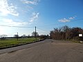
 North of Little Hyde Lane - geograph.org.uk - 3050196.jpg 640 × 480; 116 KB
-
 Old Gate to Fryerning Wood - geograph.org.uk - 5770462.jpg 640 × 424; 109 KB
-

-
 On the old A12 - geograph.org.uk - 2602519.jpg 640 × 428; 126 KB
-
 Open space near Ingatestone Hall - geograph.org.uk - 5330765.jpg 640 × 480; 96 KB
-
 Path from Fryerning past Dunsteads - geograph.org.uk - 6431268.jpg 1 024 × 714; 201 KB
-
 Path in Mill Green Common, Writtle Forest - geograph.org.uk - 3675149.jpg 3 648 × 2 736; 5,22 MB
-
 Path near Ingatestone Hall - geograph.org.uk - 5330812.jpg 640 × 480; 148 KB


