Category:Ingram, Northumberland
Aller à la navigation
Aller à la recherche
village britannique  | |||||
| Téléverser des médias | |||||
| Nature de l’élément | |||||
|---|---|---|---|---|---|
| Lieu | Northumberland, Angleterre du Nord-Est, Angleterre | ||||
| Réputé identique à | Ingram (page en doublon, paroisse civile) | ||||
 | |||||
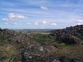
English: Ingram is a small village in Northumberland, England. It is located in the Cheviots on the River Breamish, and on the edge of Northumberland National Park; it houses a National Park visitor centre.
Sous-catégories
Cette catégorie comprend 10 sous-catégories, dont les 10 ci-dessous.
B
- Brandon, Northumberland (27 F)
C
- Castle Knowe, Northumberland (3 F)
F
L
M
- St Michael's church, Ingram (9 F)
R
- Reaveley, Northumberland (11 F)
W
Média dans la catégorie « Ingram, Northumberland »
Cette catégorie comprend 647 fichiers, dont les 200 ci-dessous.
(page précédente) (page suivante)-
 'Glitters' below Ewe Hill - geograph.org.uk - 4980866.jpg 1 024 × 769 ; 265 kio
-
 'Upper Fort', Grieve's Ash - geograph.org.uk - 3144603.jpg 1 024 × 768 ; 411 kio
-
 A field to avoid^ - geograph.org.uk - 3843172.jpg 1 600 × 1 126 ; 552 kio
-
 A galvanised trough - geograph.org.uk - 3442001.jpg 640 × 360 ; 212 kio
-
 A grass track and drystone wall - geograph.org.uk - 640885.jpg 640 × 480 ; 116 kio
-
 A tributary of Reaveley Burn - geograph.org.uk - 3843142.jpg 1 600 × 1 065 ; 361 kio
-
 A697 northbound - geograph.org.uk - 3184215.jpg 640 × 450 ; 47 kio
-
 A697 northbound - geograph.org.uk - 3187837.jpg 640 × 446 ; 52 kio
-
 A697 northbound - geograph.org.uk - 3187840.jpg 640 × 436 ; 53 kio
-
 A697 northbound - geograph.org.uk - 3393108.jpg 640 × 460 ; 50 kio
-
 A697 northbound - geograph.org.uk - 3393110.jpg 640 × 464 ; 45 kio
-
 A697 northbound - geograph.org.uk - 3393114.jpg 640 × 480 ; 51 kio
-
 A697 northbound - geograph.org.uk - 3393116.jpg 640 × 455 ; 47 kio
-
 Above Greensidehill - geograph.org.uk - 3935129.jpg 1 600 × 1 200 ; 627 kio
-
 Above Linhope from west end of Grieve's Ash - geograph.org.uk - 3144827.jpg 1 024 × 769 ; 358 kio
-
 Across the River Breamish - geograph.org.uk - 4979416.jpg 1 024 × 768 ; 329 kio
-
 Alnhammoor beside the River Breamish - geograph.org.uk - 4090705.jpg 1 600 × 1 110 ; 348 kio
-
 Another enclosure on Ewe Hill - geograph.org.uk - 3713705.jpg 1 600 × 1 143 ; 559 kio
-
 Approaching a fence at the end of Access Land - geograph.org.uk - 4416369.jpg 1 600 × 1 052 ; 297 kio
-
 Approaching Coldlaw Cairn - geograph.org.uk - 5807029.jpg 2 000 × 1 333 ; 401 kio
-
 Approaching Greensidehill - geograph.org.uk - 3054465.jpg 1 600 × 1 181 ; 158 kio
-
 Approaching Ingram - geograph.org.uk - 1509970.jpg 640 × 427 ; 131 kio
-
 Approaching Linhope village - geograph.org.uk - 6059360.jpg 1 600 × 1 177 ; 434 kio
-
 Approaching Reaveleyhill - geograph.org.uk - 4418267.jpg 1 600 × 1 211 ; 366 kio
-
 Arable land under Heddon Hill - geograph.org.uk - 3441424.jpg 640 × 480 ; 297 kio
-
 Arable land under Heddon Hill - geograph.org.uk - 3441432.jpg 640 × 480 ; 281 kio
-
 Barebellies Plantation - geograph.org.uk - 3843229.jpg 1 600 × 1 035 ; 225 kio
-
 Base of communications mast on East Hill - geograph.org.uk - 3843297.jpg 1 600 × 1 129 ; 310 kio
-
 Base of medieval wayside cross below East Hill - geograph.org.uk - 4979583.jpg 1 024 × 768 ; 235 kio
-
 Bedroom fireplace, Reaveleyhill Farm - geograph.org.uk - 3143519.jpg 1 024 × 769 ; 321 kio
-
 Bird Hide - geograph.org.uk - 2662320.jpg 4 000 × 3 000 ; 2,83 Mio
-
 Bivallate enclosure of 'Eastern Fort', Grieve's Ash - geograph.org.uk - 3144797.jpg 1 024 × 768 ; 290 kio
-
 Bluebells below East Hill - geograph.org.uk - 4979459.jpg 1 024 × 768 ; 272 kio
-
 Bluebells on north slopes of East Hill - geograph.org.uk - 4983788.jpg 1 024 × 768 ; 311 kio
-
 Bluebells turn East Hill blue - geograph.org.uk - 4979495.jpg 1 024 × 768 ; 281 kio
-
 Board-walk near Ingram Church - geograph.org.uk - 4979250.jpg 1 024 × 768 ; 399 kio
-
 Boulder on Reaveley Hill - geograph.org.uk - 4418304.jpg 1 600 × 1 200 ; 437 kio
-
 Boulders between Brough Law and Ewe Hill - geograph.org.uk - 3713580.jpg 1 600 × 1 125 ; 438 kio
-
 Boundary fence near Lumsden Hill - geograph.org.uk - 6256573.jpg 1 600 × 1 200 ; 491 kio
-
 Bowl Holes - geograph.org.uk - 2219063.jpg 3 888 × 2 395 ; 1,63 Mio
-
 Bowl Holes - geograph.org.uk - 4416572.jpg 1 600 × 1 200 ; 409 kio
-
 Bracken on the western slopes of Knock Hill - geograph.org.uk - 3713689.jpg 1 600 × 1 200 ; 407 kio
-
 Brandon Dean - geograph.org.uk - 3843302.jpg 1 600 × 1 200 ; 377 kio
-
 Branton Burn - geograph.org.uk - 3777053.jpg 1 600 × 1 200 ; 377 kio
-
 Branton Burn joins the Pow Burn - geograph.org.uk - 3777051.jpg 1 600 × 1 200 ; 562 kio
-
 Breamish House - geograph.org.uk - 5763831.jpg 640 × 480 ; 295 kio
-
 Breamish sound trail - geograph.org.uk - 3054490.jpg 750 × 1 000 ; 174 kio
-
 Breamish sound trail - geograph.org.uk - 3054504.jpg 750 × 1 000 ; 184 kio
-

-

-
 Breamish Valley Sound Trail, Hartside - geograph.org.uk - 3145146.jpg 1 024 × 768 ; 294 kio
-
 Breamish Valley W of Ingram - geograph.org.uk - 6013168.jpg 5 184 × 2 920 ; 6,08 Mio
-
 Bridges over River Breamish - geograph.org.uk - 1132394.jpg 640 × 480 ; 119 kio
-
 Bridleway leading to the minor road west of Linhope - geograph.org.uk - 3144948.jpg 1 024 × 768 ; 259 kio
-
 Bridleway leading W towards Chesters Burn, Cheviots - geograph.org.uk - 6013349.jpg 5 184 × 2 920 ; 5,97 Mio
-
 Bridleway south of Cunyan Crags - geograph.org.uk - 3144493.jpg 1 024 × 768 ; 277 kio
-
 Bridleway towards Linhope - geograph.org.uk - 3144338.jpg 1 024 × 769 ; 209 kio
-
 Brizlee - geograph.org.uk - 2219040.jpg 3 152 × 1 809 ; 493 kio
-
 Bronze Age burial cairn north-east of Wether Law - geograph.org.uk - 1804988.jpg 1 024 × 768 ; 258 kio
-
 Bronze Age burial cairn north-east of Wether Law - geograph.org.uk - 1805125.jpg 1 024 × 768 ; 235 kio
-
 Brough Law from the west - geograph.org.uk - 3149813.jpg 1 024 × 768 ; 240 kio
-
 Brough Law Hillfort - geograph.org.uk - 3713620.jpg 1 600 × 1 200 ; 421 kio
-
 Brough Law hillfort - geograph.org.uk - 4418322.jpg 1 600 × 1 200 ; 295 kio
-
 Brough Law, Ingram Valley - geograph.org.uk - 787465.jpg 640 × 480 ; 81 kio
-
 Brough Law, Ingram Valley - geograph.org.uk - 787490.jpg 640 × 480 ; 75 kio
-
 Brough law.jpg 1 152 × 864 ; 48 kio
-
 Brown hare south-west of Hartside - geograph.org.uk - 3145201.jpg 1 024 × 769 ; 385 kio
-
 Bulby's Wood car park - geograph.org.uk - 3054976.jpg 1 600 × 1 158 ; 272 kio
-
 Byway to Ingram - geograph.org.uk - 1964648.jpg 600 × 450 ; 240 kio
-
 Byway towards Ingram - geograph.org.uk - 1964665.jpg 600 × 450 ; 221 kio
-
 Byway towards Ingram - geograph.org.uk - 1964688.jpg 600 × 450 ; 275 kio
-
 Cairn east of Ewe Hill - geograph.org.uk - 4980747.jpg 1 024 × 769 ; 227 kio
-
 Cairn on East Hill - geograph.org.uk - 4979546.jpg 1 024 × 768 ; 255 kio
-
 Cairn on the summit of East Hill - geograph.org.uk - 1583805.jpg 640 × 480 ; 79 kio
-
 Cairn on the summit of Grieve`s Ash (also known as Greaves Ash) - geograph.org.uk - 2317460.jpg 3 648 × 2 736 ; 3,69 Mio
-
 Carpark river.jpg 1 152 × 864 ; 104 kio
-
 Carswell Cleugh - geograph.org.uk - 2218481.jpg 3 888 × 2 319 ; 1,42 Mio
-
 Cat Crag on Dunmoor Hill - geograph.org.uk - 2317466.jpg 3 648 × 2 736 ; 3,86 Mio
-
 Cattle grid on track to Alnhammoor - geograph.org.uk - 4090739.jpg 1 600 × 1 200 ; 337 kio
-
 Cattle in pasture near Ingram - geograph.org.uk - 3055133.jpg 1 600 × 1 132 ; 184 kio
-
 Cheviot Holiday Cottages, Ingram - geograph.org.uk - 1964617.jpg 600 × 450 ; 362 kio
-
 Chubden Camp from slopes of Old Fawdon Hill - geograph.org.uk - 4980243.jpg 1 024 × 768 ; 219 kio
-
 Climb, Glanton Pyke - geograph.org.uk - 3442004.jpg 640 × 360 ; 228 kio
-
 Coldlaw Burn - geograph.org.uk - 1113663.jpg 480 × 640 ; 99 kio
-
 Comb Fell - geograph.org.uk - 2877601.jpg 1 024 × 768 ; 278 kio
-
 Common Bugle (Ajuga reptans), Fawdon Dean - geograph.org.uk - 4982351.jpg 768 × 1 024 ; 200 kio
-
 Confluence of Linhope Burn and Dunmoor Burn - geograph.org.uk - 6059104.jpg 1 600 × 1 067 ; 302 kio
-
 Corbie Cleugh - geograph.org.uk - 1806563.jpg 1 024 × 768 ; 256 kio
-
 Corbie Cleugh - geograph.org.uk - 4980644.jpg 1 024 × 768 ; 241 kio
-
 Corbie Cleugh - geograph.org.uk - 6256603.jpg 1 200 × 1 600 ; 745 kio
-
 Cottage with snowdrops - geograph.org.uk - 6059353.jpg 1 600 × 1 075 ; 522 kio
-
 Cottages west of Ingram Farm - geograph.org.uk - 3177340.jpg 1 024 × 768 ; 312 kio
-
 Crawley Tower - geograph.org.uk - 5763834.jpg 640 × 480 ; 221 kio
-
 Cross-dyke between Cochrane Pike and Wether Hill - geograph.org.uk - 1804865.jpg 1 024 × 768 ; 239 kio
-
 Cultivation terraces above Ingram Hill - geograph.org.uk - 4980677.jpg 1 024 × 768 ; 259 kio
-
 Cultivation terraces on Heddon Hill - geograph.org.uk - 3843134.jpg 1 600 × 1 015 ; 259 kio
-
 Cultivation terraces on Heddon Hill - geograph.org.uk - 4979525.jpg 1 024 × 768 ; 212 kio
-
 Cunyan Crags - geograph.org.uk - 3143838.jpg 1 024 × 768 ; 275 kio
-
 Cunyan Crags - geograph.org.uk - 3935140.jpg 1 600 × 1 200 ; 453 kio
-
 Cunyan Crags from bridleway - geograph.org.uk - 1102405.jpg 640 × 480 ; 103 kio
-
 Cunyan Crags from the south-east - geograph.org.uk - 1840974.jpg 1 024 × 768 ; 211 kio
-

-
 Curious sisters^ - geograph.org.uk - 3843215.jpg 1 600 × 1 143 ; 444 kio
-
 Cyclists on the footbridge over the River Breamish - geograph.org.uk - 3055110.jpg 1 600 × 1 200 ; 333 kio
-

-
 Dilapidated Sheepfold - geograph.org.uk - 5507666.jpg 1 066 × 800 ; 229 kio
-
 Dun's Knowe - geograph.org.uk - 1966097.jpg 600 × 450 ; 255 kio
-
 Dunmoor Hill - geograph.org.uk - 3935148.jpg 1 600 × 1 200 ; 566 kio
-

-
 East gateway of 'Western Fort', Grieve's Ash - geograph.org.uk - 3144836.jpg 1 024 × 768 ; 240 kio
-
 East Hill - geograph.org.uk - 1964131.jpg 600 × 450 ; 250 kio
-
 East Hill - geograph.org.uk - 4979574.jpg 1 024 × 768 ; 202 kio
-
 East Hill from south-west - geograph.org.uk - 4979601.jpg 1 024 × 768 ; 229 kio
-
 East side of East Hill - geograph.org.uk - 4982469.jpg 1 024 × 768 ; 266 kio
-
 East slopes of Fawdon Dean - geograph.org.uk - 4980550.jpg 1 024 × 768 ; 195 kio
-
 East wall of enclosed settlement, Hartside Hill - geograph.org.uk - 3148684.jpg 1 024 × 768 ; 211 kio
-
 Edge of forest on Ewe Hill - geograph.org.uk - 3713721.jpg 1 600 × 1 200 ; 392 kio
-
 Edge of the National Park - geograph.org.uk - 1509877.jpg 640 × 427 ; 212 kio
-
 Eminence in farmland looking towards Powburn - geograph.org.uk - 1086882.jpg 640 × 480 ; 70 kio
-
 Enclosed settlement, Hartside Hill - geograph.org.uk - 3148588.jpg 1 024 × 768 ; 258 kio
-
 Enclosure on Ewe Hill - geograph.org.uk - 3713697.jpg 1 600 × 972 ; 414 kio
-
 End of the public road at Hartside - geograph.org.uk - 5762895.jpg 640 × 480 ; 267 kio
-
 Entrance to Brough Law Hillfort - geograph.org.uk - 3713610.jpg 1 600 × 1 200 ; 511 kio
-
 Erosion of picnic site beside River Breamish - geograph.org.uk - 3714286.jpg 1 600 × 1 200 ; 482 kio
-
 Erosion on the River Breamish - geograph.org.uk - 5510925.jpg 1 066 × 800 ; 282 kio
-
 Ewe Hill and River Breamish - geograph.org.uk - 6222468.jpg 800 × 600 ; 167 kio
-
 Ewe with triplet lambs - geograph.org.uk - 4418386.jpg 1 600 × 1 305 ; 610 kio
-
 Excavated 'tri-radial' cairn, Turf Knowe - geograph.org.uk - 1806798.jpg 1 024 × 768 ; 339 kio
-
 Excavated Bronze Age burial cairn, Turf Knowe - geograph.org.uk - 1806759.jpg 1 024 × 768 ; 328 kio
-

-
 Faint path above Mere Burn - geograph.org.uk - 4980231.jpg 1 024 × 768 ; 301 kio
-
 False summit - geograph.org.uk - 6223237.jpg 800 × 600 ; 108 kio
-
 Farm Labour's Cottages at Ingram Farm - geograph.org.uk - 5510927.jpg 1 066 × 800 ; 255 kio
-
 Farm track and hedgerow - geograph.org.uk - 5762962.jpg 640 × 480 ; 248 kio
-
 Farm Track below Hartside - geograph.org.uk - 4138848.jpg 1 600 × 1 067 ; 460 kio
-
 Farmland at West Hill - geograph.org.uk - 638984.jpg 640 × 480 ; 128 kio
-
 Farmland near Clinch - geograph.org.uk - 4979636.jpg 1 024 × 768 ; 265 kio
-
 Fawdon Burn - geograph.org.uk - 3849571.jpg 1 600 × 1 200 ; 491 kio
-
 Fawdon Burn near Ingram Mill - geograph.org.uk - 4979395.jpg 1 024 × 769 ; 268 kio
-
 Fawdon Dean - geograph.org.uk - 4980540.jpg 1 024 × 768 ; 278 kio
-
 Fawdon Dean - geograph.org.uk - 4980557.jpg 1 024 × 768 ; 234 kio
-
 Fence between Hedgehope Hill and Comb Fell - geograph.org.uk - 2877493.jpg 1 024 × 768 ; 282 kio
-
 Fence junction on Hedgehope Hill - geograph.org.uk - 6163775.jpg 1 024 × 576 ; 216 kio
-
 Fence junction south of Coldlaw Cairn - geograph.org.uk - 5807019.jpg 2 000 × 1 333 ; 445 kio
-
 Fence line on Branton Middle Steads land - geograph.org.uk - 1086877.jpg 640 × 480 ; 67 kio
-
 Field and footpath near Powburn - geograph.org.uk - 1332529.jpg 640 × 480 ; 116 kio
-
 Field remains on north-east ridge of Hartside Hill - geograph.org.uk - 3148777.jpg 1 024 × 768 ; 191 kio
-
 Field with cattle - geograph.org.uk - 5763632.jpg 640 × 480 ; 248 kio
-
 Flood channel, River Breamish - geograph.org.uk - 3441422.jpg 640 × 480 ; 313 kio
-
 Flood Defences, River Breamish - geograph.org.uk - 3924263.jpg 1 600 × 1 179 ; 582 kio
-
 Footbridge over River Breamish - geograph.org.uk - 2809244.jpg 1 082 × 450 ; 72 kio
-
 Footbridge over the Pow Burn - geograph.org.uk - 3776964.jpg 1 600 × 1 176 ; 495 kio
-
 Footbridge over the Pow Burn - geograph.org.uk - 3777042.jpg 1 600 × 1 200 ; 712 kio
-
 Footbridge over the River Breamish - geograph.org.uk - 5763678.jpg 640 × 480 ; 323 kio
-
 Footbridge over the River Breamish - geograph.org.uk - 5763682.jpg 640 × 480 ; 330 kio
-
 Footbridge over the River Breamish - geograph.org.uk - 6059299.jpg 1 600 × 1 067 ; 412 kio
-
 Footpath across Moorland - geograph.org.uk - 5507645.jpg 1 066 × 800 ; 223 kio
-
 Footpath through Wheat Field - geograph.org.uk - 1964127.jpg 600 × 450 ; 278 kio
-
 Footpath to Branton - geograph.org.uk - 3777054.jpg 1 600 × 1 200 ; 257 kio
-
 Footpath to Middle Dean - geograph.org.uk - 6256594.jpg 1 600 × 1 200 ; 599 kio
-
 Footpaths converge below Gibb's Hill - geograph.org.uk - 1965954.jpg 600 × 450 ; 242 kio
-
 Ford and Half a Footbridge - geograph.org.uk - 1964111.jpg 600 × 450 ; 257 kio
-
 Ford at Linhope - geograph.org.uk - 4389206.jpg 3 872 × 2 592 ; 4,32 Mio
-
 Ford on a track over The Knock Hill Burn - geograph.org.uk - 3075713.jpg 4 000 × 3 000 ; 4,92 Mio
-
 Ford on the Knock Hill Burn - geograph.org.uk - 3985857.jpg 3 872 × 2 592 ; 3,63 Mio
-
 Ford over Greensidehill Burn - geograph.org.uk - 3149939.jpg 1 024 × 769 ; 330 kio
-
 Ford over the River Breamish - geograph.org.uk - 5763685.jpg 640 × 480 ; 294 kio
-
 Ford south-west of Alnhammoor - geograph.org.uk - 3145298.jpg 1 024 × 768 ; 360 kio
-
 Forest beyond Broughlow Slack - geograph.org.uk - 3713595.jpg 1 600 × 1 223 ; 488 kio
-
 Forest plantation by Cobden Burn - geograph.org.uk - 3147055.jpg 1 024 × 768 ; 286 kio
-
 Functional bridge over the River Breamish - geograph.org.uk - 4090712.jpg 1 600 × 1 200 ; 591 kio
-
 Gate into Plantation, Chesters Burn - geograph.org.uk - 6256502.jpg 1 600 × 1 200 ; 933 kio
-
 Gate on bridleway above Hartside - geograph.org.uk - 3144518.jpg 1 024 × 769 ; 238 kio
-
 Gate south-west of Hedgehope Hill summit - geograph.org.uk - 2877331.jpg 1 024 × 770 ; 198 kio
-
 Gate ^ stile on bridleway south of The Dod - geograph.org.uk - 1842764.jpg 1 024 × 768 ; 280 kio
-
 Gibb's Hill - geograph.org.uk - 1965963.jpg 600 × 450 ; 226 kio
-
 Gibb's Hill - geograph.org.uk - 3849551.jpg 1 600 × 1 200 ; 422 kio
-
 Gingling Cleugh above Fawdon Dean - geograph.org.uk - 4982340.jpg 1 024 × 768 ; 271 kio
-
 Glacial gullies on south ridge of Knock Hill - geograph.org.uk - 3149929.jpg 1 024 × 768 ; 284 kio
-
 Grassland near Fawdon Burn - geograph.org.uk - 4979625.jpg 1 024 × 768 ; 232 kio
-
 Great Standrop - geograph.org.uk - 2538802.jpg 3 888 × 2 592 ; 3,2 Mio
-
 Greaves Ash - geograph.org.uk - 1102368.jpg 640 × 480 ; 97 kio
-
 Greenside Hill - geograph.org.uk - 5510869.jpg 1 066 × 800 ; 228 kio
-
 Greensidehill - geograph.org.uk - 2218425.jpg 3 837 × 2 199 ; 1,26 Mio
-
 Greensidehill Farm - geograph.org.uk - 5762913.jpg 640 × 480 ; 252 kio
-
 Greensidehill Farm - geograph.org.uk - 5762923.jpg 640 × 480 ; 257 kio
-
 Grouse butts above Shank Sike - geograph.org.uk - 1113652.jpg 640 × 480 ; 79 kio
-
 Hartside - geograph.org.uk - 1864862.jpg 3 888 × 2 346 ; 1,57 Mio
-
 Hartside - geograph.org.uk - 3054547.jpg 1 600 × 1 200 ; 307 kio
-
 Hartside - geograph.org.uk - 3145182.jpg 1 024 × 768 ; 271 kio
-
 Hartside Farm from Hartside Hill - geograph.org.uk - 3147111.jpg 1 024 × 640 ; 219 kio
-
 Hartside Hill - geograph.org.uk - 3147078.jpg 1 024 × 768 ; 239 kio
-
 Hartside Hill from north-east - geograph.org.uk - 3149830.jpg 1 024 × 768 ; 291 kio
-
 Harvesting - geograph.org.uk - 2340237.jpg 3 626 × 2 988 ; 3,83 Mio
-
 Hawthorn below East Hill - geograph.org.uk - 4979432.jpg 1 024 × 769 ; 243 kio
-
 Hawthorn blossom above River Breamish - geograph.org.uk - 4979490.jpg 1 024 × 767 ; 252 kio
-
 Head of the Ingram valley - geograph.org.uk - 5762902.jpg 640 × 480 ; 267 kio
-
 Heavy shower clouds on track from Wether Hill towards Ingram - geograph.org.uk - 6013360.jpg 5 184 × 2 920 ; 5,72 Mio
-
 Heavy shower clouds on track from Wether Hill towards Ingram - geograph.org.uk - 6013361.jpg 5 184 × 2 920 ; 5,33 Mio
-
 Heddon - geograph.org.uk - 3843177.jpg 1 600 × 1 200 ; 222 kio


_-_geograph.org.uk_-_2317460.jpg)


,_Fawdon_Dean_-_geograph.org.uk_-_4982351.jpg)


