Category:Interstate 40 in New Mexico
Jump to navigation
Jump to search
States of the United States: Arizona · Arkansas · California · New Mexico · North Carolina · Oklahoma · Tennessee · Texas
section of Interstate Highway in New Mexico, United States | |||||
| Upload media | |||||
| Instance of | |||||
|---|---|---|---|---|---|
| Location | New Mexico | ||||
| Transport network | |||||
| Owned by | |||||
| Maintained by | |||||
| Start time |
| ||||
| Inception |
| ||||
| Length |
| ||||
| Terminus | |||||
| |||||
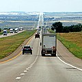
English: Media related to Interstate 40 in New Mexico (I‑40), a 373.53-mile (601.14 km) section of Interstate Highway in New Mexico, United States, that connects I‑40 in Arizona with I‑40 in Texas.
Subcategories
This category has the following 2 subcategories, out of 2 total.
B
- Big I (interchange) (11 F)
Media in category "Interstate 40 in New Mexico"
The following 39 files are in this category, out of 39 total.
-
2013, Descending to the Rio Puerco and Route 66 Casino - panoramio.jpg 4,150 × 3,113; 1.4 MB
-
2013, I Catch the I-40 Electric - panoramio.jpg 6,000 × 4,000; 4.66 MB
-
2013, View W to I-40 From Old Route 66, Owl (^) Rock - panoramio.jpg 6,000 × 4,000; 8.72 MB
-
Aerial view of Route 66 Casino Hotel 01.jpg 4,288 × 2,848; 9.73 MB
-
Aerial view of Route 66 Casino Hotel 02.jpg 4,288 × 2,848; 8.8 MB
-
Aerial view of Route 66 Casino Hotel 03.jpg 4,288 × 2,848; 7.07 MB
-
Aerial view of Route 66 Casino Hotel 04.jpg 4,288 × 2,848; 7.15 MB
-
Albuquerque - aerial - I-40 east from Juan Tabo Blvd NE.jpg 4,288 × 2,848; 6.92 MB
-
Albuquerque aerial.jpg 1,024 × 690; 617 KB
-
Albuquerque, New Mexico, USA (50293669916).jpg 2,500 × 2,500; 4.69 MB
-
Albuquerque, New Mexico, USA (50300509308).jpg 2,500 × 2,500; 3.69 MB
-
Albuquerque, New Mexico, USA (50318311973).jpg 2,500 × 2,500; 3.52 MB
-
APD Crime Scene Tech Van (7280949010).jpg 2,592 × 1,936; 1.84 MB
-
Club Cafe sign near Santa Rosa NM.jpg 819 × 566; 151 KB
-
Continental Divide and I-40.jpg 834 × 1,000; 242 KB
-
Continental Divide, NM, View N from Marker on Old Route 66, 2010 - panoramio.jpg 3,648 × 2,736; 4.99 MB
-
Driving Near Albuquerque New Mexico September 2013.JPG 4,272 × 2,848; 4.01 MB
-
Exit 104 to Cubero, Budville, and Seama, New Mexico, I-40 Westbound (5276636716).jpg 2,816 × 2,112; 2.06 MB
-
Flickr - Nicholas T - Finespun (1).jpg 2,816 × 1,915; 3.11 MB
-
Glenrio-topographic-map.png 1,013 × 805; 732 KB
-
Grade intersection on I-40.jpg 418 × 300; 15 KB
-
I-40 (NM) map.svg 1,475 × 860; 54 KB
-
I-40 in New Mexico.jpg 2,592 × 1,936; 900 KB
-
I-40 Sign (33640198536).jpg 1,600 × 2,400; 1.47 MB
-
I-40 West Exit 131 - To'hajiilee (33524358212).jpg 2,400 × 1,600; 1.13 MB
-
Incredible New Mexico sky. (4920528348).jpg 600 × 800; 83 KB
-
Interstate 25 in Albuquerque looking south.gk.jpg 3,200 × 2,368; 3.43 MB
-
Interstate 40 at Rio Puerco near Albuquerque.jpg 2,600 × 1,404; 891 KB
-
Interstate 40 in eastern New Mexico.jpg 1,952 × 1,464; 399 KB
-
Laguna Pueblo and Rio San Jose.jpg 2,688 × 1,512; 1.16 MB
-
Land of Enchantment, NM, USA (50139336238).jpg 2,542 × 2,542; 4.88 MB
-
Loves Truck Stop sign, Santa Rosa, NM.jpg 3,057 × 2,181; 485 KB
-
New Mexico State Road 45 at Interstate 40.jpg 3,264 × 2,448; 2.05 MB
-
New Mexico State Road 556 at Interstate 40.jpg 3,264 × 2,448; 2.1 MB
-
Santa Rosa, New Mexico, USA (50169336597).jpg 3,000 × 3,000; 5.06 MB


