Category:Iron County, Missouri
Vai alla navigazione
Vai alla ricerca
Counties of Missouri: Adair · Andrew · Atchison · Audrain · Barry · Barton · Bates · Benton · Bollingern · Boone · Buchanan · Butler · Caldwell · Callaway · Camden · Cape Girardeau · Carroll · Carter · Cass · Cedar · Chariton · Christian · Clark · Clay · Clinton · Cole · Cooper · Crawford · Dade · Dallas · Daviess · DeKalb · Dent · Douglas · Dunklin · Franklin · Gasconade · Gentry · Greene · Grundy · Harrison · Henry · Hickory · Holt · Howard · Howell · Iron · Jackson · Jasper · Jefferson · Johnson · Knox · Laclede · Lafayette · Lawrence · Lewis · Lincoln · Linn · Livingston · Macon · Madison · Maries · Marion · McDonald · Mercer · Miller · Mississippi · Moniteau · Monroe · Montgomery · Morgan · New Madrid · Newton · Nodaway · Oregon · Osage · Ozark · Pemiscot · Perry · Pettis · Phelps · Pike · Polk · Pulaski · Putnam · Ralls · Randolph · Ray · Reynolds · Ripley · Saline · Schuyler · Scotland · Scott · Shannon · Shelby · St. Charles · St. Clair · St. Francois · St. Louis · Ste. Genevieve · Stoddard · Stone · Sullivan · Taney · Texas · Vernon · Warren · Washington · Wayne · Webster · Worth · Wright · Independent citiy: St. Louis
contea statunitense del Missouri   | |||||
| Carica un file multimediale | |||||
| Istanza di | |||||
|---|---|---|---|---|---|
| Prende il nome da | |||||
| Luogo | Missouri, Stati Uniti d'America | ||||
| Capitale | |||||
| Data di fondazione o creazione |
| ||||
| Punto più alto | |||||
| Popolazione |
| ||||
| Superficie |
| ||||
| Distinto da | |||||
| sito web ufficiale | |||||
 | |||||
Sottocategorie
Questa categoria contiene le 15 sottocategorie indicate di seguito, su un totale di 15.
C
- Council Bluff Lake (4 F)
E
- Elephant Rocks State Park (32 F)
F
- Fort Davidson (78 F)
G
M
- Magmont Mine (4 F)
- Minerals of Bixby (1 F)
P
- Pilot Knob Mine (1 F)
T
File nella categoria "Iron County, Missouri"
Questa categoria contiene 14 file, indicati di seguito, su un totale di 14.
-
 Enough Missouri savannah sign 20191019 124538.jpg 4 032 × 2 268; 6,68 MB
-
 Map of Missouri highlighting Iron County.png 300 × 263; 12 KB
-
 Map of Missouri highlighting Iron County.svg 1 291 × 1 136; 98 KB
-
 Missouri - Taum Sauk-J Shutins area shaded relief.png 1 417 × 932; 1,28 MB
-
 MOMap-doton-Annapolis.png 300 × 263; 13 KB
-
 MOMap-doton-Arcadia.png 300 × 263; 13 KB
-
 MOMap-doton-Ironton.png 300 × 263; 13 KB
-
 MOMap-doton-Pilot Knob.png 300 × 263; 13 KB
-
 MOMap-doton-Viburnum.png 300 × 263; 13 KB
-
 Ozark Trail completed sections w relief v1.jpg 764 × 764; 141 KB
-
 Ozark Trail completed sections w relief v3.jpg 1 214 × 924; 812 KB
-

-
 USA Iron County, Missouri age pyramid.svg 520 × 600; 8 KB
-
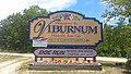 Viburnum Mo.jpg 4 128 × 2 322; 4,73 MB


.JPG)

