Category:Daviess County, Missouri
Jump to navigation
Jump to search
Counties of Missouri: Adair · Andrew · Atchison · Audrain · Barry · Barton · Bates · Benton · Bollingern · Boone · Buchanan · Butler · Caldwell · Callaway · Camden · Cape Girardeau · Carroll · Carter · Cass · Cedar · Chariton · Christian · Clark · Clay · Clinton · Cole · Cooper · Crawford · Dade · Dallas · Daviess · DeKalb · Dent · Douglas · Dunklin · Franklin · Gasconade · Gentry · Greene · Grundy · Harrison · Henry · Hickory · Holt · Howard · Howell · Iron · Jackson · Jasper · Jefferson · Johnson · Knox · Laclede · Lafayette · Lawrence · Lewis · Lincoln · Linn · Livingston · Macon · Madison · Maries · Marion · McDonald · Mercer · Miller · Mississippi · Moniteau · Monroe · Montgomery · Morgan · New Madrid · Newton · Nodaway · Oregon · Osage · Ozark · Pemiscot · Perry · Pettis · Phelps · Pike · Polk · Pulaski · Putnam · Ralls · Randolph · Ray · Reynolds · Ripley · Saline · Schuyler · Scotland · Scott · Shannon · Shelby · St. Charles · St. Clair · St. Francois · St. Louis · Ste. Genevieve · Stoddard · Stone · Sullivan · Taney · Texas · Vernon · Warren · Washington · Wayne · Webster · Worth · Wright · Independent citiy: St. Louis
county in Missouri, United States   | |||||
| Upload media | |||||
| Instance of | |||||
|---|---|---|---|---|---|
| Named after | |||||
| Location | Missouri | ||||
| Capital | |||||
| Inception |
| ||||
| Population |
| ||||
| Area |
| ||||
| Different from | |||||
| official website | |||||
 | |||||
Subcategories
This category has the following 8 subcategories, out of 8 total.
Media in category "Daviess County, Missouri"
The following 20 files are in this category, out of 20 total.
-
 Aerial view of Jamesport, Missouri 9-2-2013.JPG 4,928 × 3,264; 3.99 MB
-
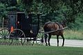 Amish horse and buggy (MSA) (5789077730).jpg 629 × 416; 100 KB
-
 Broad View of Daviess County, Missouri (7235164186).jpg 4,000 × 3,000; 2.25 MB
-
 Interstate 35, Daviess County Missouri (7235160590).jpg 4,000 × 3,000; 2.12 MB
-
 Interstate 35, Daviess County Missouri (7235161420).jpg 4,000 × 3,000; 2.01 MB
-
 Interstate 35, Daviess County Missouri (7235162334).jpg 4,000 × 3,000; 2.11 MB
-
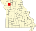
 Map of Missouri highlighting Daviess County.png 300 × 263; 13 KB
-
 Map of Missouri highlighting Daviess County.svg 5,812 × 5,110; 112 KB
-
 Missouri - Pattonsburg through Weldon Springs - NARA - 23941803.jpg 4,385 × 3,382; 3.31 MB
-
 Missouri - Pattonsburg through Weldon Springs - NARA - 23941807.jpg 4,385 × 3,382; 2.55 MB
-
 Missouri - Pattonsburg through Weldon Springs - NARA - 23941811.jpg 4,385 × 3,382; 2.83 MB
-
 MOMap-doton-Altamont.png 300 × 263; 13 KB
-
 MOMap-doton-Coffey.png 300 × 263; 13 KB
-
 MOMap-doton-Gilman City.png 300 × 263; 13 KB
-
 MOMap-doton-Jameson.png 300 × 263; 13 KB
-
 MOMap-doton-Jamesport.png 300 × 263; 13 KB
-
 MOMap-doton-Lock Springs.png 300 × 263; 13 KB
-
 MOMap-doton-Pattonsburg.png 300 × 263; 13 KB
-
 MOMap-doton-Winston.png 300 × 263; 13 KB
-
 USA Daviess County, Missouri age pyramid.svg 520 × 600; 8 KB

_(5789077730).jpg)
.jpg)
.jpg)
.jpg)
.jpg)


