Category:Jedediah Hotchkiss
Jump to navigation
Jump to search
Confederate Army officer cartographer, and topographer  | |||||
| Upload media | |||||
| Date of birth | 30 November 1828 Windsor | ||||
|---|---|---|---|---|---|
| Date of death | 17 January 1899, 17 January 1898 Staunton | ||||
| Country of citizenship | |||||
| Residence |
| ||||
| Occupation | |||||
| |||||
Media in category "Jedediah Hotchkiss"
The following 61 files are in this category, out of 61 total.
-
-

-
 3rd Winchester Final Stand.png 808 × 612; 996 KB
-

-

-
 Base map of Alabama. LOC 2005625108.jpg 7,110 × 6,061; 5.49 MB
-
 Base map of Alabama. LOC 2005625108.tif 7,110 × 6,061; 123.29 MB
-
 Battle of McDowell map.jpg 754 × 1,307; 316 KB
-
 Battle of Monocacy Map, 1864 (6300bd86-994e-4d38-a229-be2a3adfae9a).jpg 4,008 × 5,184; 3.25 MB
-
 Battle of the Wilderness 1864 map.png 2,355 × 1,519; 2.43 MB
-
 Confederate Military History - 1899 - Volume 3 (page 14 crop).jpg 1,042 × 1,425; 1,010 KB
-
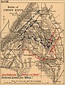 Cross-keys-hotchkiss.jpg 1,120 × 1,461; 326 KB
-
 Historical map of the Battle of the Wilderness.jpg 1,120 × 832; 127 KB
-

-
 Hotchkiss, Jedediah. Map of Tide-water Virginia. 1873.jpg 1,245 × 1,711; 399 KB
-

-

-
 Jedediah Hotchkiss 2.jpg 389 × 552; 49 KB
-
 Jedediah Hotchkiss.jpg 225 × 225; 26 KB
-
 Map of Madison County, Virginia (6093622577).jpg 1,602 × 2,000; 3.07 MB
-
 Map of Rappahannock County, Virginia (6094159550).jpg 1,613 × 2,000; 2.8 MB
-
 Map of Rockingham County, Virginia (6094161298).jpg 1,998 × 2,000; 3.87 MB
-
 Map of Shenandoah & Page counties and part of Warren County, Virginia (5960824689).jpg 1,789 × 2,000; 3.5 MB
-
 Map of the city of Richmond, Virginia LOC 2006626036.jpg 7,513 × 6,294; 5.22 MB
-
 Map of the city of Richmond, Virginia LOC 2006626036.tif 7,513 × 6,294; 135.29 MB
-

-

-

-

-

-
 Preliminary map of Lunenburg County, Virginia LOC 2012592147.jpg 6,969 × 6,212; 5.31 MB
-
 Preliminary map of Lunenburg County, Virginia LOC 2012592147.tif 6,969 × 6,212; 123.86 MB
-
 Railroad map of South Carolina by Jed. Hotchkiss, T.E., Stanton, Va. LOC 98688557.jpg 4,486 × 3,642; 2.48 MB
-
 Railroad map of South Carolina by Jed. Hotchkiss, T.E., Stanton, Va. LOC 98688557.tif 4,486 × 3,642; 46.74 MB
-
 Robert E. Lee and the Southern Confederacy, 1807-1870 (1897) (14593944250).jpg 2,544 × 1,816; 438 KB
-
 Sketch of Action at Guard Hill August 16 1864 Hotchkiss.jpg 2,332 × 2,936; 824 KB
-

-

-

-
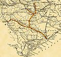 SouthCarolinaRR RoadMap1880.jpg 2,636 × 2,472; 869 KB
-
 Survey of Orange County, Virginia LOC 2002627460.jpg 18,082 × 9,269; 20.72 MB
-
 The Shenandoah Limestone and Martinsburg Shale.pdf 975 × 1,404, 9 pages; 1.07 MB
-
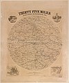 Thirty five miles around Richmond, Va. LOC 2006629172.jpg 8,432 × 10,107; 10.29 MB
-
 Thirty five miles around Richmond, Va. LOC 2006629172.tif 8,432 × 10,107; 243.82 MB
-
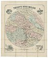
 Thirty five miles around Richmond, Va. LOC 99439228.jpg 5,867 × 7,122; 8.95 MB
-
 Thirty five miles around Richmond, Va. LOC 99439228.tif 5,867 × 7,122; 119.55 MB
-
 Thirty five miles around Richmond, Va. LOC lva0000175.jpg 8,349 × 9,993; 14.2 MB
-
 Thirty five miles around Richmond, Va. LOC lva0000175.tif 8,349 × 9,993; 238.7 MB
-

-
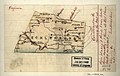
 Topographic map of the battle-field of Port Republic, Virginia, June 9, 1862 LOC 99446761.tif 3,090 × 2,984; 26.38 MB
-

-

-
 Virginia - Mecklenburgh (i.e. Mecklenburg). LOC 2005625184.jpg 2,574 × 1,623; 501 KB
-
 Virginia - Mecklenburgh (i.e. Mecklenburg). LOC 2005625184.tif 2,574 × 1,623; 11.95 MB
-

-

-

-

-

-

-
 Virginia- a geographical and political summary, embracing a description of the state (IA virginiageograph02virg).pdf 897 × 1,395, 354 pages; 28.19 MB
.jpg)


.jpg)

.jpg)


_Jackson_in_the_Shenandoah_Valley_of_Virginia_-_From_November_4,_1861,_to_June_17,_1862_(1880)_(14786122963).jpg)

.jpg)
.jpg)

.jpg)
.jpg)
.jpg)
.jpg)


._LOC_2005625086.jpg)


_(14593944250).jpg)

_LOC_2005625260.jpg)


._LOC_2005625184.jpg)
_(14754347356).jpg)
_(14774162331).jpg)
_(14774182901).jpg)
_(14774994104).jpg)
_(14777334585).jpg)
_(14777353315).jpg)