Category:Jura-Höhenweg
Jump to navigation
Jump to search
  | |||||
| Upload media | |||||
| Instance of | |||||
|---|---|---|---|---|---|
| Location | |||||
| Maintained by |
| ||||
| Part of the series |
| ||||
| Length |
| ||||
| official website | |||||
| |||||
Subcategories
This category has the following 5 subcategories, out of 5 total.
Media in category "Jura-Höhenweg"
The following 39 files are in this category, out of 39 total.
-
 Balsthal03.JPG 3,648 × 2,736; 3.65 MB
-
 Brugg IMG 6744 ShiftN.jpg 2,360 × 3,147; 2.4 MB
-
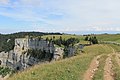
 Challhöchi Pass.JPG 2,816 × 2,112; 2.37 MB
-
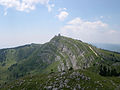
 Chasseral - panoramio.jpg 3,872 × 2,592; 8.23 MB
-
 Chasseral Triangulationspunkt.jpg 2,048 × 1,536; 1.51 MB
-
 Chasseron - 01.jpg 502 × 750; 153 KB
-
 Chörnlisberg Aargauer Weg.jpg 2,592 × 1,944; 1.69 MB
-
 Creux du Van - panoramio (50).jpg 4,272 × 2,848; 11.77 MB
-
 Creux du Van - panoramio (51).jpg 2,848 × 4,272; 13.35 MB
-
 Creux du Van - panoramio (65).jpg 4,272 × 2,848; 13.95 MB
-
 Creux du Van - panoramio (67).jpg 4,272 × 2,848; 11.73 MB
-
 Creux du Van - panoramio (73).jpg 4,272 × 2,848; 11.16 MB
-
 Crête du Mont Tendre - img 28011.jpg 4,080 × 2,720; 2.25 MB
-
 Dielsdorf-Stacidomo 280.jpg 1,600 × 1,200; 522 KB
-
 Frinvillier01.JPG 2,048 × 1,536; 1.47 MB
-
 Gebenstorfer Horn 2723.jpg 3,888 × 2,592; 5.66 MB
-
 Gebenstorfer Horn Jura- Höhenweg.jpg 1,944 × 2,592; 2.6 MB
-
 Gebenstorfer Horn Wanderweg E4.jpg 2,048 × 1,536; 678 KB
-
 Hauensteintunnel Gedenkstein.JPG 2,112 × 2,816; 4.15 MB
-
 Jurahöhenweg01.JPG 2,048 × 1,536; 1.47 MB
-
 La Dole.jpg 2,272 × 1,704; 3.07 MB
-
 La Dôle - panoramio (15).jpg 4,272 × 2,848; 9.65 MB
-
 La-Dôle-2.jpg 5,472 × 3,648; 12.7 MB
-
 Logo Jurahöhenweg.svg 150 × 150; 22 KB
-
 Lägern - Hochwacht 20100524 17-27-48.JPG 2,848 × 4,288; 5.59 MB
-
 Lägern - Jura-Höhenweg 20100524 16-08-30.JPG 4,288 × 2,848; 5.51 MB
-
 Lägern - Jura-Höhenweg 20100524 16-24-34.JPG 2,848 × 4,288; 6.74 MB
-
 Lägern - Jura-Höhenweg 20100524 16-24-42.jpg 2,522 × 3,800; 1.33 MB
-
 Lägern - Schartenfels 20100524 15-05-02.JPG 2,848 × 4,288; 6.37 MB
-
 Panneaux à la Pivette - img 28008.jpg 4,080 × 2,720; 2.16 MB
-
 Regensberg 20100524 18-23-16.JPG 2,667 × 4,000; 2.21 MB
-
 Salhöhe Bunker1.jpg 4,032 × 3,024; 4.17 MB
-
 Vallorbe.jpg 400 × 590; 69 KB
-
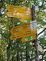
 Wanderwegweiser Balsthal 500.JPG 1,024 × 768; 666 KB
-
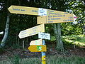
 Wanderwegweiser Hellchöpfli 1232.jpg 1,037 × 778; 664 KB
-
 Wanderwegweiser Roggenflue 995.JPG 1,024 × 768; 701 KB
-
 Wanderwegweiser Schwengimatt 1000.jpg 1,037 × 778; 551 KB
-
 Windisch Reusssteg.JPG 2,816 × 2,112; 2.11 MB
-
 Zentralbibliothek Solothurn Ernst Klöti 0583 Niederwiler Stierenberg.jpg 6,415 × 4,184; 17.87 MB


.jpg)
.jpg)
.jpg)
.jpg)
.jpg)


.jpg)


