Category:Kaaistraat 14, Brielle
Jump to navigation
Jump to search
| Object location | | View all coordinates using: OpenStreetMap |
|---|
 | |||||
| Upload media | |||||
| Instance of |
| ||||
|---|---|---|---|---|---|
| Location | Brielle, Voorne aan Zee, South Holland, Netherlands | ||||
| Street address |
| ||||
| Located on street | |||||
| Heritage designation |
| ||||
 | |||||
|
This is a category about rijksmonument number 10671
|
| Address |
|
Media in category "Kaaistraat 14, Brielle"
The following 11 files are in this category, out of 11 total.
-
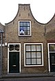 Brielle - rijksmonument 10671 - Kaaistraat 14 20111112.jpg 536 × 800; 192 KB
-
 Brielle, Kaaistraat foto1 2011-06-26 12.47.JPG 4,416 × 3,312; 5.65 MB
-
 Brielle, Kaaistraat foto2 2011-06-26 12.48.JPG 4,416 × 3,312; 5.43 MB
-
 Brielle, Kaaistraat foto3 2011-06-26 12.48.JPG 4,416 × 3,312; 4.85 MB
-
 Brielle, Kaaistraat foto5 2011-06-26 12.49.JPG 4,416 × 3,312; 5.26 MB
-
 Brielle, Kaaistraat foto6 2011-06-26 12.50.JPG 4,416 × 3,312; 5.99 MB
-
 Brielle, Kaaistraat foto7 2011-06-26 12.50.JPG 4,416 × 3,312; 5.6 MB
-
 En hoger, overzicht - Brielle - 20042874 - RCE.jpg 1,200 × 959; 213 KB
-
 Exterieur ACHTERGEVELS, ACHTERHUIS EN SCHUUR - Brielle - 20315417 - RCE.jpg 1,190 × 1,200; 346 KB
-
 Overzicht zuid wand - Brielle - 20042873 - RCE.jpg 1,200 × 959; 227 KB
-
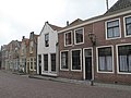
 Voorgevels - Brielle - 20042876 - RCE.jpg 1,200 × 959; 246 KB


