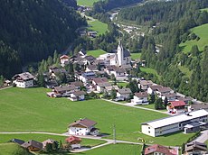
Category:Kals am Großglockner
Jump to navigation
Jump to search
municipality in Lienz District, Tyrol, Austria | |||||
| Upload media | |||||
| Instance of |
| ||||
|---|---|---|---|---|---|
| Named after | |||||
| Location | Lienz District, Tyrol, Austria | ||||
| Mountain range | |||||
| Population |
| ||||
| Area |
| ||||
| Elevation above sea level |
| ||||
| official website | |||||
 | |||||
Kals am Grossglockner (Osttirol) is divided into the following Katastralgemeinden: Unterpeischlach, Oberpeischlach, Staniska, Arnig, Lesach, Lana, Ködnitz, Glor-Berg, Großdorf, Unterburg, and Burg.
Subcategories
This category has the following 17 subcategories, out of 17 total.
Pages in category "Kals am Großglockner"
This category contains only the following page.
Media in category "Kals am Großglockner"
The following 8 files are in this category, out of 8 total.
-
Böses Weibl 360° Panorama.jpg 5,055 × 1,024; 3.35 MB
-
Kalser Bach Ausschotterung.jpg 5,874 × 3,487; 29.56 MB
-
Rappler, Arnhörner, Hochegg, Blitzkofel, Ochsen Bichl, Regenstein.jpg 4,000 × 6,000; 9.57 MB
-
Regenstein, Kugelspitze, Hohes Kreuz, Spitz beim Kreuz, Firstkogel.jpg 4,000 × 6,000; 9.57 MB
-
Tramerkamp, Zinggetz, Grindenkarköpfe von südlich unterhalb des Figerhorns.jpg 8,514 × 3,916; 31.1 MB
-
Tschadinhorn und Schönleitenspitze (2).jpg 6,239 × 3,540; 19.85 MB
-
Wappen at kals am grossglockner.png 166 × 192; 2 KB


