Category:Kalverstraat 4 (Hindeloopen)
Jump to navigation
Jump to search
| Object location | | View all coordinates using: OpenStreetMap |
|---|
building in Súdwest-Fryslân, Netherlands  | |||||
| Upload media | |||||
| Instance of | |||||
|---|---|---|---|---|---|
| Location | Hindeloopen, Hindeloopen | ||||
| Located on street | |||||
| Heritage designation |
| ||||
 | |||||
|
This is a category about rijksmonument number 22170
|
| Address |
|
Media in category "Kalverstraat 4 (Hindeloopen)"
The following 8 files are in this category, out of 8 total.
-
 Aanzicht - Hindeloopen - 20113524 - RCE.jpg 1,200 × 801; 173 KB
-
 Exterieur OVERZICHT RECHTER ZIJGEVEL - Hindeloopen - 20285074 - RCE.jpg 1,192 × 1,200; 248 KB
-
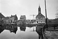
 Hindeloopen003.jpg 480 × 360; 167 KB
-
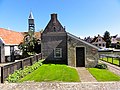 Kalverstraat4 Hindeloopen.jpg 3,648 × 2,736; 1.02 MB
-
 Litshuus - Hindeloopen - 20525100 - RCE.jpg 1,200 × 900; 120 KB
-
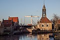
 Overzicht 't Oost met sluis - Hindeloopen - 20113468 - RCE.jpg 1,200 × 815; 153 KB
-
 Schutsluis met houten ophaalbrug.jpg 2,449 × 1,633; 1.72 MB
-
 Verbouwd litshuus - Unknown - 20525064 - RCE.jpg 1,200 × 900; 127 KB


