Category:Karakoram
Pereiti į navigaciją
Jump to search
اردو: سلسلہ کوہ قراقرم
پنجابی: قراقرم
English: The Karakoram is a large mountain range spanning the borders between Pakistan, India and China, located in regions of Gilgit-Baltistan—Pakistan, Ladakh—India, and Xinjiang—China. It is one of the Greater Ranges of Asia, and a part of the greater geologic Himalaya system while north of the actual Himalaya Range.
Four of the fourteen world's highest mountains are in the Karakoram range, including the second highest mountain of the world - K2.
Four of the fourteen world's highest mountains are in the Karakoram range, including the second highest mountain of the world - K2.
हिन्दी: काराकोरम
中文(简体):喀喇昆仑山脉
major mountain range spanning the borders between India, Pakistan, and China  K2 (Qogir Feng)  | |||||
| Įkelti mediją | |||||
| Tai yra | |||||
|---|---|---|---|---|---|
| Yra dalis |
| ||||
| Vieta |
| ||||
| Ilgis |
| ||||
| Aukščiausia vieta | |||||
| Aukštis virš jūros lygio |
| ||||
| Skiriasi nuo | |||||
 | |||||
- For images of the Karakoram's subranges see Category:Mountain ranges of the Karakoram. Images of individual mountain peaks are categorized within their subrange categories.
Subkategorijos
Rodoma 10 subkategorijų (iš viso yra 10 subkategorijų).
A
C
E
- First Karakoram Expedition (72 F)
- Third Karakoram Expedition (65 F)
- Fourth Karakoram Expedition (38 F)
G
K
M
~
- Unidentified Karakoram peaks (11 F)
Daugialypės terpės rinkmenos kategorijoje „Karakoram“
Rodomi 29 šios kategorijos rinkmenos (iš viso kategorijoje yra 29 rinkmenos).
-
De-Karakorum.ogg 2,3 s; 22 KiB
-
De-Karakorum2.ogg 2,1 s; 20 KiB
-
 Ecoregion PA1006.png 1 100 × 1 100; 2,11 MiB
-
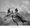
 Fanny Bullock Workman and William Hunter Workman 1903.png 546 × 792; 411 KiB
-

-
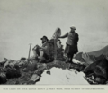
 Fanny Bullock Workman and William Hunter Workman on Mt Buspar in 1902.png 594 × 548; 283 KiB
-
 Fanny Bullock Workman on the summit of Siegfriedhorn.png 683 × 585; 376 KiB
-

-
 Hunza Valley, view from Eagle's Nest.jpg 10 489 × 6 744; 45,14 MiB
-
 ISS006-E-16016 - View of Pakistan.jpg 3 032 × 2 064; 1,93 MiB
-
 Johnson-journey-ilchi1865-mapa.jpg 1 688 × 1 600; 495 KiB
-
 Kanjut River near Chalt in E.F. Knight's book.jpg 606 × 462; 65 KiB
-
 Kanjut Valley near Passu in E.F. Knight's book.jpg 558 × 420; 66 KiB
-

-
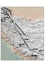
 Karakoram location map plus.png 2 701 × 1 812; 9,82 MiB
-
 Karakoram location map.png 2 701 × 1 812; 8,57 MiB
-
 Karakoram relief location map.svg 865 × 580; 978 KiB
-
 Karakoram, Pakistan.jpg 3 872 × 2 576; 2,06 MiB
-
 Karakoram-Nubra.jpg 500 × 333; 26 KiB
-
 Karakoram-West Tibetan Plateau alpine steppe.jpg 1 417 × 911; 992 KiB
-

-
 Karakorum fault superimposed on top of topographic map.pdf 1 275 × 1 650; 431 KiB
-
 Map of Chogo Lungma Glacier and its surrounding 1903.png 1 199 × 998; 1,98 MiB
-
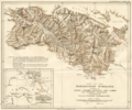
 Map of Ladakh or Little Tibet (Klein Tubet) in 1858 Vorder-Asien (cropped).jpg 777 × 1 143; 473 KiB
-

-
 Mountain passes Afghanistan Pakistan.png 1 122 × 866; 1,93 MiB
-
 The Karakoram Mountains.jpg 2 615 × 2 094; 2,1 MiB
-
 Workmans Two summers in the ice-wilds ill to face page 84.png 966 × 689; 903 KiB
-
 Workmans Two summers in the ice-wilds map Hushe and Kondus Glaciers after page 118.png 1 040 × 906; 1,75 MiB


_in_1858_Vorder-Asien_(cropped).jpg)
.jpg)


_(14782518804).jpg)