Category:Kasteel Hardenbroek
Jump to navigation
Jump to search
| Object location | | View all coordinates using: OpenStreetMap |
|---|
building in the Netherlands  | |||||
| Upload media | |||||
| Instance of | |||||
|---|---|---|---|---|---|
| Part of | |||||
| Location | Driebergen-Rijsenburg, Utrecht, Netherlands | ||||
| Street address |
| ||||
| Located on street |
| ||||
| Heritage designation |
| ||||
 | |||||
|
This is a category about rijksmonumentcomplex number 528024
|
Hoofdgebouw:
|
This is a category about rijksmonument number 528025
|
Historische park- en tuinaanleg:
|
This is a category about rijksmonument number 528026
|
Dubbele houten brug:
|
This is a category about rijksmonument number 528027
|
Twee vazen op sokkel:
|
This is a category about rijksmonument number 528028
|
Brug:
|
This is a category about rijksmonument number 528029
|
Twee pompoenvormige ornamenten:
|
This is a category about rijksmonument number 528030
|
Twee lantaarns:
|
This is a category about rijksmonument number 528031
|
Zes schampstenen:
|
This is a category about rijksmonument number 528032
|
Oranjerie:
|
This is a category about rijksmonument number 528033
|
Koetshuis:
|
This is a category about rijksmonument number 528034
|
Dienstwoning:
|
This is a category about rijksmonument number 528035
|
| Address |
|
Subcategories
This category has the following 3 subcategories, out of 3 total.
H
- Godert Jan van Hardenbroek (1 F)
V
- Joost van Hardenbroek (3 F)
Media in category "Kasteel Hardenbroek"
The following 57 files are in this category, out of 57 total.
-
 Bij kasteel Hardenbroek.jpg 4,770 × 3,177; 3.31 MB
-

-
 Hardenbroek koetshuis.jpg 2,154 × 1,476; 549 KB
-
 Hardenbroek oranjerie.jpg 2,142 × 1,470; 626 KB
-
 Hardenbroek pompoenen.jpg 992 × 326; 78 KB
-
 Hardenbroek, achtergevel - Driebergen-Rijsenburg - 20063904 - RCE.jpg 1,200 × 882; 244 KB
-
 Hardenbroek, gevel - Driebergen-Rijsenburg - 20063897 - RCE.jpg 1,200 × 1,200; 365 KB
-
 Hardenbroek, ingangspartij - Driebergen-Rijsenburg - 20063898 - RCE.jpg 1,200 × 1,200; 360 KB
-
 Hardenbroek, Kasteel, toegangshek - Driebergen-Rijsenburg - 20063908 - RCE.jpg 954 × 1,200; 334 KB
-
 Hardenbroek, Kasteel, toegangshek - Driebergen-Rijsenburg - 20063909 - RCE.jpg 961 × 1,200; 332 KB
-
 Hardenbroek, Kasteel, toegangshek - Driebergen-Rijsenburg - 20063910 - RCE.jpg 950 × 1,200; 366 KB
-
 Hardenbroek, Kasteel, voorgevel - Driebergen-Rijsenburg - 20063905 - RCE.jpg 1,188 × 1,200; 351 KB
-
 Hardenbroek, Kasteel, voorgevel - Driebergen-Rijsenburg - 20063906 - RCE.jpg 1,195 × 1,200; 276 KB
-
 Hardenbroek, Kasteel, voorgevel - Driebergen-Rijsenburg - 20063907 - RCE.jpg 1,193 × 1,200; 344 KB
-
 Hardenbroek, voorbrug - Driebergen-Rijsenburg - 20063902 - RCE.jpg 1,193 × 1,200; 375 KB
-

-
 Hardenbroek, voorgevel - Driebergen-Rijsenburg - 20063900 - RCE.jpg 1,195 × 1,200; 267 KB
-
 Hardenbroek, voorgevel - Driebergen-Rijsenburg - 20063901 - RCE.jpg 1,190 × 1,200; 276 KB
-
 Hardenbroek, zuid-oost gevel - Driebergen-Rijsenburg - 20063899 - RCE.jpg 1,200 × 1,200; 319 KB
-
 Hardenbroek-1998.jpg 1,000 × 590; 80 KB
-
 Hardenbroek-Beijer.jpg 1,200 × 947; 425 KB
-

-

-
-

-

-

-

-

-

-

-

-

-

-

-
-

-
-
 Interieur, overzicht de zaal - Driebergen-Rijsenburg - 20351852 - RCE.jpg 1,193 × 1,200; 255 KB
-

-

-

-

-

-

-
 Kasteel Hardenbroek Kromme Rijnstreek.jpg 4,770 × 3,177; 3.65 MB
-
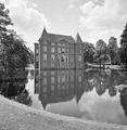
 Kasteel Hardenbroek.jpg 4,770 × 3,177; 4.74 MB
-
 Kasteel-Hardenbroek.jpg 4,832 × 3,221; 9.48 MB
-
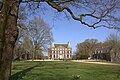
 Landgoed en kasteel Hardenbroek in het voorjaar.jpg 4,770 × 3,177; 3.58 MB
-
 Landgoed en kasteel Hardenbroek.jpg 4,770 × 3,177; 3.91 MB
-
 Overzicht achtergevel - Driebergen-Rijsenburg - 20339963 - RCE.jpg 1,174 × 1,200; 291 KB
-
 Overzicht achtergevel - Driebergen-Rijsenburg - 20339964 - RCE.jpg 1,181 × 1,200; 374 KB
-
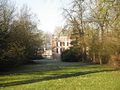 Park Huis Hardenbroek.jpg 1,024 × 768; 187 KB
-
-
STICHTING NATIONAAL CENTRUM-PGM4011531.webm 3 min 49 s, 720 × 576; 30.69 MB
-
 Voorgevel vm ridderhofstad "Hardenbroek" - Nederlangbroek - 20451152 - RCE.jpg 1,200 × 900; 177 KB
-
 Zegel van Joost van Hardenbroek uit 1538.jpg 4,288 × 2,848; 1.35 MB

,_RP-P-AO-5-109-4.jpg)


