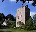
Category:Kasteel Lunenburg
Jump to navigation
Jump to search
| Object location | | View all coordinates using: OpenStreetMap |
|---|
.JPG) | |||||
| Upload media | |||||
| Instance of | |||||
|---|---|---|---|---|---|
| Location |
| ||||
| Street address |
| ||||
| Located on street |
| ||||
| Heritage designation |
| ||||
 | |||||
|
This is a category about rijksmonument number 23886
|
| Address |
|
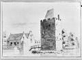
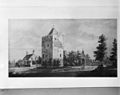
Media in category "Kasteel Lunenburg"
The following 75 files are in this category, out of 75 total.
-
 Detail hardstenen pijler van toegangshek - Neerlangbroek - 20162975 - RCE.jpg 1,193 × 1,200; 512 KB
-
 Detail raamkozijn - Neerlangbroek - 20162963 - RCE.jpg 1,195 × 1,200; 293 KB
-
 Exterieur - Neerlangbroek - 20162926 - RCE.jpg 1,200 × 804; 203 KB
-
 Exterieur - Neerlangbroek - 20162927 - RCE.jpg 1,200 × 794; 198 KB
-
 Exterieur - Neerlangbroek - 20162928 - RCE.jpg 783 × 1,200; 192 KB
-
 Exterieur - Neerlangbroek - 20162929 - RCE.jpg 792 × 1,200; 224 KB
-
 Exterieur - Neerlangbroek - 20162930 - RCE.jpg 797 × 1,200; 221 KB
-
 Exterieur - Neerlangbroek - 20162931 - RCE.jpg 805 × 1,200; 228 KB
-
 Exterieur - Neerlangbroek - 20162932 - RCE.jpg 1,200 × 805; 164 KB
-
 Gedeelte raam - Neerlangbroek - 20162960 - RCE.jpg 1,192 × 1,200; 352 KB
-

-
-

-
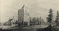
 HUA-201526-Gezicht op een ommuurd kasteel met een forse vierkante toren.jpg 2,097 × 1,495; 487 KB
-

-

-

-

-

-

-

-
 Interieur detail gangmuur - Neerlangbroek - 20162971 - RCE.jpg 1,195 × 1,200; 167 KB
-
 Interieur detail venster - Neerlangbroek - 20162965 - RCE.jpg 1,200 × 1,200; 159 KB
-
 Interieur detail venster - Neerlangbroek - 20162966 - RCE.jpg 1,192 × 1,200; 190 KB
-
 Interieur gangmuur - Neerlangbroek - 20162970 - RCE.jpg 1,200 × 1,200; 140 KB
-
 Interieur kamer - Neerlangbroek - 20162969 - RCE.jpg 1,200 × 1,199; 215 KB
-
 Interieur muur in kamer - Neerlangbroek - 20162967 - RCE.jpg 1,200 × 1,195; 214 KB
-
 Interieur muur in kamer - Neerlangbroek - 20162968 - RCE.jpg 1,191 × 1,200; 210 KB
-
 Interieur venster - Neerlangbroek - 20162964 - RCE.jpg 1,190 × 1,200; 200 KB
-
 Langbroek - Lunenburg koetshuis RM23886.JPG 4,368 × 3,435; 1.44 MB
-
 Langbroek - Lunenburg RM23886.JPG 3,981 × 3,393; 3.61 MB
-
 Langbroek - Lunenburg RM23886moderate.JPG 3,693 × 3,313; 7.55 MB
-
 Langbroek - Lunenburg tuin RM23886.JPG 4,608 × 3,456; 1.89 MB
-
 Luik - Neerlangbroek - 20162947 - RCE.jpg 1,190 × 1,200; 360 KB
-
 Luik - Neerlangbroek - 20162948 - RCE.jpg 1,195 × 1,200; 295 KB
-
 Luik - Neerlangbroek - 20162949 - RCE.jpg 1,200 × 1,197; 303 KB
-
 Luik - Neerlangbroek - 20162950 - RCE.jpg 1,200 × 1,200; 224 KB
-
 Luiken - Neerlangbroek - 20162945 - RCE.jpg 1,193 × 1,200; 298 KB
-
 Luiken - Neerlangbroek - 20162946 - RCE.jpg 1,200 × 1,199; 295 KB
-
 Lunenburg (26).JPG 3,008 × 2,000; 1.73 MB
-
 Oprijlaan met toegangshek - Neerlangbroek - 20322290 - RCE.jpg 1,200 × 879; 313 KB
-
 Overzicht - Neerlangbroek - 20162935 - RCE.jpg 960 × 1,200; 336 KB
-
 Overzicht - Neerlangbroek - 20162941 - RCE.jpg 1,200 × 957; 249 KB
-
 Overzicht - Neerlangbroek - 20162942 - RCE.jpg 1,200 × 957; 266 KB
-
 Paviljoen in tuin - Neerlangbroek - 20322288 - RCE.jpg 1,200 × 874; 262 KB
-
 Portret van Jan Hendrik Lynden van Lunenburg, RP-P-1910-2270 (cropped).jpg 857 × 1,048; 523 KB
-
 Portret van Jan Hendrik Lynden van Lunenburg, RP-P-1910-2270.jpg 1,730 × 2,500; 876 KB
-
 Raamkozijn - Neerlangbroek - 20162959 - RCE.jpg 1,200 × 1,197; 313 KB
-
 Raamkozijn - Neerlangbroek - 20162961 - RCE.jpg 1,195 × 1,200; 280 KB
-
 Raamkozijn - Neerlangbroek - 20162962 - RCE.jpg 1,197 × 1,200; 232 KB
-
 Reproductie van gravure - Neerlangbroek - 20162938 - RCE.jpg 1,200 × 857; 350 KB
-
 Tekening - Neerlangbroek - 20162936 - RCE.jpg 1,200 × 879; 170 KB
-
 Tekening A.de Haan 1725 Museum Flehite - Neerlangbroek - 20162922 - RCE.jpg 1,200 × 951; 243 KB
-
 Tekening A.S. (Schoemaker) Museum Flehite - Neerlangbroek - 20162924 - RCE.jpg 1,200 × 948; 433 KB
-
 Tekening D.H.de Winter, Museum Flehite - Neerlangbroek - 20162925 - RCE.jpg 1,200 × 927; 256 KB
-
-
 Tekening door J.de Beyer - Neerlangbroek - 20162937 - RCE.jpg 1,200 × 973; 407 KB
-
 Tekening Museum Flehite Amersfoort - Neerlangbroek - 20162923 - RCE.jpg 1,200 × 925; 303 KB
-
 Toegangshek - Neerlangbroek - 20162972 - RCE.jpg 1,188 × 1,200; 452 KB
-
 Toegangshek - Neerlangbroek - 20162973 - RCE.jpg 1,195 × 1,200; 443 KB
-
 Toren en achtergevel huis - Neerlangbroek - 20162944 - RCE.jpg 1,200 × 958; 292 KB
-
 Toren en huis - Neerlangbroek - 20162943 - RCE.jpg 1,200 × 947; 336 KB
-
 Utr lunenburg jan de beyer.jpg 674 × 480; 102 KB
-
 Venster - Neerlangbroek - 20162951 - RCE.jpg 1,198 × 1,200; 360 KB
-
 Venster - Neerlangbroek - 20162952 - RCE.jpg 1,200 × 1,195; 303 KB
-
 Venster - Neerlangbroek - 20162953 - RCE.jpg 1,188 × 1,200; 335 KB
-
 Venster - Neerlangbroek - 20162954 - RCE.jpg 1,200 × 1,192; 330 KB
-
 Venster - Neerlangbroek - 20162955 - RCE.jpg 1,195 × 1,200; 325 KB
-
 Venster - Neerlangbroek - 20162956 - RCE.jpg 1,200 × 1,200; 321 KB
-
 Venster - Neerlangbroek - 20162957 - RCE.jpg 1,200 × 1,200; 371 KB
-
 Venster - Neerlangbroek - 20162958 - RCE.jpg 1,195 × 1,200; 366 KB
-
 Voorgevel - Neerlangbroek - 20162933 - RCE.jpg 1,200 × 957; 371 KB
-
 Zicht op tuin met prieel - Neerlangbroek - 20322287 - RCE.jpg 1,200 × 885; 246 KB
-
 Zicht op tuin met vijver - Neerlangbroek - 20322289 - RCE.jpg 1,200 × 883; 286 KB
-
 Zijgevel - Neerlangbroek - 20162934 - RCE.jpg 948 × 1,200; 317 KB


.jpg)


_Museum_Flehite_-_Neerlangbroek_-_20162924_-_RCE.jpg)


