Category:Kasteel Montfoort
Jump to navigation
Jump to search
| Object location | | View all coordinates using: OpenStreetMap |
|---|
 | |||||
| Upload media | |||||
| Instance of | |||||
|---|---|---|---|---|---|
| Location | Montfoort, Utrecht, Netherlands | ||||
| Street address |
| ||||
| Located on street |
| ||||
| Heritage designation |
| ||||
 | |||||
|
This is a category about rijksmonument number 30061
|
| Address |
|
Media in category "Kasteel Montfoort"
The following 107 files are in this category, out of 107 total.
-
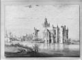
 17e eeuwse tekening Provinciaal archief Utrecht - Montfoort - 20160479 - RCE.jpg 1,200 × 953; 228 KB
-

-
-
 Exterieur - Montfoort - 20160477 - RCE.jpg 1,200 × 895; 215 KB
-
 Exterieur OVERZICHT VOORBURCHT RICHTING POORTGEBOUW - Montfoort - 20314219 - RCE.jpg 1,183 × 1,200; 364 KB
-

-

-

-

-
 Gezicht op het kasteel van Montfoort, RP-P-OB-59.340.jpg 5,271 × 4,172; 3.72 MB
-

-

-

-

-

-
 HUA-107408-Gezicht op het kasteel Montfoort te Montfoortuit het zuidoosten.jpg 3,931 × 2,882; 2.92 MB
-

-

-

-

-

-
 HUA-12495-Gezicht op het Kasteel te Montfoort.jpg 5,843 × 3,927; 3.37 MB
-
 HUA-135300-Gezicht op het kasteel Montfoort te Montfoort uit het zuidwesten.jpg 3,934 × 3,301; 3.71 MB
-

-

-

-
-

-

-

-
 HUA-200227-Gezicht op een hoek van de hoofdburcht van het kasteel te Montfoort.jpg 1,519 × 1,115; 496 KB
-
 HUA-200228-Gezicht op een hoek van de hoofdburcht van het kasteel te Montfoort.jpg 1,509 × 1,120; 534 KB
-

-

-

-

-
 HUA-200246-Gezicht op enkele gebouwen van het kasteel te Montfoort.jpg 1,780 × 1,397; 729 KB
-

-

-
 HUA-201589-Gezicht op het kasteel Montfoort te Montfoort.jpg 3,543 × 2,407; 2.74 MB
-
 HUA-201590-Gezicht op het kasteel Montfoort te Montfoort.jpg 3,543 × 2,510; 2.89 MB
-
 HUA-201591-Gezicht over de Hollandsche IJssel op het kasteel Montfoort te Montfoort.jpg 3,543 × 2,485; 2.31 MB
-
 HUA-201592-Gezicht over de Hollandsche IJssel op het kasteel van Montfoort te Montfoort.jpg 3,543 × 2,769; 3.64 MB
-
 HUA-201593-Gezicht over de Hollandsche IJssel op het kasteel van Montfoort te Montfoort.jpg 3,543 × 3,044; 2.92 MB
-

-
-

-

-

-
 HUA-6420-Gezicht op een gedeelte van het kasteel te Montfoort.jpg 1,680 × 1,285; 436 KB
-
 HUA-809980-Gezicht op een gedeelte van het kasteel te Montfoort.jpg 3,543 × 1,991; 949 KB
-
 Jan van Goyen 015.jpg 3,288 × 2,509; 718 KB
-
 Kasteel Montfoort 001.jpg 2,592 × 1,944; 2.23 MB
-
 Kasteel Montfoort 01.jpg 2,592 × 1,552; 1.03 MB
-
 Kasteel Montfoort 06052012.JPG 4,288 × 2,848; 3.03 MB
-
 Kasteel montfoort 116.JPG 3,264 × 2,448; 2.16 MB
-
 Kasteel Montfoort 1900.jpg 491 × 378; 35 KB
-
 Kasteel Montfoort Avond 06052012.JPG 4,080 × 1,782; 1.8 MB
-
 Kasteel Montfoort bij nacht 02.JPG 3,968 × 2,976; 2.46 MB
-
 Kasteel Montfoort bij nacht 03.JPG 3,968 × 2,976; 2.4 MB
-
 Kasteel Montfoort bij nacht 04.JPG 3,968 × 2,976; 2.55 MB
-
 Kasteel Montfoort bij nacht 05.JPG 3,968 × 2,976; 2.67 MB
-
 Kasteel Montfoort bij nacht 06.JPG 3,968 × 2,976; 2.67 MB
-
 Kasteel Montfoort bij nacht 07.JPG 3,968 × 2,976; 2.65 MB
-
 Kasteel Montfoort bij nacht 08.JPG 3,968 × 2,976; 2.58 MB
-
 Kasteel Montfoort bij nacht 09.JPG 3,577 × 2,976; 1.99 MB
-
 Kasteel Montfoort bij nacht 10.JPG 3,002 × 2,976; 1.62 MB
-
 Kasteel Montfoort bij nacht 11.JPG 2,291 × 2,976; 1.42 MB
-
 Kasteel Montfoort Bloesem 01.JPG 3,968 × 2,976; 2.61 MB
-
 Kasteel Montfoort Bloesem 02.JPG 3,968 × 2,976; 2.68 MB
-
 Kasteel Montfoort Bloesem 03.JPG 3,968 × 2,976; 2.61 MB
-
 Kasteel Montfoort Boom Binnenplaats.jpg 1,552 × 2,592; 1.23 MB
-
 Kasteel Montfoort Bruiloft.jpg 1,840 × 3,264; 1.77 MB
-
 Kasteel Montfoort in vogelvlucht 2.JPG 3,968 × 2,976; 2.57 MB
-
 Kasteel Montfoort Nacht.JPG 2,848 × 4,288; 3.48 MB
-
 Kasteel Montfoort Panorama 7.JPG 4,939 × 2,193; 3.34 MB
-
 Kasteel Montfoort plein.jpg 2,592 × 1,944; 2.48 MB
-
 Kasteel Montfoort van boven.JPG 3,968 × 2,976; 2.64 MB
-
 Kasteel Montfoort Winter Nacht.JPG 4,288 × 2,848; 2.99 MB
-
 Kasteel Montfoort, poort.jpg 1,024 × 763; 162 KB
-
 Kasteel Montfoort.jpg 1,552 × 2,592; 873 KB
-
 Kasteelmontfoort.jpg 400 × 284; 44 KB
-
 Kasteelplein Montfoort..JPG 1,024 × 712; 341 KB
-
 Kasteelpoort Montfoort..JPG 1,024 × 756; 299 KB
-
 Lantaarn Sneeuw.JPG 4,288 × 2,848; 2.89 MB
-

-
 Montfoort -Slot - A.G.Welsch - 1893.jpg 496 × 328; 23 KB
-
 Montfoort 2006.jpg 480 × 640; 247 KB
-
 Montfoort bij nacht Kasteel.JPG 3,968 × 2,976; 2.6 MB
-
 Montfoort Kasteel 003.JPG 3,264 × 2,448; 5.01 MB
-
 Montfoort kastele.jpg 480 × 640; 276 KB
-
 Montfoort Poortgebouw kasteel.jpg 2,048 × 1,536; 1.46 MB
-
 Montfoort, foto 1 Jacob Olie (max res).jpg 7,078 × 5,653; 6.83 MB
-
 Montfoort. Bij het Kasteel..JPG 4,752 × 3,168; 3.59 MB
-
 Montfoort. Provincie Utrecht Holland. Bij het Kasteel.JPG 4,752 × 3,168; 3.55 MB
-
 Montfoort.jpg 1,000 × 665; 757 KB
-
-
 Naar oude tekening - Montfoort - 20160480 - RCE.jpg 1,200 × 819; 224 KB
-
 Naar oude tekening - Montfoort - 20160481 - RCE.jpg 1,200 × 828; 207 KB
-

-
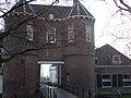
 Poortgebouw - Montfoort - 20160490 - RCE.jpg 894 × 1,200; 195 KB
-

-
 Restant - Montfoort - 20160498 - RCE.jpg 1,200 × 948; 377 KB
-
 Restant - Montfoort - 20160499 - RCE.jpg 1,200 × 957; 362 KB
-
 Restant - Montfoort - 20160500 - RCE.jpg 956 × 1,200; 190 KB
-
 Ruine Kasteel Montfoort.JPG 4,288 × 2,848; 2.73 MB
-
 Zicht op Kasteel Montfoort Kasteel te Montfoort 1631 (titel op object), RP-P-OB-73.553.jpg 4,858 × 3,508; 2.65 MB

.jpg)


,_RP-P-AO-5-46B-2.jpg)
,_RP-P-OB-73.555.jpg)
_Kastelen_in_Nederland_(serietitel),_RP-P-1905-2235.jpg)

,_RP-P-AO-5-46B-1.jpg)
,_RP-P-OB-73.554.jpg)
,_RP-P-AO-5-50X-2.jpg)
,_RP-P-AO-5-50X-1.jpg)
,_RP-P-OB-73.552.jpg)


.jpg)


,_RP-P-OB-73.553.jpg)