Category:Kasteel te Culemborg
Jump to navigation
Jump to search
| Object location | | View all coordinates using: OpenStreetMap |
|---|
 | |||||
| Upload media | |||||
| Instance of | |||||
|---|---|---|---|---|---|
| Location | Culemborg, Gelderland, Netherlands | ||||
| Street address |
| ||||
| Heritage designation |
| ||||
 | |||||
Nederlands: "Kasteelemplacement". Aan de noord-oostzijde van de oude stad bij het "Voorburg" het omgrachte terrein met funderingsresten van het voormalige kasteel te Culemborg en de voorburcht van dit slot
|
This is a category about rijksmonument number 11611
|
| Address |
|
Media in category "Kasteel te Culemborg"
The following 13 files are in this category, out of 13 total.
-
 11611 Kasteel Culemborg.jpg 3,000 × 2,000; 6.09 MB
-
 Culemborg 1750.png 626 × 484; 376 KB
-
 Culemborg Kasteeltuin 1.jpg 4,565 × 3,404; 4.46 MB
-
 Culemborg Kasteeltuin 2.jpg 3,439 × 4,590; 6.64 MB
-
 Culemborg, castle - panoramio - archengigi.jpg 6,401 × 2,196; 5.74 MB
-
 Culemborg, castle - panoramio.jpg 5,856 × 2,235; 4.79 MB
-
 Culemborg, Netherlands - panoramio (26).jpg 2,048 × 1,148; 697 KB
-
 De Kasteeltuin - panoramio.jpg 3,296 × 1,854; 917 KB
-
 Kasteel Culemborg.JPG 3,264 × 2,448; 2.41 MB
-
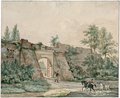 Muur en poort van het kasteel te Culemborg PK-T-2616, PK-T-2134.tiff 2,835 × 2,316; 18.82 MB
-
 Naar tekening 17e eeuw, in Museum Teyler - Culemborg - 20051496 - RCE.jpg 1,200 × 871; 273 KB
-

-
 Tekening 18e eeuw - Culemborg - 20051495 - RCE.jpg 1,200 × 966; 298 KB


.jpg)


