Category:Katsuura, Tokushima
Jump to navigation
Jump to search
town in Katsuura district, Tokushima prefecture, Japan | |||||
| Upload media | |||||
| Instance of | |||||
|---|---|---|---|---|---|
| Location |
| ||||
| Legal form |
| ||||
| Inception |
| ||||
| Population |
| ||||
| Area |
| ||||
| Replaces |
| ||||
| official website | |||||
 | |||||
日本語: 徳島県勝浦町に関するカテゴリ。
Subcategories
This category has the following 6 subcategories, out of 6 total.
B
- Big hinamatsuri (13 F)
H
- Hoshi-no-iwaya (20 F)
I
- Mount Nakatsumine (4 F)
K
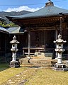
- Kakurinji (Katsuura) (51 F)
S
- Sakamoto ohina kaidou (23 F)
T
Media in category "Katsuura, Tokushima"
The following 68 files are in this category, out of 68 total.
-
 Big-hinamatsuri(tokushima).JPG 778 × 584; 141 KB
-
 Chofuku-ji.jpeg 1,440 × 1,795; 795 KB
-
 Cornaer of an old street - お遍路交差点 - panoramio.jpg 4,000 × 3,000; 4.18 MB
-
 Emblem of Katsuura, Tokushima.jpg 153 × 110; 6 KB
-
 Flag of Katsuura Tokushima.JPG 393 × 239; 11 KB
-
 Flag of Katsuura, Tokushima.svg 600 × 400; 1 KB
-
 Fureainosato-sakamoto1.jpeg 4,032 × 3,024; 3.47 MB
-
 Fureainosato-sakamoto2.jpeg 3,024 × 4,032; 4.02 MB
-
 Henromiti 02a.jpg 1,600 × 1,196; 478 KB
-
 Hoshitani undo park.jpeg 827 × 611; 195 KB
-
 Hoshitani undo park2.jpeg 828 × 820; 1.3 MB
-
 Iwayatanigawa.jpeg 4,032 × 3,024; 6.61 MB
-
 Kakurin temple Pay phone.jpg 1,209 × 960; 265 KB
-
 Kakurinnzi 21.jpg 1,600 × 1,199; 473 KB
-

-

-
-

-
-
 Katsuura in Tokushima Prefecture Ja.svg 720 × 602; 12 KB
-
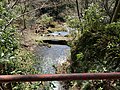
 Katsuura river - 勝浦川 - panoramio.jpg 4,000 × 3,000; 4.06 MB
-
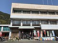
 Katsuura town hall.JPG 4,000 × 2,251; 3.99 MB
-
 Katsuura Town Ikuhina elementary school.JPG 3,264 × 2,354; 1.84 MB
-
 Katsuura Town Katsuura junior high school.JPG 3,180 × 2,143; 975 KB
-
-
-
-
-

-
-

-
-
-
-
-
-

-

-

-

-

-
 Katsuuratown Nue 神谷 Tokushimapref.jpg 640 × 480; 75 KB
-
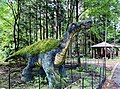 Kyouryuunosato.jpeg 828 × 616; 1.12 MB
-
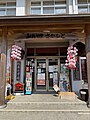
 Lowson Katsuuratown Nue store.jpg 640 × 480; 77 KB
-
 Map Katsuura,Tokushima en.png 1,281 × 801; 49 KB
-
 National Health Insurance Katsuura Hospital.JPG 3,203 × 2,307; 1.36 MB
-
 Old house - 古民家 - panoramio (1).jpg 4,000 × 3,000; 3.95 MB
-
 Old house - 古民家 - panoramio.jpg 4,000 × 3,000; 3.4 MB
-
 Old house -御倉のある古民家 - panoramio.jpg 4,000 × 3,000; 2.96 MB
-
 Old street - 遍路道 - panoramio.jpg 3,000 × 4,000; 3.46 MB
-
 Population distribution of Katsuura, Tokushima, Japan.svg 512 × 256; 22 KB
-
 Sakamoto-gawa.jpeg 4,032 × 3,024; 7.31 MB
-
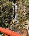 Senshinnotaki.jpeg 1,440 × 1,800; 1.51 MB
-
 Tazukawakeikoku.jpeg 828 × 619; 975 KB
-
 The bridge under the water when big flood comes - 勝浦町の沈下橋 - panoramio.jpg 4,000 × 3,000; 4.35 MB
-
 Tokushima Prefectural Komatsushimanishi High School Katsuura Branch School.JPG 3,264 × 2,204; 1.75 MB
-
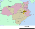 Tokushima-katsuura-town.svg 720 × 602; 20 KB
-
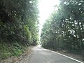
 Tsuru Pass in Tokushimaprefectural road 283 Wajiki Katsuura line.jpg 1,280 × 960; 266 KB
-
 ひなの里かつうら.jpg 4,000 × 3,000; 1.27 MB
-
 ひなの里かつうらトイレ.jpg 1,600 × 1,200; 1.36 MB
-
 ひなの里かつうら電話.jpg 1,860 × 1,395; 1.37 MB
-
 勝浦町生比奈.jpg 1,200 × 1,600; 1.05 MB
-
 坂本八幡神社の花手水.jpeg 512 × 640; 192 KB
-
 変電所と梅 - power trance and ume tree - panoramio.jpg 4,272 × 2,848; 5.53 MB
-
 徳島医療福祉専門学校校舎.jpg 480 × 270; 57 KB
-
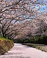 生名谷川の桜.jpeg 515 × 640; 226 KB
-
 稼勢山.jpeg 828 × 614; 560 KB
-
 野上ハイツ - nogami hights - panoramio.jpg 4,000 × 3,000; 3.39 MB


.jpg)


.JPG)