Category:Kelsall
Aller à la navigation
Aller à la recherche
village britannique .jpg) | |||||
| Téléverser des médias | |||||
| Nature de l’élément | |||||
|---|---|---|---|---|---|
| Lieu | Cheshire West and Chester, Cheshire, Angleterre du Nord-Ouest, Angleterre | ||||
| À ne pas confondre avec | |||||
| Réputé identique à | Kelsall (page en doublon, paroisse civile) | ||||
 | |||||
Sous-catégories
Cette catégorie comprend 2 sous-catégories, dont les 2 ci-dessous.
D
P
- St Philip's Church, Kelsall (4 F)
Média dans la catégorie « Kelsall »
Cette catégorie comprend 91 fichiers, dont les 91 ci-dessous.
-
 A54 Kelsall bypass.JPG 3 648 × 2 736 ; 3,63 Mio
-
 A54 road 1.JPG 3 648 × 2 736 ; 3,64 Mio
-
 A54, Kelsall - geograph.org.uk - 1750572.jpg 1 600 × 1 067 ; 308 kio
-
 A54, Looking East from a Layby near Tarvin - geograph.org.uk - 4657784.jpg 640 × 480 ; 420 kio
-
 Back Lane, Kelsall - geograph.org.uk - 5776489.jpg 4 000 × 3 000 ; 3,2 Mio
-
 Building site, Willington Lane, Kelsall - geograph.org.uk - 4490285.jpg 1 600 × 1 200 ; 1,37 Mio
-
 Bus stop, Kelsall - geograph.org.uk - 2008988.jpg 640 × 480 ; 76 kio
-
 Butchers and grocery store, Kelsall.JPG 3 648 × 2 736 ; 3,46 Mio
-
 Chester Road and "milestone" - geograph.org.uk - 2664036.jpg 800 × 600 ; 433 kio
-
 Church Street, Kelsall - geograph.org.uk - 4490275.jpg 1 600 × 1 200 ; 1,65 Mio
-
 Close-up of the inscription (OpenBenches 3507).jpg 2 560 × 1 536 ; 1,42 Mio
-
 Common Lane - geograph.org.uk - 2008992.jpg 640 × 480 ; 106 kio
-
 Community centre, Kelsall.JPG 3 648 × 2 736 ; 3,68 Mio
-
 Cottages, Kelsall.JPG 3 648 × 2 736 ; 3,6 Mio
-
 Cut Mark ^2, Longley Lane, Delamere - geograph.org.uk - 2267622.jpg 3 648 × 2 736 ; 3,75 Mio
-
 Cut Mark, Forest Farm, Delamere - geograph.org.uk - 2267645.jpg 3 648 × 2 736 ; 3,07 Mio
-
 Cut Mark, Longley Lane, Delamere - geograph.org.uk - 2267616.jpg 3 648 × 2 736 ; 3,47 Mio
-
 Cut Mark, Methodist Church, Kelsall - geograph.org.uk - 2347686.jpg 3 648 × 2 736 ; 4,11 Mio
-
 Delamere - view towards Eddisbury Lodge Cottage - geograph.org.uk - 978764.jpg 640 × 480 ; 266 kio
-
 Eastern end of Shay Lane - geograph.org.uk - 1750584.jpg 640 × 427 ; 75 kio
-
 Entrance to old service area - geograph.org.uk - 2901064.jpg 640 × 499 ; 71 kio
-
 Footpath to The Commons - geograph.org.uk - 5780415.jpg 4 000 × 3 000 ; 2,42 Mio
-
 Former chapel, Boothsdale - geograph.org.uk - 4490258.jpg 1 600 × 1 200 ; 1,42 Mio
-
 Green Lane Farm, Kelsall - geograph.org.uk - 5780407.jpg 4 000 × 3 000 ; 2,88 Mio
-
 Houses, Kelsall.JPG 3 648 × 2 736 ; 3,56 Mio
-
 Iron "milestone" on Chester Road - geograph.org.uk - 2664010.jpg 800 × 600 ; 457 kio
-
 Kelsall bypass at Hollands Lane overbridge - geograph.org.uk - 2901058.jpg 640 × 438 ; 71 kio
-
 Kelsall Community Centre - geograph.org.uk - 3471877.jpg 640 × 480 ; 45 kio
-
 Kelsall Community Centre - geograph.org.uk - 4686840.jpg 1 024 × 762 ; 122 kio
-
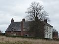 Kelsall Hall.JPG 1 800 × 1 350 ; 436 kio
-
 Kelsall Lock-up - geograph.org.uk - 2664019.jpg 800 × 600 ; 374 kio
-
 Kelsall lock-up.JPG 1 800 × 1 350 ; 571 kio
-
 Kelsall Methodist Church - geograph.org.uk - 2664032.jpg 600 × 800 ; 460 kio
-
 Kelsall Methodist Church - geograph.org.uk - 5772109.jpg 4 000 × 3 000 ; 2,57 Mio
-
 Kelsall Service Station, Chester Road - geograph.org.uk - 5772150.jpg 4 000 × 3 000 ; 2,02 Mio
-
 Kelsall sign, Chester Road.JPG 3 648 × 2 736 ; 3,63 Mio
-
 Kelsall, St. Philip's - geograph.org.uk - 4686816.jpg 1 024 × 768 ; 250 kio
-
 King's Gate Car Park - geograph.org.uk - 3669527.jpg 5 184 × 3 456 ; 5,06 Mio
-
 Kissing Gate - geograph.org.uk - 2276699.jpg 2 304 × 3 216 ; 446 kio
-
 Kissing gate on Kelsall Hill - geograph.org.uk - 1750580.jpg 683 × 1 024 ; 213 kio
-
 Looking down Boothsdale - geograph.org.uk - 6082527.jpg 5 184 × 3 888 ; 4,86 Mio
-
 Morning sun on snow at Kelsall - geograph.org.uk - 36210.jpg 640 × 480 ; 59 kio
-
 Morrey's Nursery, Kelsall - geograph.org.uk - 4226854.jpg 4 000 × 3 000 ; 2,28 Mio
-
 Old Milestone by the former A54, Chester Road, Kelsall (geograph 5487580).jpg 1 200 × 1 600 ; 279 kio
-
 Old Telephone Exchange in Kelsall - geograph.org.uk - 6082521.jpg 3 888 × 5 184 ; 3,55 Mio
-
 Path to Primrosehill Wood - geograph.org.uk - 3669544.jpg 5 184 × 3 456 ; 5,65 Mio
-
 Playground, Kelsall Primary School - geograph.org.uk - 4490280.jpg 1 600 × 1 200 ; 1,59 Mio
-
 Public footpath, Kelsall 1.JPG 2 736 × 3 648 ; 3,6 Mio
-
 Public footpath, Kelsall 2.JPG 2 736 × 3 648 ; 3,59 Mio
-
 Quarry Lane, Kelsall - geograph.org.uk - 4490266.jpg 1 600 × 1 200 ; 1,45 Mio
-
 Road Crossing - geograph.org.uk - 2276695.jpg 2 304 × 3 344 ; 539 kio
-
 Road out of Kelsall on a wet March day - geograph.org.uk - 6082524.jpg 5 184 × 3 888 ; 3,33 Mio
-
 Scene of dereliction at Longley Farm - geograph.org.uk - 6082518.jpg 5 184 × 3 888 ; 4,61 Mio
-
 Shops in Church Street, Kelsall - geograph.org.uk - 2663990.jpg 800 × 600 ; 417 kio
-
 Signs, Chester Road, Kelsall.JPG 3 648 × 2 736 ; 3,67 Mio
-
 St Philip's Church, Kelsall - geograph.org.uk - 3471873.jpg 640 × 480 ; 73 kio
-
 St Philip's Church, Kelsall - geograph.org.uk - 5772098.jpg 4 000 × 3 000 ; 2,22 Mio
-
 St. Philip's Church, Kelsall - geograph.org.uk - 2663995.jpg 800 × 600 ; 419 kio
-
 Telecommunications mast on Birch Hill - geograph.org.uk - 2663918.jpg 600 × 800 ; 448 kio
-
 The A54 approach to the B5393 junction near Tarvin - geograph.org.uk - 3674027.jpg 1 600 × 1 200 ; 278 kio
-
 The entrance to Tarvin Sands Fishery off the A54 - geograph.org.uk - 3674043.jpg 1 600 × 1 139 ; 223 kio
-
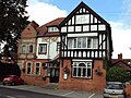
 The Farmers Arms in Kelsall - geograph.org.uk - 3674018.jpg 1 600 × 1 151 ; 270 kio
-
 The Farmers Arms, Kelsall.JPG 3 648 × 2 736 ; 3,67 Mio
-
 The Lord Binning, Kelsall (geograph 2664026).jpg 800 × 600 ; 353 kio
-
 The Morris Dancer, Kelsall.JPG 3 648 × 2 736 ; 3,63 Mio
-
 The Oak pub, Kelsall 1.JPG 3 648 × 2 736 ; 3,57 Mio
-
 The Oak pub, Kelsall 2.JPG 3 648 × 2 736 ; 3,54 Mio
-
 The Royal Oak, Kelsall - geograph.org.uk - 2664024.jpg 600 × 800 ; 414 kio
-
 The Royal Oak, Kelsall - geograph.org.uk - 5769991.jpg 4 000 × 3 000 ; 3,1 Mio
-
 The Steps - geograph.org.uk - 2276687.jpg 2 304 × 3 364 ; 624 kio
-
 The Steps - geograph.org.uk - 2276690.jpg 2 256 × 2 520 ; 360 kio
-
 The Trail - geograph.org.uk - 2276683.jpg 3 456 × 2 304 ; 336 kio
-
 Tobogganers on Kelsall Hill - geograph.org.uk - 3313352.jpg 640 × 513 ; 93 kio
-
 Up The Hill - geograph.org.uk - 2276698.jpg 2 304 × 3 284 ; 451 kio
-
 Vegetable Fields - geograph.org.uk - 2276701.jpg 3 456 × 2 304 ; 494 kio
-
 Waste Lane, Kelsall - geograph.org.uk - 3669539.jpg 5 184 × 3 456 ; 4,81 Mio
-
 West end of Kelsall bypass - geograph.org.uk - 2901061.jpg 640 × 464 ; 75 kio
-
 Willington Lane junction with Quarry Lane - geograph.org.uk - 2663979.jpg 800 × 600 ; 313 kio
-
 Bird Rock, Willington Corner - geograph.org.uk - 152831.jpg 640 × 480 ; 60 kio
-
 Converted Mill. Waste Lane, Kelsall - geograph.org.uk - 153335.jpg 640 × 480 ; 60 kio
-
 Forest Gate Lane - geograph.org.uk - 289802.jpg 640 × 480 ; 92 kio
-
 Guidepost at The Green, Oscroft. - geograph.org.uk - 108030.jpg 640 × 480 ; 121 kio
-
 Just a confirmation of changing times. - geograph.org.uk - 170690.jpg 640 × 457 ; 68 kio
-

-
 Lane and Footpath Junction in Kelsall - geograph.org.uk - 331632.jpg 640 × 480 ; 216 kio
-
 Manor Farm, Nr Kelsall - geograph.org.uk - 214240.jpg 640 × 471 ; 95 kio
-
 Mill Pond, Waste Lane, Kelsall - geograph.org.uk - 153329.jpg 640 × 480 ; 61 kio
-
 Radio Mast on Birch Hill near Kelsall - geograph.org.uk - 153339.jpg 640 × 480 ; 60 kio
-
 Radio Masts on Pale Heights - geograph.org.uk - 11565.jpg 640 × 603 ; 115 kio
-
 Summertrees Tearoom, Willington - geograph.org.uk - 152826.jpg 640 × 480 ; 61 kio
-
 Willington Road from Weetwood Grange - geograph.org.uk - 311409.jpg 426 × 640 ; 167 kio


.jpg)


.jpg)


_-_geograph.org.uk_-_111776.jpg)


