Category:Kelvedon Hatch
Jump to navigation
Jump to search
village in Essex, England, UK  | |||||
| Upload media | |||||
| Instance of | |||||
|---|---|---|---|---|---|
| Location | Kelvedon Hatch, Brentwood, Essex, East of England, England | ||||
 | |||||
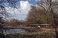
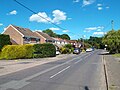
English: Kelvedon Hatch is a village in the civil parish of Kelvedon Hatch, in south Essex, England. It is situated just north of Pilgrims Hatch, approximately 4 miles to the north of Brentwood and is surrounded by Metropolitan Green Belt. The village today is no longer a rural backwater with a large proportion of its population commuting to work elsewhere.
Subcategories
This category has only the following subcategory.
Media in category "Kelvedon Hatch"
The following 86 files are in this category, out of 86 total.
-
 'The Shepherd Inn' on Blackmore Road - geograph.org.uk - 730621.jpg 640 × 433; 53 KB
-
 A128 Ongar Road, Kelvedon Hatch - geograph.org.uk - 4401721.jpg 424 × 640; 110 KB
-
 Ancient Hornbeam in Pole's Wood - geograph.org.uk - 4401864.jpg 424 × 640; 96 KB
-
 Assault Course - geograph.org.uk - 4401792.jpg 640 × 424; 108 KB
-
 Barn at Langford Bridge Farm, Kelvedon Hatch - geograph.org.uk - 6501519.jpg 3,648 × 2,255; 3.5 MB
-
 Bend in the Ongar Rd - geograph.org.uk - 5770647.jpg 640 × 424; 75 KB
-
 Beware falling conkers - geograph.org.uk - 5596275.jpg 4,000 × 3,000; 4.6 MB
-
 Bridge to Great Myles - geograph.org.uk - 4401817.jpg 640 × 424; 79 KB
-
 Bridleway Near Great Myles - geograph.org.uk - 4401824.jpg 424 × 640; 113 KB
-
 Bridleway Near Langford Bridge - geograph.org.uk - 4401842.jpg 640 × 424; 62 KB
-
 Bridleway Through Pole's Wood - geograph.org.uk - 4401753.jpg 424 × 640; 133 KB
-
 Bridleway through The Coppice, Kelvedon Hatch - geograph.org.uk - 6610535.jpg 2,736 × 2,736; 5.56 MB
-
 Bridleway to Langford Bridge - geograph.org.uk - 4401731.jpg 424 × 640; 117 KB
-
 Bridleway ^ Estate Cottages - geograph.org.uk - 4401831.jpg 640 × 424; 129 KB
-
 Byway to Fox Hatch - geograph.org.uk - 2963193.jpg 640 × 480; 131 KB
-
 Byway to Fox Hatch - geograph.org.uk - 2963195.jpg 640 × 480; 182 KB
-
 Church Road, Kelvedon Hatch - geograph.org.uk - 4516023.jpg 640 × 480; 105 KB
-

-
 Crest on The Gate - geograph.org.uk - 5770667.jpg 424 × 640; 57 KB
-
 Crow Farm lane - geograph.org.uk - 3358329.jpg 424 × 640; 115 KB
-

-

-
 Doddinghurst Radio Mast - geograph.org.uk - 4547416.jpg 3,000 × 4,000; 3.75 MB
-
 Eagle Field - geograph.org.uk - 4547666.jpg 4,000 × 3,000; 4.99 MB
-

-
 Farm Drive to Germain's Farm - geograph.org.uk - 5770681.jpg 424 × 640; 104 KB
-
 Field Margin by The River Roding - geograph.org.uk - 5927830.jpg 1,024 × 678; 209 KB
-
 Field margin, tilled land, Kelvedon Hatch - geograph.org.uk - 6610525.jpg 3,648 × 2,255; 4.02 MB
-
 Field north of Kelvedon Hatch churchyard - geograph.org.uk - 2963121.jpg 640 × 480; 123 KB
-
 Footbridge to Germains Farm - geograph.org.uk - 5927818.jpg 1,024 × 678; 212 KB
-
 Footpath from Cow Farm Lane to the Ongar Road - geograph.org.uk - 4302532.jpg 1,024 × 681; 253 KB
-
 Footpath through field, near Stocks Lane, Kelvedon Hatch - geograph.org.uk - 6610542.jpg 3,648 × 2,255; 3.47 MB
-
 Footpath to Stondon Massey - geograph.org.uk - 4401770.jpg 424 × 640; 116 KB
-
 Gatehouse to Kelvedon Hall - geograph.org.uk - 5770663.jpg 640 × 424; 78 KB
-
 Grass field near Great Myles House, Kelvedon Hatch - geograph.org.uk - 6507158.jpg 3,648 × 2,736; 4.39 MB
-
 Group of willows near Cow Farm, Kelvedon Hatch - geograph.org.uk - 6610548.jpg 2,936 × 1,815; 1.71 MB
-
 Harvested field near Pump Farm Cottages, Kelvedon Hatch - geograph.org.uk - 6608356.jpg 3,648 × 2,255; 3.03 MB
-
 Hornbeam Pollards in Pole's Wood - geograph.org.uk - 4401866.jpg 424 × 640; 103 KB
-
 Kelvedon Hatch churchyard - geograph.org.uk - 6342585.jpg 1,024 × 768; 430 KB
-

-
 Kelvedon Hatch village sign (close-up) - geograph.org.uk - 4184726.jpg 4,320 × 3,240; 3.96 MB
-
 Kelvedon Hatch village sign - geograph.org.uk - 4184721.jpg 3,240 × 4,320; 5.59 MB
-
 Kelvedon Hatch War Memorial - geograph.org.uk - 4516014.jpg 640 × 480; 99 KB
-
 Kumru Lodge, Kelvedon Hatch - geograph.org.uk - 3446214.jpg 643 × 394; 82 KB
-
 Kumru Lodge, Kelvedon Hatch - geograph.org.uk - 3446223.jpg 646 × 364; 62 KB
-
 Lake by Great Myles - geograph.org.uk - 4401804.jpg 640 × 292; 46 KB
-
 Langford Bridge Farm bus stops - geograph.org.uk - 3505848.jpg 640 × 480; 138 KB
-
 Looking towards Kelvedon Hall, Kelvedon Hatch - geograph.org.uk - 6610497.jpg 3,648 × 2,255; 2.01 MB
-
 Muddy Path Through "The Coppice" - geograph.org.uk - 4401735.jpg 424 × 640; 100 KB
-
 North end of Cow Farm Lane, Kelvedon Hatch - geograph.org.uk - 4302508.jpg 1,024 × 681; 304 KB
-
 Nuclear Races, Kelvedon Hatch - geograph.org.uk - 6166157.jpg 1,808 × 1,132; 1.19 MB
-
 Nuclear Races, Kelvedon Hatch - geograph.org.uk - 6166160.jpg 1,842 × 1,150; 1.05 MB
-
 Obstacle course apparatus, Kelvedon Hatch - geograph.org.uk - 6507153.jpg 3,648 × 2,736; 6.04 MB
-
 Oilseed Rape Panorama - geograph.org.uk - 5770637.jpg 640 × 251; 44 KB
-

-
 Ongar Road, Fox Hatch - geograph.org.uk - 6166266.jpg 1,828 × 1,124; 1.14 MB
-
 Ongar Road, Kelvedon Hatch - geograph.org.uk - 4516018.jpg 640 × 480; 87 KB
-
 Ongar Road, Kelvedon Hatch - geograph.org.uk - 6163580.jpg 1,886 × 1,226; 1.24 MB
-
 Ongar Road, Kelvedon Hatch - geograph.org.uk - 6166230.jpg 1,920 × 1,280; 1.88 MB
-
 Ploughed Up Path to Germains Farm - geograph.org.uk - 5919527.jpg 1,024 × 678; 253 KB
-
 Ponies in field near Furze Wood, Kelvedon Hatch - geograph.org.uk - 6618605.jpg 3,648 × 2,255; 1.95 MB
-
 Right of Way^ - geograph.org.uk - 4401777.jpg 640 × 424; 88 KB
-
 River Roding at Langford Bridge - geograph.org.uk - 4401850.jpg 424 × 640; 78 KB
-
 Road Junction on Blackmore Road - geograph.org.uk - 3282486.jpg 2,464 × 1,632; 1.03 MB
-
 School Road - geograph.org.uk - 4401723.jpg 640 × 424; 60 KB
-
 School Road, Kelvedon Hatch - geograph.org.uk - 4516012.jpg 640 × 480; 87 KB
-
 Sheds, Round Spring - geograph.org.uk - 3117102.jpg 640 × 480; 80 KB
-
 Soggy Path in Pole's Wood - geograph.org.uk - 4401748.jpg 424 × 640; 112 KB
-
 St Nicholas's church clock, Kelvedon Hatch - geograph.org.uk - 6342580.jpg 1,024 × 684; 237 KB
-
 St Nicholas's church, Kelvedon Hatch - geograph.org.uk - 6342575.jpg 1,024 × 768; 345 KB
-
 Stream Near Great Myles - geograph.org.uk - 4401835.jpg 424 × 640; 116 KB
-
 Stream ^ Bushey Wood - geograph.org.uk - 4401761.jpg 424 × 640; 114 KB
-
 The Coppice, Kelvedon Hatch - geograph.org.uk - 4516010.jpg 640 × 480; 91 KB
-
 The End of Crow Farm Lane - geograph.org.uk - 3359598.jpg 424 × 640; 91 KB
-
 The old Langford Bridge - geograph.org.uk - 3496048.jpg 640 × 480; 179 KB
-
 The Shepherd Inn - geograph.org.uk - 4184701.jpg 4,320 × 3,240; 3.37 MB
-
 Tilled field, Navestock Side - geograph.org.uk - 6608351.jpg 3,648 × 2,255; 4.15 MB
-
 Time 4 Pets on Ongar Road, Kelvedon Hatch - geograph.org.uk - 6163933.jpg 1,920 × 1,280; 856 KB
-
 Towards Clapgate - geograph.org.uk - 4401768.jpg 640 × 424; 92 KB
-
 Towards Kelvedon Hall Lane - geograph.org.uk - 5770685.jpg 424 × 640; 106 KB
-
 Towards the Roding - geograph.org.uk - 5927823.jpg 1,024 × 678; 194 KB
-
 Tree by Ongar Road, Kelvedon Hatch - geograph.org.uk - 6166227.jpg 1,920 × 1,280; 1.8 MB
-
 Tree in tilled field, Navestock Side - geograph.org.uk - 6608349.jpg 3,648 × 2,255; 2.59 MB
-
 Tree in wheat field - geograph.org.uk - 3506901.jpg 640 × 480; 95 KB
-
 Woodland, Doddinghurst Common - geograph.org.uk - 6344005.jpg 1,024 × 768; 442 KB
-


_-_geograph.org.uk_-_4184726.jpg)


