Category:Kemnath
Salti al navigilo
Salti al serĉilo
komunumo en Bavario, Germanio      | |||||
| Alŝuti plurmedion | |||||
| Prononco-registraĵo | |||||
|---|---|---|---|---|---|
| Estas |
| ||||
| Parto de |
| ||||
| Loko | distrikto Tirschenreuth, Supra Palatinato, Bavario, Germanio | ||||
| Loĝantaro |
| ||||
| Areo |
| ||||
| Supermara alteco |
| ||||
| Alia ol | |||||
| oficiala retejo | |||||
 | |||||
Subkategorioj
Ĉi tiu kategorio havas la 11 jenajn subkategoriojn, el 11 entute.
B
C
H
- Härtling bei Anzenberg (2 D)
K
- Kemnath Karpfenweg (10 D)
M
R
S
- Schlossberg bei Waldeck (6 D)
- Stadtweiher (Kemnath) (7 D)
- Streets and squares in Kemnath (15 D)
Dosieroj en kategorio “Kemnath”
La jenaj 43 dosieroj estas en ĉi tiu kategorio, el 43 entute.
-
 300 Jahre Familie Thorer - 50 Jahre Theodor Thorer (04).jpg 1 042 × 1 500; 264 KB
-
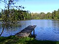
 Am Luderweiher - panoramio.jpg 2 304 × 3 072; 1,62 MB
-
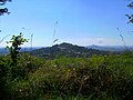
 Armesberg - panoramio (1).jpg 3 072 × 2 304; 1,09 MB
-
 Armesberg - panoramio.jpg 3 072 × 2 304; 1,37 MB
-
 Blick vom Kuschberg (HDR) - panoramio.jpg 4 292 × 2 687; 1,94 MB
-
 Blick von der Ruine Waldeck zum Rauhen Kulm - panoramio.jpg 1 600 × 1 200; 388 KB
-
 Burg Oberndorf.PNG 605 × 403; 607 KB
-
De-Kemnath.ogg 2,0 s; 19 KB
-
 Die alte Ulme am Anzenstein - panoramio.jpg 4 608 × 3 456; 2,67 MB
-
 Die Grünen-Kemnath.jpg 5 184 × 3 456; 4,29 MB
-
 Digitales Orthofoto von Kemnath (Bayerische Vermessungsverwaltung).tif 37 500 × 22 500; 1,54 GB
-
 Fischweiher Reuthigraben - panoramio.jpg 1 600 × 1 200; 286 KB
-
 Flag of Kemnath.svg 1 280 × 800; 2 KB
-
 Galgenberg - panoramio.jpg 4 608 × 3 456; 4,13 MB
-
 Gipfelfelsen Anzenstein - panoramio.jpg 3 456 × 4 608; 2,02 MB
-
 Hessenreuther Wald - panoramio.jpg 4 608 × 3 456; 2,23 MB
-
 Hütte Anzenberg - panoramio.jpg 4 091 × 3 065; 3,46 MB
-
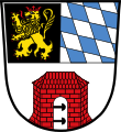 DEU Kemnath COA.svg 512 × 559; 73 KB
-
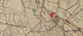
 Kemnath in TIR.svg 780 × 516; 594 KB
-
 Kemnath Maibaum.JPG 1 581 × 3 306; 394 KB
-
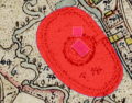
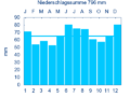 KEMNATH nieder.png 480 × 360; 5 KB
-
 KEMNATH nieder.svg 512 × 427; 21 KB
-
 Kemnath, Gasthaus Weißes Ross und Goldene Krone, Gewerbeschild.jpg 2 277 × 1 697; 614 KB
-
 Kemnath, Haus Stadtplatz 18, Gewerbeschild.jpg 2 551 × 1 701; 857 KB
-
 Kneippanlage "Fischbrunnen" - panoramio.jpg 4 608 × 3 456; 2,36 MB
-
 Kuschberg - panoramio.jpg 1 600 × 1 200; 292 KB
-
 Kuschberg 1 - panoramio.jpg 4 608 × 3 456; 2,09 MB
-
 Kuschberg 2 - panoramio.jpg 3 936 × 2 955; 1,39 MB
-
 Kuschberggipfel - panoramio.jpg 4 608 × 3 456; 1,84 MB
-
 Luderweiher - panoramio.jpg 3 072 × 2 304; 2,59 MB
-
 Rastplatz am Seeweiher - panoramio.jpg 4 075 × 3 057; 2,49 MB
-
 Schloss Fortschau.PNG 962 × 426; 903 KB
-
 Schloss Ober- und Unterschönreuth.PNG 647 × 426; 596 KB
-
 Schloss Schlackenhof.PNG 573 × 448; 708 KB
-
 Siebmacher107-Kemnath.jpg 577 × 777; 154 KB
-
 Vulkanlandschaft - panoramio.jpg 1 600 × 1 200; 300 KB
-
 Wappen Kemnath.png 192 × 208; 7 KB
-
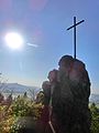
 Wegkreuz am Bergholz - panoramio.jpg 4 608 × 3 456; 3,06 MB
-
 Wegkreuz am Kühberg - panoramio.jpg 3 456 × 4 608; 3,32 MB
-
 Wegkreuz am Sportplatz - panoramio.jpg 3 456 × 4 608; 3,7 MB
-
 Wegkreuz bei Ziegelhütte - panoramio.jpg 3 456 × 4 608; 3,79 MB
-
 Weiher im Deißental - panoramio.jpg 3 915 × 2 943; 1,49 MB
-
 Weiher im Reuthigraben - panoramio.jpg 4 608 × 3 456; 2,32 MB
.jpg)

.jpg)

_-_panoramio.jpg)


