Category:Kennington, Kent
Aller à la navigation
Aller à la recherche
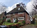
English: Kennington is a suburb of Ashford in Kent, England. It is about a mile northeast of the town centre and north of the M20 motorway, and contains the 12th century church, St Mary's. The main A28 Canterbury Road and A251 Faversham Road run through the village. In recent years the village has expanded with the building of new housing estates in the Little Burton and Towers View areas.
village britannique  | |||||
| Téléverser des médias | |||||
| Nature de l’élément | |||||
|---|---|---|---|---|---|
| Lieu | Ashford, Ashford (borough), Kent, Angleterre du Sud-Est, Angleterre | ||||
 | |||||
Sous-catégories
Cette catégorie comprend 13 sous-catégories, dont les 13 ci-dessous.
B
- Bybrook Cemetery (3 F)
C
- The Conningbrook, Kennington (2 F)
E
- Eastwell Towers (12 F)
J
K
L
- Lodge house, Eastwell Park (3 F)
M
- M20 junction 9 footbridge (39 F)
O
- Oasts in Kennington (2 F)
- The Old Mill, Kennington (7 F)
R
- The Rose Inn, Kennington (4 F)
Média dans la catégorie « Kennington, Kent »
Cette catégorie comprend 231 fichiers, dont les 200 ci-dessous.
(page précédente) (page suivante)-
 243 Faversham Road, Kennington.jpg 3 456 × 4 608 ; 5,06 Mio
-
 28 The Street, Kennington.jpg 3 246 × 2 434 ; 1,26 Mio
-
 60 The Street, Kennington 2.jpg 4 608 × 3 456 ; 3,99 Mio
-
 60 The Street, Kennington.jpg 4 608 × 3 456 ; 4,4 Mio
-
 64-68 The Street, Kennington 2.jpg 4 608 × 3 456 ; 4,25 Mio
-
 64-68 The Street, Kennington.jpg 4 608 × 3 456 ; 6,09 Mio
-
 A2042 Faversham Road - geograph.org.uk - 5862499.jpg 1 024 × 684 ; 299 kio
-
 A2042 junction with A251, near Ashford - geograph.org.uk - 3996057.jpg 3 696 × 2 448 ; 4,03 Mio
-
 A2070 at Kennington, Ashford - geograph.org.uk - 3390441.jpg 1 024 × 683 ; 137 kio
-
 A2070 Willesborough Road - geograph.org.uk - 3996024.jpg 3 544 × 2 272 ; 3,22 Mio
-
 A251 junction with Sandyhurst Lane - geograph.org.uk - 3812240.jpg 3 550 × 2 588 ; 1,14 Mio
-
 A251 roundabout west of Grosvenor Hall - geograph.org.uk - 3812203.jpg 3 648 × 2 736 ; 1,65 Mio
-
 A28 Canterbury Road - geograph.org.uk - 5862484.jpg 1 024 × 768 ; 258 kio
-
 A28 Canterbury Road - geograph.org.uk - 5862491.jpg 1 024 × 768 ; 302 kio
-
 A28 Canterbury Road, Kennington - geograph.org.uk - 5936747.jpg 3 769 × 2 827 ; 2,49 Mio
-
 A28 Canterbury Road, Kennington - geograph.org.uk - 5937630.jpg 4 608 × 3 456 ; 3,98 Mio
-
 A28 Canterbury Road, Kennington - geograph.org.uk - 5937637.jpg 4 608 × 3 456 ; 4,35 Mio
-
 A28 Canterbury Road, Kennington - geograph.org.uk - 5941506.jpg 4 000 × 2 937 ; 3,04 Mio
-
 A28 Canterbury Road, Kennington - geograph.org.uk - 5941641.jpg 4 608 × 3 456 ; 3,86 Mio
-
 A28 Canterbury Road, Kennington - geograph.org.uk - 5941660.jpg 4 608 × 3 456 ; 3,94 Mio
-
 Almshouse - geograph.org.uk - 414806.jpg 640 × 480 ; 229 kio
-
 Almshouse Info at Laurel Tree House.jpg 4 608 × 3 456 ; 6,01 Mio
-
 American Diner - geograph.org.uk - 4156348.jpg 640 × 480 ; 96 kio
-
 Apple Cottage, Kennington - 53128428487.jpg 4 608 × 3 456 ; 6,23 Mio
-
 Arable land - geograph.org.uk - 5158131.jpg 640 × 426 ; 58 kio
-
 Ashford , Faversham Road - geograph.org.uk - 916804.jpg 640 × 480 ; 143 kio
-
 Ashford , Pump House, Kennington - geograph.org.uk - 916471.jpg 426 × 640 ; 148 kio
-
 Ashford , Pump House, Kennington - geograph.org.uk - 916478.jpg 473 × 640 ; 154 kio
-
 Ashford , Pump House, Kennington - geograph.org.uk - 916485.jpg 391 × 640 ; 134 kio
-
 Ashford bound train - geograph.org.uk - 2995506.jpg 640 × 430 ; 68 kio
-
 Ashford Golf Course - geograph.org.uk - 1880345.jpg 3 072 × 2 304 ; 1,8 Mio
-
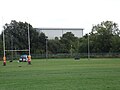
 Ashford Rugby Football Club Pavilion at Kinneys Field - geograph.org.uk - 5941987.jpg 4 608 × 3 456 ; 4,36 Mio
-
 Ashford Rugby Football Club Pavilion at Kinneys Field - geograph.org.uk - 5942721.jpg 4 608 × 3 456 ; 3,94 Mio
-
 Ashford Rugby Football Club Pavilion at Kinneys Field - geograph.org.uk - 5942725.jpg 4 608 × 3 456 ; 4 Mio
-
 Ashford Rugby Football Club Pavilion at Kinneys Field - geograph.org.uk - 5943414.jpg 4 608 × 3 456 ; 4,05 Mio
-
 Ashford Rugby Football Club sign - geograph.org.uk - 5941916.jpg 4 608 × 3 456 ; 3,75 Mio
-
 Ashford Rugby Football Club sign - geograph.org.uk - 5942492.jpg 2 944 × 3 926 ; 4,26 Mio
-
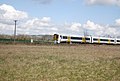
 Ashford to Canterbury railway line - geograph.org.uk - 2995498.jpg 640 × 430 ; 64 kio
-
 Ashford to Canterbury railway line - geograph.org.uk - 402249.jpg 640 × 480 ; 77 kio
-
 Ashford Travelodge - geograph.org.uk - 2769070.jpg 4 288 × 3 216 ; 5,78 Mio
-
 Ashford Wastewater Treatment ^ Recycling Centre Building - geograph.org.uk - 5942579.jpg 4 608 × 3 456 ; 3,89 Mio
-
 Ashford Wastewater Treatment ^ Recycling Centre Building - geograph.org.uk - 5943409.jpg 4 000 × 1 826 ; 1,66 Mio
-
 Ashford Wastewater Treatment ^ Recycling Centre sign - geograph.org.uk - 5941940.jpg 3 866 × 2 900 ; 4,43 Mio
-

-
 Ashford, Kennington Memorial Shelter - geograph.org.uk - 1763999.jpg 462 × 640 ; 121 kio
-
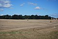 Bales in the Stour Valley - geograph.org.uk - 4188910.jpg 640 × 430 ; 53 kio
-
 Ball Lane, Kennington.jpg 3 456 × 4 608 ; 8,53 Mio
-
 Bannatyne's Heath Club, Ashford - geograph.org.uk - 2558843.jpg 3 072 × 2 304 ; 1,63 Mio
-
 Barton House, Kennington.jpg 4 608 × 2 592 ; 2,25 Mio
-
 Big Field - geograph.org.uk - 5158130.jpg 640 × 426 ; 42 kio
-
 Bockhanger Farmhouse.jpg 3 712 × 2 784 ; 2,56 Mio
-
 Bushes in a farming landscape - geograph.org.uk - 5158134.jpg 640 × 426 ; 54 kio
-
 Bybrook Road - geograph.org.uk - 2535918.jpg 640 × 480 ; 118 kio
-
 Cane Gardener, Ashford - geograph.org.uk - 2558807.jpg 3 072 × 2 304 ; 2,44 Mio
-
 Canon Woods Way, Kennington, Ashford - geograph.org.uk - 2215667.jpg 4 320 × 3 240 ; 3,8 Mio
-
 Canterbury Road (A28), Kennington, Ashford, Kent - geograph.org.uk - 5776011.jpg 1 024 × 664 ; 222 kio
-
 Canterbury Road - geograph.org.uk - 2536092.jpg 640 × 480 ; 84 kio
-
 Canterbury Road, (A28) Ashford - geograph.org.uk - 2215662.jpg 4 320 × 3 240 ; 3,84 Mio
-
 Chapel Bridge - geograph.org.uk - 1842272.jpg 3 072 × 2 304 ; 2,27 Mio
-
 Church of Jesus Christ of Latter-day Saints, Kennington - geograph.org.uk - 5941672.jpg 3 000 × 4 000 ; 3,35 Mio
-
 Clarke Crescent, Kennington - geograph.org.uk - 3422486.jpg 2 048 × 1 536 ; 1,48 Mio
-
 Coast-bound M20 - geograph.org.uk - 5835286.jpg 1 024 × 684 ; 170 kio
-
 Coast-bound M20 - geograph.org.uk - 5835307.jpg 1 024 × 684 ; 286 kio
-
 Coast-bound M20 - geograph.org.uk - 5835325.jpg 1 024 × 684 ; 194 kio
-
 Converted Barn by Temple House.jpg 4 608 × 2 592 ; 1,81 Mio
-
 Corner of hedge - geograph.org.uk - 5825914.jpg 1 024 × 681 ; 106 kio
-
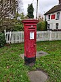 Corroded Postbox, Kennington.jpg 3 456 × 4 608 ; 7,56 Mio
-
 Croft Hotel, Canterbury Road - geograph.org.uk - 6256805.jpg 3 264 × 2 448 ; 2,02 Mio
-
 Culvers Barn - 53129018291.jpg 4 608 × 3 456 ; 6,69 Mio
-
 Cycle Path to Kennington - geograph.org.uk - 5941882.jpg 2 879 × 3 839 ; 4,21 Mio
-
 Ditch or small stream at field boundary - geograph.org.uk - 796169.jpg 640 × 480 ; 230 kio
-
 Elm Tree listed building.jpg 4 608 × 3 456 ; 5,33 Mio
-
 Entrance to Ashford Wastewater Treatment ^ Recycling Centre - geograph.org.uk - 5941954.jpg 2 958 × 3 944 ; 4,63 Mio
-
 Entrance to Dobbies Garden Centre - geograph.org.uk - 2558817.jpg 3 072 × 2 304 ; 1,84 Mio
-
 Eureka Park Beefeater - geograph.org.uk - 2558837.jpg 2 952 × 2 154 ; 1,19 Mio
-
 Exit slip road eastbound at Junction 9 - geograph.org.uk - 2431766.jpg 640 × 481 ; 85 kio
-
 Extensive field - geograph.org.uk - 5825912.jpg 1 024 × 681 ; 105 kio
-
 Factory by the Great Stour - geograph.org.uk - 4259087.jpg 640 × 326 ; 45 kio
-
 Fallow fields - geograph.org.uk - 3451841.jpg 640 × 342 ; 34 kio
-
 Farmland in the Stour Valley - geograph.org.uk - 3451844.jpg 640 × 430 ; 35 kio
-
 Farmland in the Stour Valley - geograph.org.uk - 3451851.jpg 640 × 430 ; 31 kio
-
 Farmland in the Stour Valley - geograph.org.uk - 4188914.jpg 640 × 430 ; 56 kio
-
 Farmland in the Stour Valley - geograph.org.uk - 4259081.jpg 640 × 292 ; 28 kio
-
 Farmland in the Stour Valley - geograph.org.uk - 4259083.jpg 640 × 372 ; 32 kio
-
 Farmland on the edge of Kennington - geograph.org.uk - 3451840.jpg 640 × 341 ; 39 kio
-
 Farmland, Kennington - geograph.org.uk - 4840432.jpg 640 × 426 ; 44 kio
-
 Farmland, Stour Valley - geograph.org.uk - 3451847.jpg 640 × 430 ; 35 kio
-
 Faversham Road, Kennington, Ashford - geograph.org.uk - 3997311.jpg 3 696 × 2 448 ; 4,32 Mio
-
 Field drain near Spearmint Corner - geograph.org.uk - 1842126.jpg 3 072 × 2 304 ; 2,89 Mio
-
 Flat farmland - geograph.org.uk - 4840448.jpg 640 × 426 ; 48 kio
-
 Flat land in the Stour Valley - geograph.org.uk - 4188937.jpg 640 × 430 ; 65 kio
-
 Footbridge, M20 - geograph.org.uk - 4612467.jpg 640 × 426 ; 39 kio
-
 Footpath beside the River Great Stour - geograph.org.uk - 1842212.jpg 3 072 × 2 304 ; 1,55 Mio
-
 Footpath junction near railway and Great Stour River - geograph.org.uk - 1842046.jpg 3 072 × 2 304 ; 2,71 Mio
-
 Footpath level crossing - geograph.org.uk - 2995501.jpg 640 × 393 ; 79 kio
-
 Footpath towards Cannon Woods Way - geograph.org.uk - 1842112.jpg 3 072 × 2 304 ; 2,29 Mio
-
 Footpath towards Orchard Lane, Ashford - geograph.org.uk - 1842004.jpg 3 072 × 2 304 ; 2,4 Mio
-
 Footpath towards Spearmint Corner (2) - geograph.org.uk - 1842104.jpg 3 072 × 2 304 ; 2,04 Mio
-
 Footpath towards Spearmint Corner - geograph.org.uk - 1842068.jpg 3 072 × 2 304 ; 2,52 Mio
-
 George Williams Way, Kennington - geograph.org.uk - 5936753.jpg 3 866 × 2 900 ; 2,52 Mio
-
 George Williams Way, Kennington - geograph.org.uk - 5937624.jpg 4 000 × 2 916 ; 2,78 Mio
-
 Glovers, Kennington.jpg 4 000 × 3 000 ; 5,56 Mio
-
 Grasmere Road, Kennington - geograph.org.uk - 1440650.jpg 640 × 480 ; 116 kio
-
 Grasmere Road, Kennington - geograph.org.uk - 1440654.jpg 640 × 480 ; 75 kio
-
 Grasses, arable and barn - geograph.org.uk - 5825918.jpg 1 024 × 681 ; 96 kio
-
 Grassland, Stour Valley - geograph.org.uk - 2995508.jpg 640 × 430 ; 69 kio
-
 Great Bromley Farm Bridge on the River Great Stour - geograph.org.uk - 1842224.jpg 3 072 × 2 304 ; 2,95 Mio
-
 Great Stour - geograph.org.uk - 2992435.jpg 640 × 430 ; 66 kio
-
 Great Stour - geograph.org.uk - 3451836.jpg 640 × 366 ; 32 kio
-
 Great Stour - geograph.org.uk - 5158129.jpg 640 × 332 ; 49 kio
-
 Hedge stretching into the distance - geograph.org.uk - 3451849.jpg 640 × 430 ; 51 kio
-
 Home Farm, Kennington 1.jpg 4 608 × 3 456 ; 5,31 Mio
-
 Home Farm, Kennington 2.jpg 3 530 × 2 648 ; 1,62 Mio
-
 Home Farmhouse, Kennington 1 - 53129427840.jpg 4 608 × 3 456 ; 6,84 Mio
-
 Home Farmhouse, Kennington 2 - 53129427740.jpg 4 608 × 3 456 ; 6,64 Mio
-
 Hotel - geograph.org.uk - 414790.jpg 640 × 480 ; 248 kio
-
 House on Kinney's Lane - geograph.org.uk - 5943410.jpg 4 608 × 3 456 ; 3,73 Mio
-
 House on Kinneys Lane - geograph.org.uk - 5942613.jpg 4 608 × 3 456 ; 4,11 Mio
-
 Houses on Canterbury Road, Kennington - geograph.org.uk - 5154639.jpg 1 990 × 1 454 ; 849 kio
-
 Houses on Frank Edinger Close - geograph.org.uk - 5942538.jpg 4 608 × 3 456 ; 3,7 Mio
-
 Houses on Frank Edinger Close - geograph.org.uk - 5942544.jpg 4 608 × 3 456 ; 3,87 Mio
-
 Houses on Frank Edinger Close - geograph.org.uk - 5942549.jpg 4 608 × 3 456 ; 3,83 Mio
-
 In the Stour Valley - geograph.org.uk - 2995513.jpg 640 × 430 ; 65 kio
-
 Is this the end of the stack of vehicles - geograph.org.uk - 4585301.jpg 1 024 × 425 ; 77 kio
-
 Junction of Canterbury Road and Bybrook Road - geograph.org.uk - 3997318.jpg 3 509 × 2 308 ; 3,35 Mio
-
 Kennington Garden of Rememberance.jpg 4 608 × 3 456 ; 8,19 Mio
-
 Kennington Hall - geograph.org.uk - 1457623.jpg 640 × 480 ; 96 kio
-
 Kennington Junior School.jpg 4 608 × 3 456 ; 5,05 Mio
-
 Kennington Lodge.jpg 4 608 × 3 456 ; 7,56 Mio
-
 Kennington United Church.jpg 4 608 × 3 456 ; 5,82 Mio
-
 Kennington vs Croydon FC 22.02.2020 2.jpg 6 000 × 4 000 ; 2,88 Mio
-
 Kennington vs Croydon FC 22.02.2020.jpg 5 355 × 3 570 ; 2,03 Mio
-
 Kennington Women's Institute.jpg 4 608 × 3 456 ; 5,31 Mio
-
 Kinney's Lane sign - geograph.org.uk - 5941537.jpg 4 608 × 3 456 ; 3,96 Mio
-
 Kinney's Lane, Kennington - geograph.org.uk - 5941515.jpg 4 608 × 3 456 ; 4,24 Mio
-
 Kinney's Lane, Kennington - geograph.org.uk - 5941524.jpg 4 608 × 3 456 ; 3,8 Mio
-
 Kinney's Lane, Kennington - geograph.org.uk - 5941683.jpg 4 608 × 3 456 ; 4,01 Mio
-
 Kinney's Lane, Kennington - geograph.org.uk - 5941689.jpg 4 608 × 3 456 ; 4,01 Mio
-
 Kinney's Lane, Kennington - geograph.org.uk - 5941717.jpg 4 608 × 3 456 ; 3,99 Mio
-
 Kinney's Lane, Kennington - geograph.org.uk - 5941793.jpg 4 608 × 3 456 ; 4 Mio
-
 Kinney's Lane, Kennington - geograph.org.uk - 5942483.jpg 4 608 × 3 456 ; 3,83 Mio
-
 Kinneys Field, Kennington - geograph.org.uk - 5942532.jpg 4 608 × 3 456 ; 3,95 Mio
-
 Kinneys Field, Kennington - geograph.org.uk - 5943408.jpg 4 608 × 3 456 ; 4,16 Mio
-
 Kinneys Field, Kennington - geograph.org.uk - 5943413.jpg 4 608 × 3 456 ; 4,18 Mio
-
 Kinneys Field, Kennington - geograph.org.uk - 5943416.jpg 4 608 × 3 456 ; 4,04 Mio
-
 Lake View Ashford Motel - geograph.org.uk - 2946188.jpg 640 × 446 ; 104 kio
-
 Laurel Tree House, 56 The Street 2.jpg 3 335 × 2 501 ; 1,08 Mio
-
 Laurel Tree House, 56 The Street.jpg 4 608 × 3 456 ; 4,1 Mio
-
 Level crossing near a drain - geograph.org.uk - 1842015.jpg 3 072 × 2 304 ; 3,02 Mio
-
 Level crossing near Spearmint Corner - geograph.org.uk - 1842139.jpg 3 072 × 2 304 ; 2,52 Mio
-

-
 M20 sliproad interchange with A20 - geograph.org.uk - 3812195.jpg 3 648 × 2 736 ; 2,13 Mio
-
 May Tree Cottage, Kennington.jpg 3 669 × 2 064 ; 1,92 Mio
-
 McDonald's, Rutherford Road - geograph.org.uk - 2536101.jpg 640 × 480 ; 71 kio
-
 Millers Ley, Kennington.jpg 3 880 × 2 910 ; 9,42 Mio
-

-
 Oak Farm Cottage, Kennington.jpg 2 315 × 1 737 ; 742 kio
-
 Oilseed rape - geograph.org.uk - 2995521.jpg 640 × 430 ; 67 kio
-
 Old House Cottage, Ashford - geograph.org.uk - 1457670.jpg 640 × 480 ; 96 kio
-
 Old House, Ashford - geograph.org.uk - 1457676.jpg 640 × 480 ; 110 kio
-
 Old Mill Cottage, Kennington.jpg 4 608 × 3 456 ; 8,07 Mio
-
 On the edge of Kennington - geograph.org.uk - 4840439.jpg 640 × 426 ; 43 kio
-
 One of the Conningbrook Fishing Lakes - geograph.org.uk - 1842152.jpg 3 072 × 2 304 ; 2,01 Mio
-
 Ordnance Survey Cut Mark - geograph.org.uk - 4932861.jpg 4 000 × 3 000 ; 4,28 Mio
-
 Ordnance Survey Flush Bracket 2885 - geograph.org.uk - 4932815.jpg 3 697 × 2 773 ; 2,64 Mio
-
 Pace Garage, Kennington.jpg 4 608 × 3 456 ; 13,86 Mio
-
 Pasture, The Stour Valley - geograph.org.uk - 4947816.jpg 640 × 426 ; 33 kio
-
 Penlee Point - geograph.org.uk - 1193476.jpg 640 × 480 ; 91 kio
-
 Pickelden Lane - geograph.org.uk - 1491845.jpg 640 × 427 ; 81 kio
-
 Pilgrims Way Cycle Path signpost - geograph.org.uk - 5941967.jpg 2 905 × 3 873 ; 4,61 Mio
-
 Pilgrims Way Cycle Path to Maidstone ^ Rochester - geograph.org.uk - 5941959.jpg 3 000 × 4 000 ; 3,98 Mio
-
 Premier Inn, Ashford - geograph.org.uk - 2558841.jpg 3 072 × 2 304 ; 1,76 Mio
-
 Railway and train to Ashford - geograph.org.uk - 1842023.jpg 3 072 × 2 304 ; 1,49 Mio
-
 Railway crossing - geograph.org.uk - 794961.jpg 640 × 480 ; 215 kio
-
 Railway to Ashford - geograph.org.uk - 1842132.jpg 3 072 × 2 304 ; 2,15 Mio
-
 Railway to Wye - geograph.org.uk - 1842031.jpg 3 072 × 2 304 ; 1,57 Mio
-
 Railway to Wye and Canterbury - geograph.org.uk - 1842143.jpg 3 072 × 2 304 ; 2,62 Mio
-
 Ripe wheat - geograph.org.uk - 4840447.jpg 640 × 426 ; 44 kio
-
 River Great Stour - flowing away from Ashford - geograph.org.uk - 1842234.jpg 3 072 × 2 304 ; 1,6 Mio
-
 River Great Stour - flowing towards Wye - geograph.org.uk - 1841999.jpg 3 072 × 2 304 ; 1,89 Mio
-
 River Great Stour - flowing towards Wye - geograph.org.uk - 1842176.jpg 3 072 × 2 304 ; 2,29 Mio
-
 River Great Stour - flowing towards Wye - geograph.org.uk - 1842197.jpg 3 072 × 2 304 ; 1,53 Mio
-
 River Great Stour - flowing towards Wye - geograph.org.uk - 1842240.jpg 3 072 × 2 304 ; 1,84 Mio
-
 River Great Stour - flowing towards Wye - geograph.org.uk - 1842276.jpg 3 072 × 2 304 ; 2,26 Mio
-
 River Great Stour - geograph.org.uk - 2995495.jpg 640 × 430 ; 93 kio
-
 River Great Stour and Great Bromley Farm - geograph.org.uk - 1842254.jpg 3 072 × 2 304 ; 1,74 Mio
-
 Road off the A28 Canterbury Road - geograph.org.uk - 5941709.jpg 4 608 × 3 456 ; 3,92 Mio
-
 Road works on A28 Canterbury Road - geograph.org.uk - 5862494.jpg 1 024 × 768 ; 278 kio
-
 Rough grass, The Stour Valley - geograph.org.uk - 4947817.jpg 640 × 426 ; 46 kio
-
 Roundabout at junction 9 off the M20 Motorway - geograph.org.uk - 5934803.jpg 3 724 × 2 793 ; 3,25 Mio
-
 Roundabout at the junction of Willesborough Road and Canterbury Road - geograph.org.uk - 3422549.jpg 2 048 × 1 536 ; 1,55 Mio
-
 Sewage Works - geograph.org.uk - 5158124.jpg 640 × 426 ; 51 kio
-
 Sewage works, Ashford - geograph.org.uk - 3451833.jpg 640 × 430 ; 42 kio
-
 Shops in Faversham Road, Kennington, Ashford, Kent - geograph.org.uk - 2885708.jpg 1 024 × 668 ; 247 kio
-
 Shops on George Williams Way, Kennington - geograph.org.uk - 3422568.jpg 2 048 × 1 536 ; 1,44 Mio
-
 Side of The Old House.jpg 3 616 × 2 712 ; 1,66 Mio
-
 Spearpoint Corner - geograph.org.uk - 4840421.jpg 640 × 426 ; 56 kio
-
 Stile beside the River Great Stour - geograph.org.uk - 1842182.jpg 3 072 × 2 304 ; 1,54 Mio
-
 Stone House, Kennington.jpg 4 206 × 3 155 ; 2,9 Mio
-
 Stour Valley Walk - geograph.org.uk - 2995505.jpg 640 × 430 ; 74 kio


,_Kennington,_Ashford,_Kent_-_geograph.org.uk_-_5776011.jpg)

_Ashford_-_geograph.org.uk_-_2215662.jpg)


_-_geograph.org.uk_-_1842104.jpg)


