Category:Kerk, Herbaijum
Jump to navigation
Jump to search
| Object location | | View all coordinates using: OpenStreetMap |
|---|
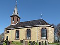
church building in Franekeradeel, Netherlands  | |||||
| Upload media | |||||
| Instance of | |||||
|---|---|---|---|---|---|
| Dedicated to | |||||
| Location | Herbaijum, Waadhoeke, Friesland, Netherlands | ||||
| Street address |
| ||||
| Located on street |
| ||||
| Heritage designation |
| ||||
| Inception |
| ||||
| Significant event |
| ||||
| official website | |||||
 | |||||
|
This is a category about rijksmonument number 15854
|
| Address |
|
Media in category "Kerk, Herbaijum"
The following 21 files are in this category, out of 21 total.
-
 20190920 Kerk1 van Herbaijum.jpg 3,456 × 5,184; 2.99 MB
-
 20190920 Kerk2 van Herbaijum.jpg 5,184 × 3,456; 3.05 MB
-
 20190920 Kerk3 van Herbaijum.jpg 3,456 × 5,184; 5.34 MB
-
 20190920 Kerk4 van Herbaijum.jpg 3,456 × 5,184; 4.49 MB
-
 Detail gewelf - Herbaijum - 20108822 - RCE.jpg 1,197 × 1,200; 140 KB
-
 Detail gewelf - Herbaijum - 20108824 - RCE.jpg 1,192 × 1,200; 148 KB
-
 Herbaijum, kerk foto2 2010-04-17 11.50.JPG 3,185 × 2,389; 5.6 MB
-
 Interieur naar het oosten - Herbaijum - 20108820 - RCE.jpg 966 × 1,200; 138 KB
-
 Interieur naar het westen - Herbaijum - 20108821 - RCE.jpg 944 × 1,200; 138 KB
-

-

-
 Noord-oost gevel - Herbaijum - 20108817 - RCE.jpg 1,200 × 946; 350 KB
-
 Noord-west gevel - Herbaijum - 20108816 - RCE.jpg 948 × 1,200; 292 KB
-
 Oostgevel - Herbaijum - 20108819 - RCE.jpg 953 × 1,200; 303 KB
-
 Preekstoel - Herbaijum - 20108823 - RCE.jpg 951 × 1,200; 151 KB
-

-
 Tsjerke fan Hjerbeam.jpg 6,000 × 4,000; 10.02 MB
-
 Voorzijde - Herbaijum - 20108834 - RCE.jpg 1,190 × 1,200; 395 KB
-
 Westgevel - Herbaijum - 20108815 - RCE.jpg 932 × 1,200; 277 KB
-
 Zijgevel - Herbaijum - 20469263 - RCE.jpg 1,200 × 900; 165 KB
-
 Zuid-oost gevel - Herbaijum - 20108818 - RCE.jpg 1,200 × 944; 268 KB


