Category:Kerk, Oudehaske
Jump to navigation
Jump to search
| Object location | | View all coordinates using: OpenStreetMap |
|---|
church building in Skarsterlân, Netherlands  | |||||
| Upload media | |||||
| Instance of | |||||
|---|---|---|---|---|---|
| Location | Oudehaske, De Fryske Marren, Friesland, Netherlands | ||||
| Street address |
| ||||
| Located on street |
| ||||
| Heritage designation |
| ||||
| Inception |
| ||||
| Significant event |
| ||||
| official website | |||||
 | |||||
Orgel
|
This is a category about rijksmonument number 526769
|
| Address |
|
Media in category "Kerk, Oudehaske"
The following 6 files are in this category, out of 6 total.
-
 Aldehaske, PKN-tsjerke.jpg 4,597 × 3,180; 9.63 MB
-
 Aldehaske, tsjerke.jpg 5,103 × 3,531; 12.41 MB
-
 Aldehaske, wynwizer PKN-tsjerke.jpg 2,994 × 4,482; 5.74 MB
-
 Exterieur - Oudehaske - 20178580 - RCE.jpg 807 × 1,200; 147 KB
-
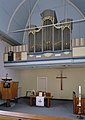 Interieur, aanzicht orgel, orgelnummer 1191 - Oudehaske - 20369394 - RCE.jpg 849 × 1,200; 142 KB
-
 Oudehaske 2.jpg 1,904 × 1,417; 1.31 MB


