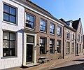
Category:Kerkstraat 59, Vollenhove
Jump to navigation
Jump to search
| Object location | | View all coordinates using: OpenStreetMap |
|---|
building in Steenwijkerland, Netherlands  | |||||
| Upload media | |||||
| Instance of | |||||
|---|---|---|---|---|---|
| Location | Vollenhove, Vollenhove | ||||
| Street address |
| ||||
| Located on street |
| ||||
| Heritage designation |
| ||||
 | |||||
|
This is a category about rijksmonument number 10572
|
| Address |
|
Media in category "Kerkstraat 59, Vollenhove"
The following 7 files are in this category, out of 7 total.
-
 Kerkstraat 61, Vollenhove.JPG 2,592 × 1,944; 1,003 KB
-
 Kerkstraat57 Vollenhove.jpg 3,168 × 2,632; 555 KB
-
 Kerkstraat59 Vollenhove.jpg 1,548 × 1,296; 269 KB
-

-
 Vollenhove 075.JPG 3,264 × 2,448; 1.93 MB
-
 Vollenhove pano 7.JPG 3,957 × 2,109; 2.14 MB
-
 Voorgevel - Vollenhove - 20245187 - RCE.jpg 808 × 1,200; 217 KB


