Category:Kerkstraat 72, Vollenhove
Jump to navigation
Jump to search
| Object location | | View all coordinates using: OpenStreetMap |
|---|
 | |||||
| Upload media | |||||
| Instance of |
| ||||
|---|---|---|---|---|---|
| Location | Vollenhove, Vollenhove | ||||
| Street address |
| ||||
| Located on street |
| ||||
| Heritage designation |
| ||||
 | |||||
|
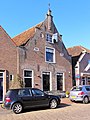
This is a category about rijksmonument number 10573
|
| Address |
|
Media in category "Kerkstraat 72, Vollenhove"
The following 5 files are in this category, out of 5 total.
-
 Kerkstraat72 Vollenhove.jpg 1,368 × 1,824; 361 KB
-
 Overzicht Kerkstraat - Vollenhove - 20244883 - RCE.jpg 1,195 × 1,200; 284 KB
-
 Overzicht voorgevels met schoudergevel met toppilaster - Vollenhove - 20350347 - RCE.jpg 1,176 × 1,200; 306 KB
-
 Vollenhove 078.JPG 2,448 × 3,264; 1.92 MB
-
 Voorgevel - Vollenhove - 20245188 - RCE.jpg 805 × 1,200; 169 KB


