Category:Kerkstraat 44, Voorburg
Jump to navigation
Jump to search
| Object location | | View all coordinates using: OpenStreetMap |
|---|
 | |||||
| Upload media | |||||
| Instance of |
| ||||
|---|---|---|---|---|---|
| Location | Voorburg, Leidschendam-Voorburg, South Holland, Netherlands | ||||
| Street address |
| ||||
| Located on street | |||||
| Heritage designation |
| ||||
 | |||||
|
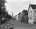
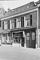
This is a category about rijksmonument number 37958
|
| Address |
|
Media in category "Kerkstraat 44, Voorburg"
The following 4 files are in this category, out of 4 total.
-
 Overzicht - Voorburg - 20245528 - RCE.jpg 1,200 × 952; 225 KB
-
 Overzicht - Voorburg - 20245531 - RCE.jpg 1,200 × 957; 249 KB
-
 Voorburg - Kerkstraat 44-48.jpg 2,592 × 1,944; 1.32 MB
-
 Voorgevels - Voorburg - 20245538 - RCE.jpg 803 × 1,200; 213 KB


