Category:Kerktoren Duizel
Jump to navigation
Jump to search
| Object location | | View all coordinates using: OpenStreetMap |
|---|
church tower in Duizel, Netherlands  | |||||
| Upload media | |||||
| Instance of |
| ||||
|---|---|---|---|---|---|
| Location | Duizel, Eersel, North Brabant, Netherlands | ||||
| Street address |
| ||||
| Located on street |
| ||||
| Heritage designation |
| ||||
 | |||||
|
This is a category about rijksmonument number 14584
|
| Address |
|
Media in category "Kerktoren Duizel"
The following 9 files are in this category, out of 9 total.
-
 Gezicht vanuit het noordwesten - Eersel - 20323566 - RCE.jpg 861 × 1,200; 159 KB
-
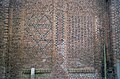 Metselteken in noordgevel ruitmotieven - Duizel - 20364028 - RCE.jpg 1,200 × 787; 253 KB
-
 Oude Kerkstraat 1 Duizel.jpg 3,000 × 4,000; 4.15 MB
-
 Overzicht kerktoren van gesloopte kerk - Duizel - 20348017 - RCE.jpg 1,193 × 1,200; 414 KB
-
 RM14584 Duizel - Kerktoren.jpg 324 × 360; 66 KB
-
 Toren - Duizel - 20065147 - RCE.jpg 1,200 × 794; 92 KB
-
 Toren - Duizel - 20065148 - RCE.jpg 1,200 × 783; 261 KB
-
 Westzijde - Eersel - 20323520 - RCE.jpg 758 × 1,200; 115 KB
-
 Zicht vanuit het zuidwesten - Eersel - 20323544 - RCE.jpg 756 × 1,200; 135 KB


