Category:Keta (Ghana)
Zur Navigation springen
Zur Suche springen
| Objektposition | | Karte mit allen Koordinaten: OpenStreetMap |
|---|
Stadt in Ghana  | |||||
| Medium hochladen | |||||
| Ist ein(e) | |||||
|---|---|---|---|---|---|
| Ort | Keta Municipal District, Volta Region, Ghana | ||||
| Schutzkategorie | |||||
| Einwohnerzahl |
| ||||
| Verschieden von | |||||
 | |||||
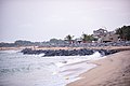
Keta (hist. "Quitta" or similarly) is the capital of the Keta Municipal District of the Volta Region of Ghana. The town is located on the spit between the Awuna Lagoon (Keta Lagoon) and the Atlantic Ocean.According to their tradition was Keta founded in 1678 by Ewe groups which came from the town "Ketu" east of the Mono river (in contemporary southwestern Nigeria).
Unterkategorien
Es werden 6 von insgesamt 6 Unterkategorien in dieser Kategorie angezeigt:
In Klammern die Anzahl der enthaltenen Kategorien (K), Seiten (S), Dateien (D)
- Beaches of Keta (Ghana) (5 D)
- Markets in Keta (Ghana) (2 D)
A
Medien in der Kategorie „Keta (Ghana)“
Folgende 11 Dateien sind in dieser Kategorie, von 11 insgesamt.
-
 Blue sea at Havedzi.JPG 3.072 × 1.728; 1,43 MB
-
 Flooding in Keta.jpg 4.160 × 3.120; 7,73 MB
-
 Keta Lagunenseite.jpg 2.995 × 2.080; 1,35 MB
-
 Keta Sea Defends.jpg 6.016 × 4.016; 3,85 MB
-
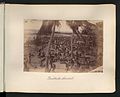
 Orphelinat Quittah.jpg 580 × 372; 52 KB
-
 Soccer (14488692682).jpg 3.336 × 1.344; 2,29 MB
-
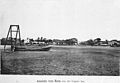
 The National Archives UK - CO 1069-30-22-001.jpg 600 × 398; 192 KB
-
 The National Archives UK - CO 1069-30-23.jpg 929 × 748; 123 KB
-
 The National Archives UK - CO 1069-39-13-1-001.jpg 672 × 474; 139 KB
-
 The National Archives UK - CO 1069-39-14-1-001.jpg 621 × 469; 102 KB
-
 Une leçon de catéchisme.jpg 1.350 × 896; 953 KB


.jpg)