Category:Kfar Chabad
Vai alla navigazione
Vai alla ricerca
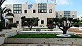
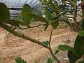
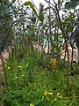
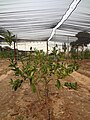
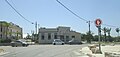
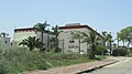
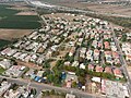
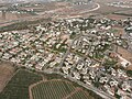
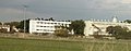
English: Kfar Chabad (, lit. Chabad Village) is a Chabad-Lubavitch village in central Israel. Located between Beit Dagan and Lod, it falls under the jurisdiction of Sdot Dan Regional Council. In 2021 it had a population of 6,797.
human settlement in Israel  | |||||
| Carica un file multimediale | |||||
| Istanza di | |||||
|---|---|---|---|---|---|
| Luogo | Sdot Dan Regional Council, Ramla sub-district, distretto Centrale, Israele | ||||
| Data di fondazione o creazione |
| ||||
| Popolazione |
| ||||
| Superficie |
| ||||
| Altezza sul mare |
| ||||
| sito web ufficiale | |||||
 | |||||
Sottocategorie
Questa categoria contiene le 4 sottocategorie indicate di seguito, su un totale di 4.
File nella categoria "Kfar Chabad"
Questa categoria contiene 81 file, indicati di seguito, su un totale di 81.
-
 93391 kfar habad PikiWiki Israel.jpg 2 560 × 1 440; 718 KB
-
 93392 kfar chavd moshav tochelat PikiWiki Israel.jpg 1 440 × 2 560; 1,48 MB
-
 93393 kfar chavd moshav tochelat PikiWiki Israel.jpg 2 560 × 1 440; 1,39 MB
-
 93404 kfar habad PikiWiki Israel.jpg 2 056 × 3 648; 2,49 MB
-
 93405 kfar habad PikiWiki Israel.jpg 3 648 × 2 056; 2,44 MB
-
 93406 kfar chavd moshav tochelat PikiWiki Israel.jpg 3 648 × 2 056; 3,59 MB
-
 93407 kfar chavd moshav tochelat PikiWiki Israel.jpg 3 648 × 2 056; 3,04 MB
-
 93409 sdot dan regional council PikiWiki Israel.jpg 3 494 × 1 968; 2,29 MB
-
 An abandoned house, near Kfar Habad (6431490445).jpg 3 615 × 1 555; 2,57 MB
-
 Beth Rivkah Kfar Chabad.jpg 2 242 × 625; 229 KB
-
 Etrog plants at kfar chabad closeup.JPG 4 608 × 3 456; 3,88 MB
-
 Etrog plants at kfar chabad with growing etrogs.JPG 3 456 × 4 608; 4,89 MB
-
 Etrog plants at kfar chabad.JPG 3 456 × 4 608; 4,36 MB
-
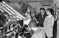
 Flickr - Government Press Office (GPO) - Baking Matzot at a bakery in Kfar Habad.jpg 2 048 × 3 072; 1,12 MB
-
 Flickr - Government Press Office (GPO) - BAKING MATZOT AT KFAR CHABAD.jpg 3 072 × 2 048; 419 KB
-
 Flickr - Government Press Office (GPO) - MAKING MATZAH DOUGH.jpg 2 048 × 3 072; 933 KB
-
-
 Historical map series for the area of al-Safiriyya (1955).jpg 740 × 743; 190 KB
-
 Historical map series for the area of al-Safiriyya (1957).jpg 740 × 743; 175 KB
-
 Kfar Chabad (997009452978105171).jpg 1 537 × 1 518; 1,8 MB
-
 Kfar Chabad (997009452978205171.jpg 1 547 × 1 625; 1,73 MB
-
 Kfar Chabad (997009452978305171).jpg 1 586 × 1 654; 1,73 MB
-
 Kfar Chabad (997009452978405171).jpg 1 518 × 1 605; 1,78 MB
-
 Kfar Chabad (997009452978505171).jpg 1 528 × 1 654; 1,95 MB
-
 Kfar Chabad (997009452978605171).jpg 1 547 × 1 654; 1,96 MB
-
 Kfar Chabad (997009452978705171).jpg 1 518 × 1 566; 1,7 MB
-
 Kfar Chabad (997009452978805171.jpg 1 528 × 1 557; 1,6 MB
-
 Kfar Chabad (997009452978905171).jpg 1 547 × 1 654; 2,04 MB
-
 Kfar Chabad (997009452979005171).jpg 1 537 × 1 576; 1,85 MB
-
 Kfar Chabad (997009452979105171).jpg 1 528 × 1 586; 1,82 MB
-
 Kfar Chabad (997009452979205171).jpg 1 528 × 1 654; 1,9 MB
-
 Kfar Chabad 1067.JPG 4 608 × 2 197; 1,7 MB
-
 Kfar Chabad 1070.JPG 4 546 × 2 078; 1,61 MB
-
 Kfar Chabad 1071.JPG 4 608 × 2 592; 3,02 MB
-
 Kfar Chabad 1072.JPG 4 608 × 2 217; 2,13 MB
-
 Kfar Chabad 1073.JPG 4 608 × 2 149; 1,54 MB
-
 Kfar Chabad 1074.JPG 4 608 × 2 592; 2,47 MB
-
 Kfar Chabad Aerial photo (1).jpg 4 000 × 3 000; 6,13 MB
-
 Kfar Chabad Aerial photo (12).jpg 4 000 × 3 000; 6,02 MB
-
 Kfar Chabad Aerial photo (13).jpg 4 000 × 3 000; 6,15 MB
-
 Kfar Chabad Aerial photo (14) מחלף חב"ד.jpg 4 000 × 3 000; 5,76 MB
-
 Kfar Chabad Aerial photo (15).jpg 4 000 × 3 000; 5,63 MB
-
 Kfar Chabad Aerial photo (2).jpg 4 000 × 3 000; 6,22 MB
-
 Kfar Chabad Aerial photo (3).jpg 4 000 × 3 000; 6,33 MB
-
 Kfar Chabad Aerial photo (4).jpg 4 000 × 3 000; 5,94 MB
-
 Kfar Chabad Aerial photo (5).jpg 4 000 × 3 000; 6,41 MB
-
 Kfar Chabad Aerial photo (6).jpg 4 000 × 3 000; 6,27 MB
-
 Kfar Chabad Aerial photo (7).jpg 4 000 × 3 000; 5,94 MB
-
 Kfar Chabad Aerial photo (8).jpg 4 000 × 3 000; 6,13 MB
-
 Kfar Chabad.jpg 3 264 × 2 316; 4,11 MB
-
 Kfar Chabad1066.JPG 3 047 × 1 709; 842 KB
-
 Kfar Habad, Israel - panoramio (1).jpg 1 600 × 1 200; 816 KB
-
 Kfar Habad, Israel - panoramio (2).jpg 1 600 × 1 200; 885 KB
-
 Kfar Habad, Israel - panoramio.jpg 1 600 × 1 200; 977 KB
-
 PikiWiki Israel 15572 Politics of Israel.jpg 640 × 431; 47 KB
-
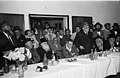
 PikiWiki Israel 15948 Shimon Peres visit in Kfar Habad.jpg 800 × 527; 91 KB
-
 PikiWiki Israel 16241 People of Israel.jpg 1 732 × 1 132; 383 KB
-
 PikiWiki Israel 16415 People of Israel.jpg 3 184 × 2 228; 1,08 MB
-
 PikiWiki Israel 17457 People of Israel.jpg 1 756 × 1 140; 510 KB
-
 PikiWiki Israel 18255 People of Israel.jpg 1 152 × 1 612; 301 KB
-
 PikiWiki Israel 18661 People of Israel.jpg 2 296 × 3 352; 1,16 MB
-
 PikiWiki Israel 18858 Education in Israel.jpg 3 324 × 2 256; 1,3 MB
-
 PikiWiki Israel 19144 Making handmade Mazot in Kfar Habad.JPG 2 048 × 1 536; 692 KB
-
 PikiWiki Israel 19145 Making handmade Mazot in Kfar Habad.JPG 2 048 × 1 536; 713 KB
-
 PikiWiki Israel 19146 Making handmade Mazot in Kfar Habad.JPG 2 048 × 1 536; 703 KB
-
 PikiWiki Israel 19403 Religion in Israel.jpg 840 × 580; 104 KB
-
 PikiWiki Israel 20951 Agriculture in Israel.jpg 3 208 × 2 240; 1,43 MB
-
 PikiWiki Israel 32840 People of Israel.jpg 3 272 × 2 304; 1,23 MB
-
 PikiWiki Israel 33723 Education in Israel.jpg 1 728 × 1 140; 404 KB
-
 PikiWiki Israel 33724 Education in Israel.jpg 1 728 × 1 136; 342 KB
-
 Train infra structure near kfar Habad.jpg 3 264 × 2 448; 1,32 MB
-
 אפיית מצות 18 רגעים.jpg 4 032 × 3 016; 2,68 MB
-
 בית רבקה.jpg 1 600 × 626; 87 KB
-
 בניין המועצה האיזורית שדות דן.jpg 1 440 × 1 080; 391 KB
-
 מכללת בית רבקה.jpg 4 160 × 2 336; 325 KB
-
 משה שילת.jpg 361 × 401; 34 KB
-
 נחום טרבניק.jpg 1 460 × 1 988; 597 KB
-
 רעפים בריטיים בכפר חב"ד - panoramio (1).jpg 4 288 × 3 216; 5,35 MB
-
 רעפים בריטיים בכפר חב"ד - panoramio (2).jpg 4 288 × 3 216; 3,53 MB
-
 רעפים בריטיים בכפר חב"ד - panoramio (3).jpg 4 288 × 3 216; 4,44 MB
-
 רעפים בריטיים בכפר חב"ד - panoramio.jpg 4 288 × 3 216; 4,09 MB


.jpg)


_-_Baking_Matzot_at_a_bakery_in_Kfar_Habad.jpg)
_-_BAKING_MATZOT_AT_KFAR_CHABAD.jpg)
_-_MAKING_MATZAH_DOUGH.jpg)
.jpg)
.jpg)
.jpg)
.jpg)

.jpg)
.jpg)
.jpg)
.jpg)
.jpg)

.jpg)
.jpg)
.jpg)
.jpg)


.jpg)
.jpg)
.jpg)
_%D7%9E%D7%97%D7%9C%D7%A3_%D7%97%D7%91%22%D7%93.jpg)
.jpg)
.jpg)
.jpg)
.jpg)
.jpg)
.jpg)
.jpg)
.jpg)

.jpg)
.jpg)


.jpg)
.jpg)
.jpg)
