Category:Kibichūō, Okayama
Reason: Japanese place names, including municipalities, are officially spelt without macrons; see the Gazetteer of Japan, #1444 provided by the Geospatial Information Authority of Japan
Date: tagged 3 February 2024.
Objections and discussion have their place at Category talk:Kibichūō, Okayama (two weeks are considered as adequate time for possible objections). See Commons:Rename a category for general information and policy.
- If the proposed rename is clearly uncontroversial or consensus-decided, place the bot command (see below) at User talk:CommonsDelinker/commands to be handled by CommonsDelinker or rename it and move the content manually. If the new destination category exists, you can remove this template, replacing it with {{category redirect|Kibichuo, Okayama}}.
- If the proposal is clearly or potentially controversial or requires a broader discussion, you can transfer the discussion to Commons:Categories for discussion (replacing this template with {{subst:cfd}})
- If the proposal is clearly nonsensical, mistaken or consensually rejected, please remove this template.
Warning: processing period depends on activity of Commons volunteers. Some proposals (especially with unclear reason or too weak support) stay waiting for many months to be handled.
Bot command: {{move cat|Kibichūō, Okayama|Kibichuo, Okayama|reason=Japanese place names, including municipalities, are officially spelt without macrons; see [https://www.gsi.go.jp/common/000238295.pdf the Gazetteer of Japan, #1444] provided by the Geospatial Information Authority of Japan}}
| − | Category: | + | Category:Kibichuo, Okayama |
| − | Category:Kibich | + | Category:Kibichuo, Okayama |
town in Kaga district, Okayama prefecture, Japan    | |||||
| Upload media | |||||
| Instance of | |||||
|---|---|---|---|---|---|
| Location |
| ||||
| Legal form |
| ||||
| Inception |
| ||||
| Population |
| ||||
| Area |
| ||||
| Replaces |
| ||||
| official website | |||||
 | |||||
Subcategories
This category has the following 7 subcategories, out of 7 total.
A
- Asahigawa Dam (6 F)
G
- Gokei (24 F)
K
M
- Myōhon-ji (Kibichūō) (17 F)
N
- Narutaki Dam (2 F)
T
- Tenrai-an (5 F)
Y
- Yoshikawa-hachimangu (15 F)
Media in category "Kibichūō, Okayama"
The following 34 files are in this category, out of 34 total.
-
 Emblem of Kayo, Okayama (black).svg 200 × 200; 638 bytes
-
 Emblem of Kayo, Okayama.svg 200 × 200; 653 bytes
-
 Emblem of Kibichūō, Okayama.jpg 367 × 270; 18 KB
-
 Emblem of Kibichūō, Okayama.svg 200 × 170; 1,020 bytes
-
 Flag of Kamogawa Okayama.JPG 354 × 224; 13 KB
-
 Flag of Kayo Okayama.JPG 354 × 224; 8 KB
-
 Flag of Kayo, Okayama.svg 600 × 400; 695 bytes
-
 Flag of Kibichuo Okayama.JPG 354 × 224; 10 KB
-
 Flag of Kibichūō, Okayama.svg 600 × 400; 1 KB
-
 Japan National Route 429 -05.jpg 2,592 × 1,944; 1.47 MB
-
 Japan National Route 484 -04.jpg 2,592 × 1,944; 1.05 MB
-
 Japan National Route 484 -05.jpg 2,592 × 1,944; 1.08 MB
-
 Kamogawa Okayama chapter.JPG 59 × 50; 3 KB
-
 Kayo Okayama chapter.JPG 55 × 50; 2 KB
-
 Kibichuo in Okayama Prefecture Ja.svg 456 × 536; 10 KB
-
 Kibichuo town office Kamogawa branch.jpg 1,600 × 1,200; 997 KB
-
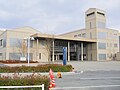 Kibichuo town office.jpg 1,600 × 1,200; 892 KB
-
 Map Kibichuo en,.png 1,281 × 901; 49 KB
-
 Mirei-gorinto.JPG 180 × 240; 89 KB
-
 Okayama Expressway -02.jpg 2,592 × 1,944; 1.13 MB
-
 Okayama Expressway, Kibichūō Town, Kita1.JPG 3,264 × 2,448; 2.53 MB
-
 Okayama Route 72 -03.jpg 2,592 × 1,944; 940 KB
-
 Population distribution of Kibichuo, Okayama, Japan.svg 512 × 256; 22 KB
-
 R429-141.jpg 1,500 × 843; 251 KB
-
 R484-2020-074.jpg 1,920 × 1,080; 514 KB
-
 Roadside Station Kamogawa Enjo 1.jpg 1,600 × 1,200; 923 KB
-
 Roadside Station Kamogawa Enjo 2.jpg 1,600 × 1,200; 839 KB
-
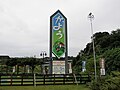 Roadside Station Kayo Name Board.jpg 1,600 × 1,200; 753 KB
-
 Roadside Station Kayo.jpg 1,600 × 1,200; 814 KB
-
 Route429 KibiChuo.jpg 2,304 × 1,728; 1.12 MB
-
 Yoshikawa Takatsuka Kofun.JPG 4,288 × 2,848; 6.46 MB
-
 吉備新線(北の終端部) - panoramio.jpg 4,320 × 3,240; 5.4 MB
-
 鳴滝森林公園 - panoramio - yas f.jpg 2,048 × 1,536; 958 KB
-
 鳴滝森林公園 - panoramio.jpg 2,048 × 1,536; 1.1 MB
.svg)


