Category:Kilmarnock
Zur Navigation springen
Zur Suche springen
Stadt in East Ayrshire, Großbritannien   | |||||
| Medium hochladen | |||||
| Ist ein(e) | |||||
|---|---|---|---|---|---|
| Ort |
| ||||
| Einwohnerzahl |
| ||||
| offizielle Website | |||||
 | |||||
Unterkategorien
Es werden 44 von insgesamt 44 Unterkategorien in dieser Kategorie angezeigt:
In Klammern die Anzahl der enthaltenen Kategorien (K), Seiten (S), Dateien (D)
A
- Ayrshire Athletics Arena (6 D)
- Ayrshire College Kilmarnock (2 D)
B
- Bellfield House (5 D)
- Burns Monument, Kilmarnock (5 D)
C
D
E
- Events in Kilmarnock (1 D)
G
- Glasgow Road, Kilmarnock (3 D)
- Grange School construction (2 D)
H
- HM Prison Kilmarnock (3 D)
J
- John Finnie Street (6 D)
K
- Kilmarnock Bus Station (5 D)
- Kilmarnock cholera pit (3 D)
- Kilmarnock Cross (6 D)
- Kilmarnock railway station (90 D)
- Kilmarnock railway viaduct (10 D)
- Kilmarnock volume (Burns) (13 D)
M
- Meikle Mosside (2 D)
N
- New Mill weir, Kilmarnock (2 D)
O
- Old Courthouse, Kilmarnock (2 D)
P
- Palace Theatre, Kilmarnock (7 D)
- Peden's Cave, River Lugar (26 D)
R
- Rugby Park (18 D)
S
- Soulis Cross (9 D)
T
- Tinkers Hill, Riccarton (4 D)
W
- West Mosside Farm (2 D)
Medien in der Kategorie „Kilmarnock“
Folgende 174 Dateien sind in dieser Kategorie, von 174 insgesamt.
-
 (NS4138) Traffic lights on Bonnyton Road.jpg 800 × 615; 94 KB
-
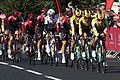
 2019 ToB stage 1 001 Ben Swift in Kilmarnock.JPG 1.366 × 1.024; 438 KB
-
 2019 ToB stage 1 006 Pavel Sivakov in Kilmarnock.JPG 1.366 × 1.024; 485 KB
-
 2019 ToB stage 1 021 Mikel Landa in Kilmarnock.JPG 1.366 × 910; 393 KB
-
 2019 ToB stage 1 Kilmarnock peloton at the sprint line.JPG 1.366 × 910; 620 KB
-

-
 42 Titchfield Street, Kilmarnock - geograph.org.uk - 4236516.jpg 2.257 × 1.920; 2,79 MB
-
 A77 Kilmarnock Bypass - geograph.org.uk - 291118.jpg 640 × 480; 212 KB
-
 A77 Kilmarnock Bypass - geograph.org.uk - 325080.jpg 640 × 478; 175 KB
-
 A77 Roadbridge near Kilmarnock - geograph.org.uk - 287836.jpg 640 × 480; 67 KB
-
 Annanhill Primary - geograph.org.uk - 316298.jpg 640 × 480; 78 KB
-
 Ayrshire College, Kilmarnock, 2018.jpg 1.600 × 1.067; 1,08 MB
-
 BMK factory - geograph.org.uk - 757146.jpg 640 × 480; 86 KB
-
 Bonnyton from the air, 2023.jpg 1.331 × 746; 430 KB
-
 Bringan Farm - geograph.org.uk - 287834.jpg 640 × 480; 43 KB
-
 Bringan or Crooksmill Ford, Craufurdland Water, East Ayrshire - east side entry.jpg 4.608 × 3.456; 6,67 MB
-
 Bringan or Crooksmill Ford, Craufurdland Water, East Ayrshire - east side.jpg 4.476 × 3.274; 6,8 MB
-
 Bringan or Crooksmill Ford, Craufurdland Water, East Ayrshire - Flood conditions.jpg 4.608 × 3.456; 6,48 MB
-
 Bringan or Crooksmill Ford, Craufurdland Water, East Ayrshire - lane running to Assloss.jpg 4.219 × 3.297; 6,39 MB
-
 Brodie Engineering, Kilmarnock.jpg 1.350 × 900; 280 KB
-
 Brownings, Kilmarnock.jpg 1.600 × 1.067; 1,17 MB
-
 Burns Mall, Kilmarnock.jpg 1.849 × 1.214; 396 KB
-
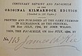 Centenary reprint and facsimile of the 'Kilmarnock Edition' 1886.jpg 3.829 × 2.602; 1,42 MB
-
 Church in Shortlees - geograph.org.uk - 291109.jpg 640 × 480; 156 KB
-
 Clydesdale Bank, Kilmarnock.jpg 3.428 × 2.017; 3,13 MB
-
 Complete Guide to Heraldry Fig668.png 870 × 600; 106 KB
-
 Construction Work at Shortlees School - geograph.org.uk - 292512.jpg 640 × 480; 151 KB
-
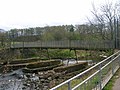 Deansuspensionbridge.JPG 2.288 × 1.712; 1,28 MB
-
 Derelict industrial building - geograph.org.uk - 1480487.jpg 640 × 480; 85 KB
-
 East Ayrshire Council Flowerbed and welcome sign.jpg 2.304 × 1.728; 1,21 MB
-
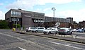
 East Ayrshire Council Headquarters - geograph.org.uk - 85506.jpg 640 × 466; 54 KB
-
 East Stand, Rugby Park, Kilmarnock.jpg 1.600 × 1.067; 492 KB
-
 EastAyrshireCouncil2012.jpg 600 × 600; 38 KB
-
 Entrance to Kilmarnock Cemetery (geograph 5077143) (cropped).jpg 1.462 × 942; 348 KB
-
 Entrance to Kilmarnock Cemetery (geograph 5077143).jpg 1.878 × 1.209; 493 KB
-
 Flowerbank Early Childhood Centre, Kilmarnock, Scotland.jpg 3.264 × 2.448; 1,11 MB
-

-
 Grange Academy building, Kilmarnock.jpg 1.600 × 1.066; 1,16 MB
-
 Grange Academy, Kilmarnock.jpg 2.304 × 1.728; 1,37 MB
-
 GreaterKilmarnock.jpg 632 × 465; 138 KB
-
 HALO building at night.png 863 × 562; 869 KB
-
 HALO Building Kilmarnock.jpg 2.794 × 2.589; 1,62 MB
-
 HALO Building, Kilmarnock, Scotland, Sept 23.jpg 982 × 941; 329 KB
-
 HALO Building, Kilmarnock, Scotland, September 2023.jpg 1.170 × 926; 1,08 MB
-
 Halo Kilmarnock Building.jpg 3.145 × 2.288; 1,64 MB
-
 HALO Kilmarnock, September 2023.jpg 1.170 × 929; 949 KB
-
 HALO Park, Kilmarnock, Scotland.jpg 498 × 744; 158 KB
-
 Hillhead Primary School - geograph.org.uk - 174489.jpg 640 × 480; 80 KB
-
 Hotel in Kilmarnock - geograph.org.uk - 264902.jpg 640 × 446; 56 KB
-
 Hurlford Cross, Scotland.jpg 5.184 × 3.456; 7,29 MB
-
 Jacobite broadside - William Boyd, 4th Earl of Kilmarnock (1702- 17460).jpg 2.500 × 5.719; 8,17 MB
-
 James Hamilton Academy, Kilmarnock (2).jpg 2.304 × 1.728; 1,25 MB
-
 James Hamilton Academy, Kilmarnock (3).jpg 4.032 × 2.236; 1,22 MB
-
 James Hamilton Academy, Kilmarnock.jpg 2.187 × 916; 541 KB
-
 JHA Blazer.jpg 464 × 620; 55 KB
-
 John Nisbet, Covenanter martyr, New Laigh Kirk, Kilmarnock, East Ayrshire.jpg 2.236 × 2.566; 1,5 MB
-
 John Wilson's printing press, Kilrmarnock, East Ayrshire.jpg 4.608 × 3.456; 3,38 MB
-
 Johnnie Walker Bond, Kilmarnock.jpg 1.878 × 1.218; 541 KB
-
 Johnnie Walker statue, Kilmarnock, Scotland.jpg 3.456 × 5.184; 7,76 MB
-
 Killie Pies and Peas.jpg 4.725 × 3.092; 7,64 MB
-
 Kilmarnock Academy original building, 2017.jpg 2.304 × 1.728; 1,24 MB
-
 Kilmarnock and Irvine Valley C Ward Map 2011.svg 901 × 577; 117 KB
-
 Kilmarnock Communion Cup 1778.JPG 1.712 × 2.288; 944 KB
-
 Kilmarnock Corporation coat of arms (geograph 2163482).jpg 640 × 394; 117 KB
-
 Kilmarnock during lockdown, 2020.jpg 1.534 × 2.048; 745 KB
-
 Kilmarnock Infirmary.jpg 400 × 254; 51 KB
-
 Kilmarnock Montage New @017.jpg 595 × 842; 839 KB
-
 Kilmarnock montage.jpg 565 × 826; 683 KB
-
 Kilmarnock mural, 2023.jpg 750 × 1.121; 673 KB
-
 Kilmarnock Railway Station 2016.jpg 1.920 × 1.280; 1,36 MB
-
 Kilmarnock rootop view1.jpg 2.848 × 2.134; 1,12 MB
-
 Kilmarnock v Queen of the South.jpg 4.032 × 3.024; 3,73 MB
-
 Kilmarnock War Memorial.jpg 2.848 × 2.134; 1,12 MB
-
 Kilmarnock's John Finnie Street decorative carvings, town centre area, East Ayrshire.jpg 3.744 × 3.352; 1,84 MB
-
 Kilmarnock's John Finnie Street from the station, town centre area, East Ayrshire.jpg 4.896 × 3.672; 3,1 MB
-
 Kilmarnock1819.jpg 700 × 500; 118 KB
-
 Kilmarnock1995.jpg 640 × 417; 77 KB
-
 Kilmarnock2012 (cropped).jpg 479 × 308; 38 KB
-
 Kilmarnock2012.jpg 480 × 640; 72 KB
-
 Kilmarnockcarpark.JPG 1.232 × 1.632; 445 KB
-
 Kilmarnockmainst.JPG 1.632 × 1.232; 427 KB
-
 KilmarnockMontage.jpg 360 × 502; 84 KB
-
 KilmarnockPresent.jpg 603 × 449; 76 KB
-
 KilmarnockRegeneration.jpg 600 × 458; 74 KB
-
 KilmarnockSept2011Sunset.jpg 640 × 480; 42 KB
-
 KilmarnockView.jpg 640 × 429; 152 KB
-
 King Street, Kilmarnock, 1900.png 1.000 × 632; 1,1 MB
-
 King Street, Kilmarnock, East Ayrshire, Scotland.jpg 3.671 × 2.206; 2,27 MB
-
 King Street, Kilmarnock.jpg 1.920 × 1.280; 1,59 MB
-
 Kirkstyle Primary School - geograph.org.uk - 166115.jpg 640 × 479; 88 KB
-
 Klin Group, Kilmarnock.jpg 417 × 640; 130 KB
-
 Lidl, Kilmarnock - geograph.org.uk - 5067871.jpg 1.920 × 1.280; 368 KB
-
 Loanhead Primary School, Kilmarnock, Scotland.jpg 2.304 × 1.728; 1,22 MB
-
 Loudon Academy, Galston.jpg 800 × 511; 108 KB
-
 Marie Macklin CBE.jpg 269 × 322; 12 KB
-

-
 Microtech Kilmarnock.jpg 1.600 × 1.067; 1,31 MB
-
 Minor Road to Earlston - geograph.org.uk - 325082.jpg 640 × 478; 187 KB
-
 Moorfield Industrial Estate - geograph.org.uk - 178486.jpg 640 × 480; 76 KB
-
 Morrisons, Kilmarnock.jpg 1.600 × 1.066; 1,05 MB
-
 Munro Avenue, Bonnyton, Kilmarnock.jpg 2.773 × 1.910; 1 MB
-
 NCN Millennium Milepost MP1085 Kilmarnock.jpeg 480 × 640; 128 KB
-
 Netherland Access point.JPG 2.288 × 1.712; 1,29 MB
-
 Netherland railway looking to Bargour.jpg 1.712 × 2.288; 1,34 MB
-
 Northcraig Reservoir.jpg 2.978 × 2.533; 1,09 MB
-
 NS4138 - Bonnyton Church - Kilmarnock.jpg 1.350 × 900; 279 KB
-
 NS4138 - Bonnyton Fish & Chips - Kilmarnock.jpg 1.350 × 900; 699 KB
-
 NS4138 - Houses on Bonnyton Road.jpg 800 × 535; 65 KB
-
 NS4238 - John Finnie Street, Kilmarnock.jpg 2.000 × 1.333; 2,06 MB
-
 NS4238 - Mason & Murphy - Kilmarnock.jpg 1.600 × 1.067; 1,26 MB
-
 NS4238 - Station Clock, Kilmarnock.jpg 1.920 × 1.280; 1,54 MB
-
 Old building of Kilmarnock Academy.jpg 2.304 × 1.728; 1,36 MB
-
 Old stone gatepiers, Bonnyton Road, Kilmarnock.jpg 1.707 × 975; 867 KB
-
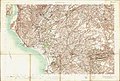 Ordnance Survey One-Inch Sheet 22 Kilmarnock, Published 1906.jpg 12.412 × 8.365; 13,66 MB
-
 Ordnance Survey One-Inch Sheet 67 Ayr, Published 1964 2.jpg 8.940 × 10.712; 20,03 MB
-
 Ordnance Survey One-Inch Sheet 67 Ayr, Published 1964.jpg 8.489 × 9.865; 11,31 MB
-
 Ordnance Survey One-Inch Sheet 78 Kilmarnock & Ayr, Published 1925.jpg 12.243 × 9.307; 21,46 MB
-
 Ordnance Survey Town Plans Kilmarnock Paisley Edinburgh, Published 1948.jpg 2.700 × 3.650; 1,1 MB
-
 Pair of old stone gatepiers, Bonnyton Road, Kilmarnock.jpg 1.585 × 823; 601 KB
-
 Paisley Arts Centre (geograph 3523519).jpg 1.600 × 1.067; 599 KB
-
 Park and Poplars - geograph.org.uk - 143708.jpg 479 × 640; 123 KB
-
 Park Hotel - geograph.org.uk - 2164363.jpg 640 × 361; 108 KB
-
 Police Station, Kilmarnock - geograph.org.uk - 1610376.jpg 640 × 480; 89 KB
-
 Pylons near East Wardlaw - geograph.org.uk - 287830.jpg 640 × 480; 48 KB
-
 Railway bridge on the B7073 - geograph.org.uk - 170802.jpg 640 × 507; 111 KB
-
 Red Hedge Near Gateside - geograph.org.uk - 291102.jpg 566 × 404; 297 KB
-
 Retail Park, Kilmarnock, Scotland.jpg 640 × 396; 52 KB
-
 Riccarton loop near Queens Drive, Kilmarnock. Looking towards Kay Park Junction.JPG 2.647 × 2.880; 4,35 MB
-
 Rough hedge, smooth hedge - geograph.org.uk - 170759.jpg 640 × 470; 59 KB
-
 Rugby Park, Kilmarnock, late 2018.jpg 1.024 × 768; 158 KB
-
 Scene of Kilmarnock stabbings, Feb 2021.jpg 2.016 × 1.512; 576 KB
-
 Scotia, Kilmarnock.jpg 1.600 × 1.067; 1,36 MB
-
 Scott-Ellis family burial ground, Dean Castle, Kilmarnock, East Ayrshire.jpg 4.398 × 3.156; 5,6 MB
-
 Services on the Kilmarnock by-pass - geograph.org.uk - 170797.jpg 640 × 450; 58 KB
-
 Sheriff Court House, Kilmarnock - geograph.org.uk - 1610382.jpg 640 × 480; 69 KB
-
 Simon's Burn - geograph.org.uk - 325005.jpg 478 × 640; 205 KB
-
 Small Wood Near Craigie Road - geograph.org.uk - 291106.jpg 640 × 480; 113 KB
-
 SouthHamiltonStreet.jpg 640 × 429; 144 KB
-
 St Josephs Academy, Kilmarnock.jpg 3.648 × 2.511; 2,46 MB
-
 Struthers Farm, Kilmarnock.JPG 4.608 × 3.456; 5,54 MB
-
 Supermarket, Kilmarnock - geograph.org.uk - 1441038.jpg 640 × 480; 62 KB
-
 The Bringan Ford Kilmarnock.JPG 2.288 × 1.712; 1,32 MB
-
 The Cotton Mill - Travel Inn - geograph.org.uk - 166125.jpg 640 × 479; 79 KB
-
 The Dean Castle and dower house, Kilmarnock, East Ayrshire.jpg 4.499 × 3.127; 4,22 MB
-
 The Edge of Kilmarnock - geograph.org.uk - 291115.jpg 640 × 480; 160 KB
-
 The HALO building, Kilmarnock.jpg 2.926 × 2.135; 1,48 MB
-
 The Kilmarnock Rifles.png 1.000 × 627; 682 KB
-
 The Kilmarnock Water in the town centre area, East Ayrshire.jpg 4.896 × 3.672; 9,01 MB
-
 The Laigh Kirk, Kilmarnock, East Ayrshire.jpg 3.690 × 2.696; 1,85 MB
-
 The New Laigh Kirk, Kilmarnock, East Ayrshire.jpg 4.217 × 2.472; 1,9 MB
-
 The New Mill weir on the River Irvine.JPG 4.608 × 3.456; 8,26 MB
-
 The players who won the 1881–82 Ayrshire Cup for Kilmarnock Portland.png 1.024 × 1.252; 2,08 MB
-
 The Robert Burns World Federation HQ, Kilmarnock, East Ayrshire. 2021.jpg 3.098 × 2.609; 1,84 MB
-
 The Robert Burns World Federation HQ, Kilmarnock, East Ayrshire. View west.jpg 4.097 × 2.400; 2,22 MB
-
 The Robert Burns World Federation HQ, Kilmarnock, East Ayrshire.jpg 2.369 × 2.592; 1,33 MB
-
 The Strand Kilmarnock.png 1.000 × 700; 812 KB
-
 The Twa Dogs, Robert Burns poetry. Kilmarnock Cross, East Ayrshire.jpg 3.337 × 1.995; 2,07 MB
-
 The Twa Dogs, Robert Burns. Kilmarnock Cross, East Ayrshire.jpg 2.631 × 1.674; 1,42 MB
-
 Tilia europea leaf with fungal bloom.JPG 2.108 × 1.638; 1,11 MB
-
 Tilia europea underside of a fungal bloom leaf.JPG 2.029 × 1.594; 1,2 MB
-
 Train Station Panorama.jpg 6.708 × 2.115; 7,96 MB
-
 University Hospital Crosshouse entrance.jpg 2.829 × 1.809; 688 KB
-
 View of Kilmarnock, September 2023 (cropped).jpg 1.170 × 584; 721 KB
-
 View of Kilmarnock, September 2023.jpg 1.170 × 804; 943 KB
-
 Waste site by the Kilmarnock bypass - geograph.org.uk - 170778.jpg 640 × 480; 131 KB
-
 Webhelp, Kilmarnock, Scotland.jpg 3.352 × 1.905; 1,18 MB
-
 Welcome to Bonnyton (2).jpg 1.170 × 1.559; 1,53 MB
-
 Welcome to Bonnyton.jpg 714 × 919; 213 KB
-
 Welcometokilmarnock2008.jpg 2.848 × 2.134; 1,2 MB
-
 West high church kilmarnock.jpg 1.024 × 771; 375 KB
-
 William McIllvanney Campus, Kilmarnock.jpg 2.569 × 2.572; 1,81 MB
-
 William McIllvanney campus, November 2018 (cropped).jpg 2.593 × 1.683; 994 KB
-
 William McIllvanney campus, November 2018.jpg 4.031 × 2.622; 1,93 MB
-
 Willowbank School, Kilmarnock.jpg 5.184 × 3.456; 5,23 MB
_Traffic_lights_on_Bonnyton_Road.jpg)


_(cropped).jpg)
.jpg)


.jpg)
.jpg)
.jpg)


.jpg)


.jpg)


.jpg)


.jpg)


.jpg)


.jpg)

