Category:Kilrush
Zur Navigation springen
Zur Suche springen
Deutsch: Kilrush ( irisch: Cill Rois) ist eine Stadt in der Grafschaft Clare, Irland, mit 2694 Einwohnern (2006).
English: Kilrush is a coastal town in County Clare, Ireland. It is located near the mouth of the River Shannon in the south-west of the county.
Français : Kilrush (Cill Rois en irlandais) est une ville du comté de Clare en République d'Irlande.
Gaeilge: Baile in Éirinn is ea Cill Rois. Tá an baile suite ar chósta thiar na tíre i g Contae an Chláir.
Italiano: Kilrush (Cill Rois in gaelico irlandese) è un centro abitato costiero del Clare, nell'Irlanda occidentale.
Nederlands: Kilrush ( Iers-Gaelisch: Cill Rois) is een Iers kustplaatsje in zuid-west County Clare, nabij de monding van de rivier Shannon.
Stadt in der Grafschaft Clare, Irland   | |||||
| Medium hochladen | |||||
| Ist ein(e) | |||||
|---|---|---|---|---|---|
| Ort | County Clare, Munster, Irland | ||||
| Liegt am oder im Gewässer | |||||
| Einwohnerzahl |
| ||||
| Fläche |
| ||||
| Höhe über dem Meeresspiegel |
| ||||
| offizielle Website | |||||
 | |||||
Unterkategorien
Es werden 5 von insgesamt 5 Unterkategorien in dieser Kategorie angezeigt:
In Klammern die Anzahl der enthaltenen Kategorien (K), Seiten (S), Dateien (D)
Medien in der Kategorie „Kilrush“
Folgende 37 Dateien sind in dieser Kategorie, von 37 insgesamt.
-
 Admiralty Chart No 1547 Shannon Carrigaholt to Scattery, Published 1843.jpg 19.493 × 11.245; 18,34 MB
-
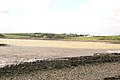
 Aylevarroo - geograph.org.uk - 12919.jpg 640 × 480; 99 KB
-
 Ballymacrinan Bay - geograph.org.uk - 13266.jpg 640 × 426; 79 KB
-
 BillPost Processing Services - geograph.org.uk - 12611.jpg 640 × 426; 127 KB
-
 Converted warehouse, Kilrush - geograph.org.uk - 4684226.jpg 2.958 × 3.084; 1,42 MB
-
 Crotty's Pub, Kilrush - geograph.org.uk - 4684213.jpg 2.950 × 3.035; 1,46 MB
-
 Ennis Rd - geograph.org.uk - 5929420.jpg 1.024 × 628; 72 KB
-
 Frances Street - geograph.org.uk - 1514855.jpg 640 × 457; 167 KB
-
 Frances Street - geograph.org.uk - 1514907.jpg 640 × 457; 169 KB
-
 Hector Street - geograph.org.uk - 1514908.jpg 640 × 457; 181 KB
-
 Henry Street - geograph.org.uk - 1514867.jpg 640 × 457; 134 KB
-
 Henry Street - geograph.org.uk - 1514881.jpg 640 × 457; 164 KB
-
 Henry Street Kilrush - geograph.org.uk - 4683906.jpg 4.000 × 3.000; 1,99 MB
-
 Houses on Frances Street Kilrush - geograph.org.uk - 4684241.jpg 4.000 × 2.000; 898 KB
-
 Houses on north side of Frances Street - geograph.org.uk - 4684223.jpg 4.000 × 2.000; 1,18 MB
-
 Kilrush - 5 Moore Street - Sarah's World Toy Shop - geograph.org.uk - 3053835.jpg 2.845 × 1.897; 2,74 MB
-
 Kilrush Business Centre - geograph.org.uk - 4684237.jpg 4.000 × 2.235; 1,65 MB
-
 Kilrush coat of arms.png 1.978 × 2.148; 348 KB
-
 Kilrush Dolphins - geograph.org.uk - 85579.jpg 600 × 409; 44 KB
-
 Kilrush Marina - geograph.org.uk - 1514935.jpg 640 × 457; 149 KB
-
 Kilrush town centre - geograph.org.uk - 1514885.jpg 640 × 457; 164 KB
-
 Kilrush Town Hall - geograph.org.uk - 6121380.jpg 5.184 × 3.888; 4,86 MB
-
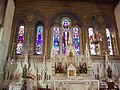 Kilrush-altar.jpg 600 × 450; 66 KB
-
 Merchant's Quay - geograph.org.uk - 1514929.jpg 640 × 457; 160 KB
-
 Moore Street - geograph.org.uk - 1514893.jpg 640 × 457; 172 KB
-
 Moore Street - geograph.org.uk - 1514896.jpg 640 × 457; 161 KB
-
 N67 - N68 junction, Kilrush - geograph.org.uk - 5929416.jpg 1.024 × 681; 101 KB
-
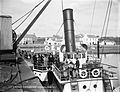 S.S. Shannon (8203181040).jpg 2.000 × 1.532; 1,48 MB
-
 Service cover - geograph.org.uk - 1514870.jpg 640 × 457; 167 KB
-
 St. Senan's Well - geograph.org.uk - 12684.jpg 640 × 480; 94 KB
-
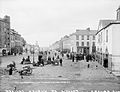 The Square, Kilrush, Co.Clare (5436106639).jpg 2.000 × 1.528; 1,47 MB
-
 Toler Street - geograph.org.uk - 1514862.jpg 640 × 457; 158 KB
-
 Tullabrack Lake - geograph.org.uk - 14154.jpg 640 × 480; 110 KB
-
 Vandeleur St - geograph.org.uk - 5929422.jpg 1.024 × 681; 76 KB
-
 Vandeleur Street - geograph.org.uk - 1514874.jpg 640 × 457; 171 KB
-
 Yachts at Cappagh Pier - geograph.org.uk - 12687.jpg 640 × 480; 113 KB
-
 Aylevarroo Caravan Park - geograph.org.uk - 12917.jpg 640 × 480; 103 KB


.jpg)


.jpg)


