Category:Kincardine O'Neil
Jump to navigation
Jump to search
village in Aberdeenshire, Scotland, UK  | |||||
| Upload media | |||||
| Instance of | |||||
|---|---|---|---|---|---|
| Location |
| ||||
 | |||||
English: Kincardine O'Neil is one of the oldest villages in Aberdeenshire, in the northeast of Scotland. It is situated between Banchory and Aboyne. The village is known locally as Kinker.
Subcategories
This category has the following 2 subcategories, out of 2 total.
B
- Broombrae Farm (4 F)
H
- Hillhead summit (34 F)
Media in category "Kincardine O'Neil"
The following 99 files are in this category, out of 99 total.
-

-
 Balnacraig House - geograph.org.uk - 77554.jpg 640 × 427; 77 KB
-
 Beech Hedge - geograph.org.uk - 1127275.jpg 640 × 480; 111 KB
-
 Bend in driveway to Kincardine O'Neil - geograph.org.uk - 1123029.jpg 640 × 480; 118 KB
-
 Bend in track from Gordonstone - geograph.org.uk - 1181315.jpg 640 × 480; 99 KB
-
 Church of Scotland - geograph.org.uk - 802601.jpg 640 × 480; 116 KB
-
 Church of Scotland, Kincardine O'Neil - geograph.org.uk - 1123068.jpg 640 × 480; 128 KB
-

-
 Converted steading at Lower Craigton - geograph.org.uk - 1352595.jpg 545 × 401; 67 KB
-
 Cottages in Kincardine O' Neil - geograph.org.uk - 1026630.jpg 567 × 425; 125 KB
-
 Deeside Drove Roads.jpg 2,338 × 1,653; 330 KB
-
 Dogleg in Pitmurchie road - geograph.org.uk - 248502.jpg 640 × 480; 75 KB
-
 Dogleg in Pitmurchie road - geograph.org.uk - 248504.jpg 640 × 480; 82 KB
-
 Drainage ditch near Stranduff - geograph.org.uk - 1136013.jpg 640 × 480; 84 KB
-
 Drinking fountain in Kincardine O'Neil - geograph.org.uk - 802611.jpg 480 × 640; 111 KB
-
 Drinking trough, Kincardine O' Neil - geograph.org.uk - 1026611.jpg 425 × 567; 152 KB
-
 Driveway to Kincardine O'Neil - geograph.org.uk - 1122811.jpg 640 × 480; 77 KB
-
 East end of Kincardine O'Neil - geograph.org.uk - 1230453.jpg 640 × 480; 67 KB
-
 Field by Gordonstone - geograph.org.uk - 1181239.jpg 640 × 480; 76 KB
-
 Ford cottage - geograph.org.uk - 249833.jpg 640 × 480; 135 KB
-
 Forest edge by Gordonstone - geograph.org.uk - 1181246.jpg 640 × 480; 97 KB
-
 Gatehouse to Kincardine House - geograph.org.uk - 802605.jpg 640 × 480; 115 KB
-

-
 Gordonstone - geograph.org.uk - 1181248.jpg 640 × 480; 92 KB
-
 Gordonstone - geograph.org.uk - 1181262.jpg 640 × 480; 108 KB
-
 House in 'Kinkers' - geograph.org.uk - 1230430.jpg 640 × 480; 83 KB
-
 Junction to Lower Craigton - geograph.org.uk - 1122786.jpg 640 × 469; 103 KB
-
 Kincardine Lodge - geograph.org.uk - 1123050.jpg 640 × 447; 81 KB
-
 Kincardine O' Neil war memorial - geograph.org.uk - 1026577.jpg 567 × 425; 174 KB
-
 Kincardine O'Neil Post Office - geograph.org.uk - 1230409.jpg 640 × 480; 62 KB
-
 Kincardine O'Neil School - geograph.org.uk - 1123073.jpg 640 × 480; 68 KB
-
 Kinkardine O'Neil, St Mary's Kirk (ruin).jpg 3,008 × 2,000; 5.1 MB
-
 KoN Hospital Site 6 7 14.jpg 3,302 × 2,377; 3.2 MB
-
 Kon Plan 1.jpg 526 × 457; 287 KB
-
 Kon Plan 2.jpg 1,270 × 829; 1.01 MB
-
 Kon Plan 3.jpg 9,342 × 5,377; 4.36 MB
-
 KoN Wiki 12 7 14.jpg 3,072 × 2,048; 4.1 MB
-
 KoN-1.jpg 2,192 × 1,550; 3.37 MB
-
 KoN-10.jpg 1,571 × 1,807; 3.4 MB
-
 KoN-100.jpg 3,072 × 2,048; 4.75 MB
-
 KoN-1000.jpg 1,566 × 2,564; 4.89 MB
-
 Lane to Stranduff - geograph.org.uk - 1127384.jpg 640 × 480; 101 KB
-
 Letter-box for Crook Tree farm - geograph.org.uk - 249065.jpg 640 × 480; 96 KB
-
 Lodge Croft, near Strandff - geograph.org.uk - 1136021.jpg 640 × 480; 84 KB
-
 Lower Craigton - geograph.org.uk - 1122800.jpg 640 × 480; 134 KB
-
 Lower Craigton - geograph.org.uk - 1352587.jpg 640 × 480; 147 KB
-
 Lower Craigton and steadings - geograph.org.uk - 1123041.jpg 640 × 471; 67 KB
-
 Marshy ground near Pitmurchie Road - geograph.org.uk - 1181366.jpg 640 × 480; 116 KB
-
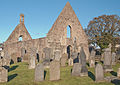
 Medieval church, Kincardine O' Neil - geograph.org.uk - 1026623.jpg 567 × 425; 106 KB
-
 Medieval church, Kincardine O' Neil - geograph.org.uk - 1026626.jpg 425 × 567; 130 KB
-
 Mineral and vegetable - geograph.org.uk - 1181408.jpg 640 × 480; 109 KB
-
 New access to water treatment plant - geograph.org.uk - 1123130.jpg 640 × 480; 90 KB
-
 Old Smiddy, Kincardine O'Neil - geograph.org.uk - 94139.jpg 640 × 480; 123 KB
-
 Old Toll house, Kincardine O'Neil.jpg 640 × 370; 46 KB
-

-
 Pine trees - geograph.org.uk - 1181337.jpg 640 × 480; 102 KB
-
 Plantation edge - geograph.org.uk - 1135994.jpg 640 × 480; 103 KB
-
 Public road near Stranduff - geograph.org.uk - 1181413.jpg 640 × 480; 76 KB
-
 Road from Broombrae to Pitmurchie - geograph.org.uk - 1136966.jpg 640 × 480; 114 KB
-
 Ross's Cottage - geograph.org.uk - 1136876.jpg 640 × 480; 142 KB
-
 St Erchard's Well - geograph.org.uk - 1352580.jpg 640 × 480; 169 KB
-
 Stone pile and derelict drinking trough - geograph.org.uk - 1181254.jpg 640 × 480; 124 KB
-
 Tanglewood - geograph.org.uk - 1181420.jpg 640 × 480; 146 KB
-
 Terraced cottages in 'Kinkers' - geograph.org.uk - 1230420.jpg 640 × 480; 56 KB
-
 The Main Street in Kincardine O'Neil - geograph.org.uk - 866941.jpg 640 × 480; 85 KB
-
 The Old Smiddy - geograph.org.uk - 1478989.jpg 640 × 480; 111 KB
-
 Track east from Stranduff - geograph.org.uk - 1127388.jpg 640 × 480; 138 KB
-
 Track from Minew to Pitmurchie Road. - geograph.org.uk - 1181403.jpg 640 × 480; 104 KB
-
 Track to Gordonstone - geograph.org.uk - 1181307.jpg 640 × 480; 115 KB
-
 Track to Gordonstone and Minew - geograph.org.uk - 1135978.jpg 640 × 480; 119 KB
-

-

-
 View from Lodge Croft junction - geograph.org.uk - 1136885.jpg 640 × 480; 97 KB
-
 View NW from Pitmurchie road. - geograph.org.uk - 1135989.jpg 640 × 480; 109 KB
-
 View south from near Ross's Cottage - geograph.org.uk - 1136880.jpg 640 × 480; 97 KB
-
 View towards Gordonstone-Minew junction - geograph.org.uk - 1181322.jpg 640 × 480; 106 KB
-
 View towards Minew farmhouse - geograph.org.uk - 1181356.jpg 640 × 480; 88 KB
-
 View west from near Stranduff - geograph.org.uk - 1127383.jpg 640 × 480; 75 KB
-
 Woodland edge - geograph.org.uk - 1181344.jpg 640 × 480; 105 KB
-
 A bend in the river at Kincardine O'Neil - geograph.org.uk - 1219552.jpg 640 × 429; 125 KB
-
 A93 out of Kincardine O'Neil - geograph.org.uk - 1123118.jpg 640 × 480; 71 KB
-
 Ancient Church, Kincardine O'Neil - geograph.org.uk - 7331.jpg 621 × 406; 99 KB
-
 Approach to Kincardine O'Neil - geograph.org.uk - 1123035.jpg 640 × 480; 117 KB
-
 Birkhall, Ballogie - geograph.org.uk - 77556.jpg 640 × 389; 61 KB
-
 Episcopal Church, Kincardine O'Neil - geograph.org.uk - 248665.jpg 640 × 480; 89 KB
-
 Fishing the Dee - geograph.org.uk - 249820.jpg 640 × 480; 92 KB
-
 Gordon Arms Hotel, Kincardine O'Neil. - geograph.org.uk - 112381.jpg 640 × 434; 131 KB
-
 Kincardine woods - geograph.org.uk - 248698.jpg 640 × 480; 109 KB
-
 Leyton farmhouse - geograph.org.uk - 249062.jpg 640 × 378; 50 KB
-
 Lodge Croft at Stranduff junction - geograph.org.uk - 248495.jpg 640 × 410; 62 KB
-
 Lower Craigton - geograph.org.uk - 248678.jpg 640 × 490; 64 KB
-
 The River Dee at Kincardine O'Neil. - geograph.org.uk - 112384.jpg 640 × 437; 162 KB
-
 The track from Balnacraig House - geograph.org.uk - 249466.jpg 480 × 640; 78 KB
-

-
 View of Hill of Fare - geograph.org.uk - 248492.jpg 640 × 480; 43 KB
-
 View of Hill of Fare - geograph.org.uk - 249069.jpg 640 × 480; 61 KB
-
 View of the River Dee - geograph.org.uk - 249461.jpg 640 × 480; 52 KB
-
 View of Westhall - geograph.org.uk - 248688.jpg 640 × 480; 54 KB
-
 View over Upper Craigton - geograph.org.uk - 248714.jpg 640 × 432; 43 KB


.jpg)


