Category:Kirkland, Lancashire
Jump to navigation
Jump to search
English: Kirkland is a civil parish located on the banks of the River Wyre midway between Preston and Lancaster in the English county of Lancashire. It is also the historic name of the village of Churchtown within the parish.
civil parish in Lancashire, England  | |||||
| Upload media | |||||
| Instance of | |||||
|---|---|---|---|---|---|
| Location | Wyre, Lancashire, North West England, England | ||||
 | |||||
Subcategories
This category has only the following subcategory.
C
Media in category "Kirkland, Lancashire"
The following 72 files are in this category, out of 72 total.
-
 A 586, Tarnacre Lane - geograph.org.uk - 2251563.jpg 1,600 × 1,200; 449 KB
-
 A6 Preston Lancaster New Road - geograph.org.uk - 6089102.jpg 1,024 × 770; 147 KB
-
 A6 southbound at Nook - geograph.org.uk - 6089104.jpg 1,024 × 769; 166 KB
-
 Ains Pool - geograph.org.uk - 5491517.jpg 1,024 × 768; 169 KB
-
 Ains Pool with flood protection dykes - geograph.org.uk - 5491519.jpg 1,024 × 768; 201 KB
-
 Ainspool Bridge into Churchtown - geograph.org.uk - 4151574.jpg 1,500 × 983; 146 KB
-
 Beck Between Ainscough and Churchtown - geograph.org.uk - 1110127.jpg 640 × 426; 124 KB
-
 Bridge Across The Ains Pool - geograph.org.uk - 1529009.jpg 640 × 480; 98 KB
-
 Church Square - geograph.org.uk - 2528314.jpg 640 × 480; 219 KB
-
 Church Street, Churchtown - geograph.org.uk - 5043643.jpg 1,280 × 959; 837 KB
-
 Church Street, The Punchbowl - geograph.org.uk - 2528321.jpg 1,280 × 960; 482 KB
-
 Churchtown sewage works - geograph.org.uk - 1041137.jpg 640 × 479; 95 KB
-
 Churchtown Village Cross - geograph.org.uk - 2528325.jpg 640 × 853; 275 KB
-
 Confluence of the Calder and Wyre - geograph.org.uk - 5994104.jpg 720 × 540; 97 KB
-
 Cragg Farmhouse - geograph.org.uk - 2242709.jpg 3,072 × 2,304; 1.44 MB
-
 Cross House Farm - geograph.org.uk - 1858464.jpg 1,024 × 673; 90 KB
-
 Dewlay Creamery - geograph.org.uk - 1110153.jpg 640 × 426; 104 KB
-
 Entrance drive to Cheese factory - geograph.org.uk - 1858475.jpg 1,024 × 771; 211 KB
-
 Farmland at Kirkland Hall - geograph.org.uk - 1110137.jpg 640 × 426; 141 KB
-
 Footbridge across the River Wyre - geograph.org.uk - 5043616.jpg 1,280 × 960; 1.09 MB
-
 Footbridge near Churchtown sewage works - geograph.org.uk - 1041134.jpg 640 × 479; 148 KB
-
 Footpath at Kirkland Hall Farm - geograph.org.uk - 5994145.jpg 739 × 540; 77 KB
-
 Footpath by Kirkland Hall - geograph.org.uk - 5994148.jpg 720 × 540; 131 KB
-
 Garstang Parish Church of St Michaels, Churchtown - geograph.org.uk - 5815487.jpg 2,914 × 3,599; 7.61 MB
-
 Gate at Gibsons Farm - geograph.org.uk - 5491511.jpg 1,024 × 768; 175 KB
-
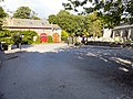
 Horns Inn, Churchtown - geograph.org.uk - 1000996.jpg 620 × 464; 172 KB
-
 I know my place - geograph.org.uk - 5043636.jpg 1,280 × 935; 1.13 MB
-
 Kirkland and Catterall Memorial Hall - geograph.org.uk - 1001006.jpg 640 × 480; 157 KB
-
 Large Wind Turbine - geograph.org.uk - 2919763.jpg 1,600 × 1,200; 255 KB
-
 Longmoor Lane at Crag Farm - geograph.org.uk - 5959492.jpg 4,102 × 2,134; 7.27 MB
-
 Longmoor Lane heading towards Nateby - geograph.org.uk - 4153751.jpg 1,500 × 999; 195 KB
-
 Longmoor Lane near Cragg Farm - geograph.org.uk - 6089098.jpg 1,024 × 769; 116 KB
-
 Longmoor Lane near Gibson's Farm - geograph.org.uk - 2764628.jpg 1,600 × 1,262; 251 KB
-
 Longmoor Lane near Nateby - geograph.org.uk - 4153753.jpg 900 × 599; 89 KB
-
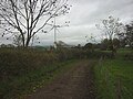
 New Access Track - geograph.org.uk - 1192068.jpg 640 × 426; 154 KB
-
 Ordnance Survey Cut Mark - geograph.org.uk - 3927797.jpg 480 × 640; 110 KB
-
 Ordnance Survey Cut Mark - geograph.org.uk - 3934249.jpg 640 × 480; 103 KB
-
 Paddock at Greenacres Farm - geograph.org.uk - 2742619.jpg 640 × 480; 100 KB
-
 Pasture off Longmoor Lane - geograph.org.uk - 5167223.jpg 1,024 × 683; 282 KB
-
 Pile of Papier Mache - geograph.org.uk - 1192038.jpg 640 × 426; 130 KB
-
 Pipeline Works - geograph.org.uk - 1528957.jpg 640 × 426; 81 KB
-
 Rear of Hamilton House Farm - geograph.org.uk - 1041130.jpg 640 × 479; 96 KB
-
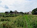
 River Wyre - geograph.org.uk - 3932845.jpg 2,560 × 1,286; 1.97 MB
-
 River Wyre - geograph.org.uk - 5043627.jpg 1,280 × 960; 1.36 MB
-
 Road Junction - geograph.org.uk - 1001002.jpg 640 × 480; 157 KB
-
 Sharples Quarry - geograph.org.uk - 5816025.jpg 4,592 × 3,056; 7.58 MB
-
 Sign for The Punchbowl, Churchtown - geograph.org.uk - 5994118.jpg 480 × 640; 153 KB
-

-
 St Helen's Church, Churchtown - geograph.org.uk - 2528199.jpg 1,280 × 960; 849 KB
-
 St Helen's Church, Churchtown - geograph.org.uk - 5043625.jpg 1,280 × 960; 947 KB
-
 St Helen's Churchyard - geograph.org.uk - 2528319.jpg 640 × 477; 217 KB
-
 St. Helen's Church, Churchtown - geograph.org.uk - 5043613.jpg 1,280 × 960; 956 KB
-
 The A586 through Churchtown - geograph.org.uk - 4151580.jpg 1,500 × 999; 200 KB
-
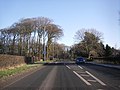
 The A6 heading to Lancaster - geograph.org.uk - 4153748.jpg 1,500 × 974; 178 KB
-
 The A6 runs past Garstang - geograph.org.uk - 4153749.jpg 1,500 × 966; 142 KB
-
 The Avenue approaching the A6 - geograph.org.uk - 4151583.jpg 1,500 × 993; 310 KB
-
 The graveyard at St Helens Church - geograph.org.uk - 5815797.jpg 2,883 × 4,333; 7.14 MB
-
 The Horns - geograph.org.uk - 2528329.jpg 640 × 479; 193 KB
-
 The Horns Country Inn - geograph.org.uk - 5815439.jpg 4,473 × 2,530; 6.85 MB
-
 The Horns Inn - geograph.org.uk - 2528334.jpg 640 × 479; 223 KB
-
 The Kirkland and Catterall Memorial Hall - geograph.org.uk - 4624622.jpg 4,592 × 3,056; 5.91 MB
-
 The Parish Church of St Helen, Churchtown - geograph.org.uk - 2528201.jpg 1,280 × 957; 616 KB
-
 The Punchbowl at Churchtown - geograph.org.uk - 5491525.jpg 1,024 × 768; 171 KB
-
 The Punchbowl, Churchtown - closed - geograph.org.uk - 5994122.jpg 640 × 480; 70 KB
-
 The River Wyre from the footbridge - geograph.org.uk - 5815579.jpg 4,592 × 3,056; 6.83 MB
-
 The track to Sharples Quarry - geograph.org.uk - 5815998.jpg 4,349 × 2,724; 7.88 MB
-
 Track to Cross House Farm - geograph.org.uk - 1110157.jpg 640 × 426; 124 KB
-
 Track to Gibson's Farm - geograph.org.uk - 1529030.jpg 640 × 480; 73 KB
-
 Track to Gibson's Farm - geograph.org.uk - 5994151.jpg 640 × 480; 116 KB
-
 Village Cross, Churchtown - geograph.org.uk - 2525376.jpg 426 × 640; 216 KB
-
 Wedding bus - geograph.org.uk - 5043630.jpg 1,280 × 959; 829 KB
-
 Wind turbine - geograph.org.uk - 5043639.jpg 1,280 × 960; 690 KB


