Category:Kirkpatrick-Fleming
Aller à la navigation
Aller à la recherche
village britannique  | |||||
| Téléverser des médias | |||||
| Nature de l’élément | |||||
|---|---|---|---|---|---|
| Lieu |
| ||||
 | |||||
Sous-catégories
Cette catégorie comprend 4 sous-catégories, dont les 4 ci-dessous.
K
- Kirkpatrick railway station (4 F)
Média dans la catégorie « Kirkpatrick-Fleming »
Cette catégorie comprend 45 fichiers, dont les 45 ci-dessous.
-
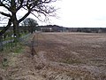 Activity centre Broats Moss. - geograph.org.uk - 143071.jpg 640 × 480 ; 97 kio
-
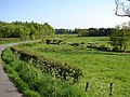 Blackcleugh, Gair - geograph.org.uk - 800968.jpg 640 × 480 ; 110 kio
-
 Boundary, Branteth - geograph.org.uk - 414210.jpg 640 × 480 ; 89 kio
-
 Bridge over the Redstones Burn - geograph.org.uk - 415167.jpg 640 × 480 ; 109 kio
-
 Broats Farm - geograph.org.uk - 711642.jpg 640 × 480 ; 80 kio
-
 Broats Farm - geograph.org.uk - 715865.jpg 640 × 473 ; 74 kio
-
 Cleughside - geograph.org.uk - 412801.jpg 640 × 483 ; 56 kio
-
 Concrete farm road - geograph.org.uk - 711610.jpg 480 × 640 ; 75 kio
-
 East Lodge, Springkell Estate - geograph.org.uk - 800970.jpg 640 × 480 ; 122 kio
-
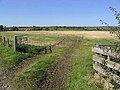 Entrance to a stubble field - geograph.org.uk - 571839.jpg 640 × 480 ; 111 kio
-
 Exposed rock, Branteth - geograph.org.uk - 414203.jpg 600 × 450 ; 95 kio
-
 Farmland near Hillhead Farm - geograph.org.uk - 571865.jpg 640 × 480 ; 104 kio
-
 Farmland to the east of Southwoodhead - geograph.org.uk - 571845.jpg 640 × 480 ; 105 kio
-
 Farmland, Chapelhill - geograph.org.uk - 413014.jpg 640 × 480 ; 87 kio
-
 Gallhills - geograph.org.uk - 387556.jpg 640 × 441 ; 67 kio
-
 Gateway to a pasture field - geograph.org.uk - 571851.jpg 640 × 480 ; 120 kio
-
 Grazing cattle to the west of Riggheads - geograph.org.uk - 574917.jpg 633 × 449 ; 106 kio
-
 High Muir - geograph.org.uk - 387512.jpg 640 × 480 ; 83 kio
-
 Inside Bruce's cave - geograph.org.uk - 111074.jpg 640 × 480 ; 98 kio
-
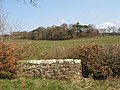
 Kirkconnel Church and Cemetery, Springkell - geograph.org.uk - 679426.jpg 640 × 480 ; 112 kio
-
 Kirkconnel Kirk - geograph.org.uk - 1396412.jpg 427 × 640 ; 257 kio
-
 Kirkconnel Kirk - geograph.org.uk - 1396447.jpg 528 × 640 ; 317 kio
-
 Kirkconnel Kirk - geograph.org.uk - 1396456.jpg 427 × 640 ; 252 kio
-
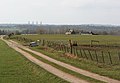
 Kirkpatrick-Fleming - geograph.org.uk - 210226.jpg 640 × 480 ; 298 kio
-
 Kirkpatrick-Fleming 2019 01.jpg 4 160 × 3 120 ; 848 kio
-
 Kirkpatrick-Fleming 2019 02.jpg 4 160 × 3 120 ; 1,27 Mio
-
 Kirkpatrick-Fleming 2019 03.jpg 4 160 × 3 120 ; 1,77 Mio
-
 Kirkpatrick-Fleming 2019 04.jpg 4 160 × 3 120 ; 925 kio
-
 Kirkpatrick-Fleming 2019 05.jpg 4 160 × 3 120 ; 829 kio
-
 Kirkpatrick-Fleming 2019 06.jpg 4 160 × 3 120 ; 949 kio
-
 Large grazing field - geograph.org.uk - 571859.jpg 640 × 480 ; 119 kio
-
 Livestock field - geograph.org.uk - 571856.jpg 640 × 480 ; 97 kio
-
 Logan Burn - geograph.org.uk - 387611.jpg 640 × 538 ; 111 kio
-
 Mapa dg cille phàdraig nam fleamach.jpg 2 004 × 1 363 ; 599 kio
-

-
 Redstones Burn - geograph.org.uk - 387624.jpg 640 × 480 ; 90 kio
-
 Ride, Robin's Wood - geograph.org.uk - 414154.jpg 640 × 480 ; 136 kio
-
 Robert the Bruce's cave - geograph.org.uk - 111071.jpg 640 × 480 ; 169 kio
-
 Sarkshields - geograph.org.uk - 387617.jpg 640 × 480 ; 89 kio
-
 Scrubland at Raeburn Flow - geograph.org.uk - 571848.jpg 640 × 480 ; 118 kio
-
 Sheep field South of Blackwoodridge - geograph.org.uk - 261530.jpg 640 × 480 ; 98 kio
-
 Southwoodhead Farm - geograph.org.uk - 1313576.jpg 640 × 480 ; 82 kio
-
 Stubble field - geograph.org.uk - 574910.jpg 640 × 480 ; 122 kio
-
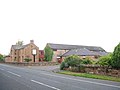 The Mill Hotel, Roman Road - geograph.org.uk - 565354.jpg 640 × 480 ; 60 kio
-
 The Mill Hotel, Roman Road - geograph.org.uk - 565357.jpg 640 × 480 ; 85 kio


