Category:Klickitat County, Washington
Salti al navigilo
Salti al serĉilo
Counties of Washington (state): Adams · Asotin · Benton · Chelan · Clallam · Clark · Columbia · Cowlitz · Douglas · Ferry · Franklin · Garfield · Grant · Grays Harbor · Island · Jefferson · King · Kitsap · Kittitas · Klickitat · Lewis · Lincoln · Mason · Okanogan · Pacific · Pend Oreille · Pierce · San Juan · Skagit · Skamania · Snohomish · Spokane · Stevens · Thurston · Wahkiakum · Walla Walla · Whatcom · Whitman · Yakima
county in the state of Washington, United States   | |||||
| Alŝuti plurmedion | |||||
| Estas | |||||
|---|---|---|---|---|---|
| Nomita laŭ | |||||
| Loko | Vaŝingtonio, Pacifika nordokcidento, Vaŝingtonio, Pacific States Region | ||||
| Ĉefurbo | |||||
| Dato de fondo aŭ kreo |
| ||||
| Loĝantaro |
| ||||
| Areo |
| ||||
| oficiala retejo | |||||
 | |||||
Subkategorioj
Ĉi tiu kategorio havas la 23 jenajn subkategoriojn, el 23 entute.
B
- Bickleton, Washington (3 D)
C
- Catherine Creek Day Use Area (1 P, 57 D)
D
G
K
L
M
P
S
- Sam Hill Memorial Bridge (15 D)
- Simcoe Mountains (1 D)
T
- Trout Lake, Washington (2 D)
W
- White Salmon, Washington (6 D)
Dosieroj en kategorio “Klickitat County, Washington”
La jenaj 75 dosieroj estas en ĉi tiu kategorio, el 75 entute.
-
 7879 1168923600 - Flickr - drewj1946.jpg 934 × 618; 374 KB
-
 Abandoned aluminium refinery east of The Dalles (10488714175).jpg 2 048 × 1 536; 892 KB
-
 Aerial view of Arlington, OR 01.jpg 4 288 × 2 848; 9,36 MB
-
 Along Washington State Highway 14 east of Columbia Gorge (10755373043).jpg 1 115 × 755; 462 KB
-
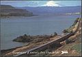 Amtrak Pioneer in Columbia River Gorge (2), 1980s postcard.jpg 1 156 × 796; 159 KB
-

-
 Big Horn wind farm 2013.JPG 4 288 × 2 848; 2,98 MB
-
 Camassia spp Near Klickitat River Valley.jpg 3 024 × 4 032; 25,52 MB
-
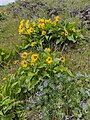 Carey's Balsamroot & Lupine Near Klickitat River Valley.jpg 3 024 × 4 032; 28,64 MB
-
 Carey's Balsamroot Near Klickitat River Valley.jpg 3 024 × 4 032; 25,63 MB
-
-
 Columbia River - Mitchell Point Viewpoint pano 01.jpg 6 527 × 2 480; 4,07 MB
-
 Columbia River from Mitchell Point Overlook 01.jpg 4 288 × 2 848; 6,91 MB
-
 Columbia River from Mitchell Point Overlook 02.jpg 4 288 × 2 848; 7,05 MB
-
 Columbia River near The Dalles.jpg 2 063 × 999; 236 KB
-
 ColumbiaRiverRowenaView.jpg 2 700 × 1 800; 1,14 MB
-
 Crawler crane preparing for drivetrain lift.JPG 2 848 × 4 288; 2,87 MB
-
 CRH Memaloose Overlook winter.jpg 2 048 × 1 536; 1,06 MB
-
 Deschutes River SRA - OR - 2002.04.jpg 1 792 × 1 200; 916 KB
-
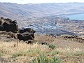 East of The Dalles, Washington side (10488900033).jpg 2 048 × 1 536; 1 006 KB
-
 East of The Dalles, Washington side of Columbia (10488724924).jpg 2 048 × 1 536; 906 KB
-
 Electric Family Values (122981113).jpeg 2 048 × 1 463; 400 KB
-
 Fall in the spring (17729661910).jpg 1 912 × 2 880; 3,25 MB
-
 Firefighter at Cougar Creek Fire (20876410259).jpg 4 608 × 3 456; 1 007 KB
-
 Fly in Klickitat County, Washington (cropped).jpg 621 × 457; 297 KB
-
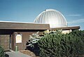 Goldendale Observatory (10755156104).jpg 1 115 × 755; 460 KB
-
 Herland Way entrance, closer-up.jpg 4 032 × 3 024; 5,74 MB
-
 Herland Way entrance.jpg 4 032 × 3 024; 5,58 MB
-
 Ice Plant-2.jpg 1 382 × 619; 582 KB
-
 Indian Camus (16923372277).jpg 4 891 × 3 363; 10,85 MB
-

-

-
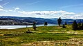
 Klickitat County vast farmlands.jpg 2 592 × 1 944; 588 KB
-
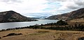
 Klickitat County, WA, USA - panoramio (1).jpg 1 936 × 2 592; 1,92 MB
-
 Klickitat County, WA, USA - panoramio (2).jpg 3 002 × 1 992; 1,95 MB
-
 Klickitat County, WA, USA - panoramio (3).jpg 1 936 × 2 592; 1,76 MB
-
 Klickitat County, WA, USA - panoramio (4).jpg 2 592 × 1 936; 1,89 MB
-
 Klickitat Desert Parsley Near Klickitat River Valley.jpg 3 024 × 4 032; 28,11 MB
-
 Klickitat downtown.jpg 3 872 × 2 592; 4,84 MB
-
 Klickitat R 2365.jpg 4 608 × 3 072; 4,39 MB
-
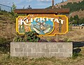 Klickitat sign.jpg 3 177 × 2 496; 2,57 MB
-
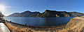
 Klickitat Valley WA.jpg 6 584 × 1 972; 6,93 MB
-
 Klickitat, Washington - panoramio.jpg 1 024 × 767; 436 KB
-
 Large-Flowered Tritelia Near Klickitat River Valley.jpg 3 024 × 4 032; 24,36 MB
-
 Looking across Columbia River from Mitchell Point Overlook 01.jpg 4 288 × 2 848; 6,11 MB
-
 Looking across Columbia River from Mitchell Point Overlook 02.jpg 4 288 × 2 848; 6,36 MB
-
 Looking across Columbia River from Mitchell Point Overlook 03.jpg 4 288 × 2 848; 6,76 MB
-
 Looking down on Wishram, WA. (10755359443).jpg 1 115 × 755; 519 KB
-
 Lupine Near Klickitat River Valley.jpg 3 024 × 4 032; 27,81 MB
-
 Maryhill (10755147576).jpg 1 115 × 755; 417 KB
-
 Maryhill (10755363363).jpg 1 115 × 755; 485 KB
-
 Maryhill Stonehenge (March 2014) 004PNG.png 4 752 × 3 168; 19,21 MB
-
 Maryhill Stonehenge (March 2014) 005PNG.png 4 752 × 3 168; 16,59 MB
-
 Maryhill Winery Ampitheater.jpg 4 032 × 3 024; 3,05 MB
-
 Maryhill Winery Entrance.jpg 4 032 × 3 024; 5 MB
-
 Maryhill Winery Pergola.jpg 3 024 × 4 032; 3,25 MB
-
 Montia perfoliata (Miner's lettuce) - Flickr - brewbooks.jpg 3 264 × 1 836; 1,8 MB
-
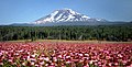 Mount Adams 2.jpg 3 326 × 1 700; 1,3 MB
-
 Multi-use trail - Flickr - brewbooks.jpg 3 264 × 1 836; 3,15 MB
-
 Near Bickleton, WA. (10755058685).jpg 1 115 × 755; 439 KB
-
 Near Bickleton, WA. (10755141626).jpg 1 115 × 755; 444 KB
-
 Near Lyle, WA, The Dalles Highway Bridge, 2008 - panoramio.jpg 3 072 × 2 304; 1,25 MB
-

-
 Rattlesnake at Juniper site (11074584105).jpg 3 072 × 2 304; 1,49 MB
-
-
 Sheep Grazing - Washington - DPLA - 0082541187351b402e5007754c30e24b.jpg 4 775 × 3 843; 2,29 MB
-
 Switching ReloadxRP - Flickr - drewj1946.jpg 1 006 × 690; 569 KB
-
 Train passing Mitchell Point Overlook 03.jpg 4 288 × 2 848; 6,37 MB
-
 Trout Lake Country Inn - Flickr - brewbooks.jpg 4 288 × 2 416; 2,89 MB
-
 Trout Lake, United States (Unsplash).jpg 4 096 × 2 727; 3,33 MB
-
 Turbine row.JPG 2 848 × 4 288; 1,86 MB
-
 USA Klickitat County, Washington age pyramid.svg 520 × 600; 7 KB
-
 USFWS Fire Briefing at Conboy Lake NWR (22719746550).jpg 3 264 × 2 448; 2,78 MB
-
 USFWS Prescribed Fire at Conboy Lake NWR (22489393517).jpg 3 264 × 2 448; 2,4 MB
-
 Winery's Awards.jpg 3 024 × 4 032; 3,48 MB

.jpg)

.jpg)
,_1980s_postcard.jpg)
.jpg)


_on_a_beutiful_spring_day._-_Flickr_-_brewbooks.jpg)


.jpg)
.jpg)
.jpeg)
.jpg)
.jpg)
.jpg)
.jpg)


.jpg)
_(cropped).jpeg)
.jpeg)

.jpg)
.jpg)
.jpg)
.jpg)


.jpg)

.jpg)
.jpg)
_004PNG.png)
_005PNG.png)


_-_Flickr_-_brewbooks.jpg)


.jpg)
.jpg)

.jpeg)
.jpg)


.jpg)


.jpg)
.jpg)
