Category:Klosterteich Schildau
Jump to navigation
Jump to search
| Object location | | View all coordinates using: OpenStreetMap |
|---|
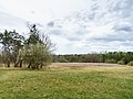
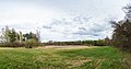
natural monument area in Belgern-Schildau Municipality, Saxony, Germany  | |||||
| Upload media | |||||
| Instance of | |||||
|---|---|---|---|---|---|
| Part of | |||||
| Located in protected area | |||||
| Location | Schildau, Belgern-Schildau, Nordsachsen, Saxony, Germany | ||||
| Heritage designation |
| ||||
| Area |
| ||||
 | |||||
Media in category "Klosterteich Schildau"
The following 3 files are in this category, out of 3 total.
-
 Schildau Klosterteich-01.jpg 5,195 × 3,896; 7.04 MB
-
 Schildau Klosterteich-02.jpg 10,358 × 5,452; 21.29 MB
-
 Schildau Klosterteich.jpg 5,333 × 4,000; 10.87 MB

