Category:Koepelkerk, Hoorn
Jump to navigation
Jump to search
| Camera location | | View all coordinates using: OpenStreetMap |
|---|
church building in Hoorn, Netherlands  | |||||
| Upload media | |||||
| Instance of | |||||
|---|---|---|---|---|---|
| Location | Hoorn, North Holland, Netherlands | ||||
| Street address |
| ||||
| Architect | |||||
| Heritage designation |
| ||||
| Inception |
| ||||
| Religion or worldview | |||||
 | |||||
|
This is a category about rijksmonument number 333537
|
| Address |
|
Subcategories
This category has only the following subcategory.
I
- Interior of Koepelkerk (Hoorn) (66 F)
Media in category "Koepelkerk, Hoorn"
The following 28 files are in this category, out of 28 total.
-
 20180719 184 hoorn.jpg 4,000 × 6,000; 10.19 MB
-
 Binnenstad met kermis, Hoorn.jpg 5,472 × 3,648; 6.29 MB
-
 Bouwwerkzaamheden aan de Cyriacuskerk in Hoorn, Inventarisnummer NL-HlmNHA 25874.JPG 2,069 × 1,459; 807 KB
-
 Christusbeeld Grote Kerk in Hoorn.jpg 960 × 1,280; 131 KB
-
 Gezicht naar het West. - Hoorn - 20116710 - RCE.jpg 1,185 × 1,200; 249 KB
-
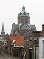
 Grote Kerk en Koepelkerk (3874758162).jpg 4,257 × 2,827; 1.85 MB
-
 Hoorn Koepelkerk 016.jpg 1,536 × 2,048; 731 KB
-
 Hoorn Koepelkerk.jpg 2,448 × 3,264; 2.04 MB
-
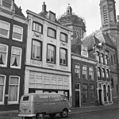
 Hoorn, straatzicht de Roode Steen foto1 2011-04-17 09.59.JPG 4,416 × 3,312; 11.17 MB
-
 Hoorn, the street "Grote Noord", view to the Koepelkerk.JPG 1,353 × 1,701; 582 KB
-
 Hoornse Hop met Hoorn op de achtergrond.jpg 3,888 × 2,592; 3.41 MB
-
 Kazuifel - Hoorn - 20115967 - RCE.jpg 1,036 × 1,200; 437 KB
-
 Kelk - Hoorn - 20115959 - RCE.jpg 939 × 1,200; 161 KB
-
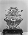
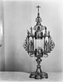 Kleine monstrans - Hoorn - 20115962 - RCE.jpg 931 × 1,200; 198 KB
-
 Koepelkerk bij nacht.jpg 5,965 × 3,977; 14.27 MB
-
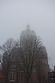
 Koepelkerk Hoorn in de mist 01.jpg 2,592 × 3,888; 4.13 MB
-
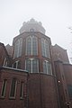 Koepelkerk Hoorn in de mist 02.jpg 2,592 × 3,888; 2.12 MB
-
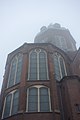 Koepelkerk Hoorn in de mist 03.jpg 2,592 × 3,888; 2.05 MB
-
 Koepelkerk Hoorn in de mist 04.jpg 2,592 × 3,888; 2.35 MB
-
 Koepelkerk Hoorn vanaf toren Grote Kerk.jpg 2,953 × 3,938; 3.84 MB
-
 Koorkap - Hoorn - 20115970 - RCE.jpg 963 × 1,200; 254 KB
-
 Nederland Hoorn 02.jpg 6,016 × 4,016; 5.59 MB
-
 Overzicht koor - Hoorn - 20115974 - RCE.jpg 959 × 1,200; 201 KB
-
 Reliquair voetstukken - Hoorn - 20115964 - RCE.jpg 945 × 1,200; 204 KB
-
 Voorgevel - Hoorn - 20115986 - RCE.jpg 957 × 1,200; 242 KB
-
 Voorgevel - Hoorn - 20115987 - RCE.jpg 937 × 1,200; 210 KB
-
 Voorgevels - Hoorn - 20116487 - RCE.jpg 1,195 × 1,200; 322 KB
-
 Wierookscheepje - Hoorn - 20115961 - RCE.jpg 1,200 × 949; 164 KB


.jpg)


