Category:Koltur
Zur Navigation springen
Zur Suche springen

färöische Insel   | |||||
| Medium hochladen | |||||
| Ist ein(e) | |||||
|---|---|---|---|---|---|
| Ist Teil von | |||||
| Ort | Kommune Tórshavn, Streymoy (Region) | ||||
| Liegt am oder im Gewässer | |||||
| Höchster Punkt |
| ||||
| Einwohnerzahl |
| ||||
| Fläche |
| ||||
| Höhe über dem Meeresspiegel |
| ||||
 | |||||
Unterkategorien
Diese Kategorie enthält folgende Unterkategorie:
In Klammern die Anzahl der enthaltenen Kategorien (K), Seiten (S), Dateien (D)
K
- Koltur (village) (10 D)
Medien in der Kategorie „Koltur“
Folgende 37 Dateien sind in dieser Kategorie, von 37 insgesamt.
-
 Dark Mountain Range (255910577).jpeg 2.048 × 1.023; 258 KB
-
 Detailed map koltur 2006.jpg 687 × 671; 146 KB
-
 Detailed map koltur.jpg 567 × 451; 47 KB
-
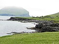 East Coast of Koltur Faroe Islands.JPG 4.608 × 3.456; 6,1 MB
-
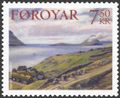
 Faroe stamp 375 koltur.jpg 300 × 201; 12 KB
-
 Faroe stamp 533 Uti a Heyggi, Velbastadur.jpg 612 × 502; 74 KB
-
 Ferry Norröna passing Koltur, Faroe Islands.JPG 2.560 × 1.704; 893 KB
-
 Hestur and Koltur.jpg 2.579 × 1.568; 444 KB
-
 Is03228-Koltur.jpg 3.008 × 2.000; 1,68 MB
-
 Kirkjubour, hestur and koltur, faroe islands.jpg 1.022 × 684; 54 KB
-
 Kirkjubøur Wikivoyage Banner.JPG 2.429 × 358; 179 KB
-
 Kirkjubøur, Faroe Islands (7).JPG 2.429 × 1.579; 727 KB
-
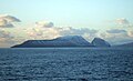
 Koltur - panoramio.jpg 2.220 × 1.632; 580 KB
-
 Koltur 1899.jpg 345 × 500; 31 KB
-
 Koltur 2.jpg 800 × 599; 31 KB
-
 Koltur 2014 view towards south and Hestur.JPG 4.608 × 3.456; 6,14 MB
-
 Koltur Faroe Islands the West Cost.JPG 3.456 × 4.608; 6,83 MB
-
 Koltur from Norðradalur.jpg 4.032 × 3.024; 2,9 MB
-
 Koltur Island-pjt.jpg 6.050 × 3.403; 10,24 MB
-
 Koltur kort.png 569 × 501; 29 KB
-
 Koltur View towards North June 2014.JPG 4.608 × 3.456; 6,5 MB
-
 Koltur View towards North.JPG 4.608 × 3.456; 5,45 MB
-
 Koltur, Faroe Islands (2).JPG 2.311 × 1.387; 545 KB
-
 Koltur, Faroe Islands (3).JPG 2.560 × 1.704; 1,97 MB
-
 Koltur, Faroe Islands (4).JPG 2.560 × 1.704; 937 KB
-
 Koltur, Faroe Islands.jpg 1.616 × 560; 434 KB
-
 Koltur, Faroe Islands.JPG 2.560 × 1.704; 679 KB
-
 Norðadalsskarð - panoramio.jpg 5.561 × 3.103; 10,88 MB
-
 Norðradalur, Streymoy 2005.jpg 2.304 × 1.728; 1,4 MB
-
 Norðradalur.jpg 8.917 × 1.645; 3,61 MB
-
 Oyggjarvegur.2010.2.jpg 3.872 × 2.592; 1,42 MB
-
 Position of Koltur on Faroe map.png 688 × 1.035; 19 KB
-
 Sandoy, Trøllhøvdið, Hestur, Koltur and Streymoy Faroe Islands.JPG 3.648 × 2.736; 2,01 MB
-
 Skælingur and the West Coast of Streymoy Faroe Islands.JPG 3.648 × 2.736; 2,1 MB
-
 Sørvágur 2014.JPG 4.608 × 3.456; 6,35 MB
-
 Velbastaður, Faroe Islands (3).JPG 2.560 × 1.704; 1,8 MB
-
 Velbastaður, Faroe Islands (9).JPG 2.560 × 1.704; 1,55 MB
.jpeg)


.JPG)


.JPG)
.JPG)
.JPG)


.JPG)
.JPG)