Category:Koltur
Vai alla navigazione
Vai alla ricerca

isola dell'arcipelago delle faer oer   | |||||
| Carica un file multimediale | |||||
| Istanza di | |||||
|---|---|---|---|---|---|
| Parte di | |||||
| Luogo | Tórshavn Municipality, Streymoy | ||||
| Situato sul mare / lago / fiume | |||||
| Punto più alto |
| ||||
| Popolazione |
| ||||
| Superficie |
| ||||
| Altezza sul mare |
| ||||
 | |||||
Sottocategorie
Questa categoria contiene un'unica sottocategoria, indicata di seguito.
K
- Koltur (village) (10 F)
Pagine nella categoria "Koltur"
Questa categoria contiene un'unica pagina, indicata di seguito.
File nella categoria "Koltur"
Questa categoria contiene 37 file, indicati di seguito, su un totale di 37.
-
 Dark Mountain Range (255910577).jpeg 2 048 × 1 023; 258 KB
-
 Detailed map koltur 2006.jpg 687 × 671; 146 KB
-
 Detailed map koltur.jpg 567 × 451; 47 KB
-
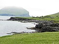 East Coast of Koltur Faroe Islands.JPG 4 608 × 3 456; 6,1 MB
-
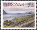
 Faroe stamp 375 koltur.jpg 300 × 201; 12 KB
-
 Faroe stamp 533 Uti a Heyggi, Velbastadur.jpg 612 × 502; 74 KB
-
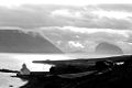
 Ferry Norröna passing Koltur, Faroe Islands.JPG 2 560 × 1 704; 893 KB
-
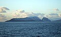 Hestur and Koltur.jpg 2 579 × 1 568; 444 KB
-
 Is03228-Koltur.jpg 3 008 × 2 000; 1,68 MB
-
 Kirkjubour, hestur and koltur, faroe islands.jpg 1 022 × 684; 54 KB
-
 Kirkjubøur Wikivoyage Banner.JPG 2 429 × 358; 179 KB
-
 Kirkjubøur, Faroe Islands (7).JPG 2 429 × 1 579; 727 KB
-
 Koltur - panoramio.jpg 2 220 × 1 632; 580 KB
-
 Koltur 1899.jpg 345 × 500; 31 KB
-
 Koltur 2.jpg 800 × 599; 31 KB
-
 Koltur 2014 view towards south and Hestur.JPG 4 608 × 3 456; 6,14 MB
-
 Koltur Faroe Islands the West Cost.JPG 3 456 × 4 608; 6,83 MB
-
 Koltur from Norðradalur.jpg 4 032 × 3 024; 2,9 MB
-
 Koltur Island-pjt.jpg 6 050 × 3 403; 10,24 MB
-
 Koltur kort.png 569 × 501; 29 KB
-
 Koltur View towards North June 2014.JPG 4 608 × 3 456; 6,5 MB
-
 Koltur View towards North.JPG 4 608 × 3 456; 5,45 MB
-
 Koltur, Faroe Islands (2).JPG 2 311 × 1 387; 545 KB
-
 Koltur, Faroe Islands (3).JPG 2 560 × 1 704; 1,97 MB
-
 Koltur, Faroe Islands (4).JPG 2 560 × 1 704; 937 KB
-
 Koltur, Faroe Islands.jpg 1 616 × 560; 434 KB
-
 Koltur, Faroe Islands.JPG 2 560 × 1 704; 679 KB
-
 Norðadalsskarð - panoramio.jpg 5 561 × 3 103; 10,88 MB
-
 Norðradalur, Streymoy 2005.jpg 2 304 × 1 728; 1,4 MB
-
 Norðradalur.jpg 8 917 × 1 645; 3,61 MB
-
 Oyggjarvegur.2010.2.jpg 3 872 × 2 592; 1,42 MB
-
 Position of Koltur on Faroe map.png 688 × 1 035; 19 KB
-
 Sandoy, Trøllhøvdið, Hestur, Koltur and Streymoy Faroe Islands.JPG 3 648 × 2 736; 2,01 MB
-
 Skælingur and the West Coast of Streymoy Faroe Islands.JPG 3 648 × 2 736; 2,1 MB
-
 Sørvágur 2014.JPG 4 608 × 3 456; 6,35 MB
-
 Velbastaður, Faroe Islands (3).JPG 2 560 × 1 704; 1,8 MB
-
 Velbastaður, Faroe Islands (9).JPG 2 560 × 1 704; 1,55 MB
.jpeg)


.JPG)


.JPG)
.JPG)
.JPG)


.JPG)
.JPG)