Category:Kreuzweg (Pilgramsberg)
Jump to navigation
Jump to search
| Object location | | View all coordinates using: OpenStreetMap |
|---|
This is the category of the Bavarian Baudenkmal (cultural heritage monument) with the ID D-2-78-179-43 (Wikidata)
|
 | |||||
| Upload media | |||||
| Instance of | |||||
|---|---|---|---|---|---|
| Location | Rattiszell, Straubing-Bogen, Lower Bavaria, Bavaria, Germany | ||||
| Street address |
| ||||
| Heritage designation | |||||
 | |||||
Media in category "Kreuzweg (Pilgramsberg)"
The following 22 files are in this category, out of 22 total.
-
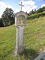
 Kreuz Pilgramsberg.jpg 3,648 × 5,472; 5.85 MB
-
 Kreuzweg Pilgramsberg 1.jpg 3,648 × 5,472; 8.43 MB
-
 Kreuzweg Pilgramsberg 2.jpg 3,648 × 5,472; 7.94 MB
-
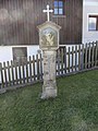
 Kreuzwegstation in Pilgramsberg I.jpg 3,456 × 4,608; 6.35 MB
-
 Kreuzwegstation in Pilgramsberg II.jpg 3,456 × 4,608; 6.21 MB
-
 Kreuzwegstation in Pilgramsberg III.jpg 3,456 × 4,608; 6.44 MB
-
 Kreuzwegstation in Pilgramsberg IV.jpg 3,456 × 4,608; 6.37 MB
-
 Kreuzwegstation in Pilgramsberg IX.jpg 3,456 × 4,608; 6.27 MB
-
 Kreuzwegstation in Pilgramsberg V.jpg 3,456 × 4,608; 6.3 MB
-
 Kreuzwegstation in Pilgramsberg VI.jpg 3,456 × 4,608; 6.38 MB
-
 Kreuzwegstation in Pilgramsberg VII.jpg 3,456 × 4,608; 6.38 MB
-
 Kreuzwegstation in Pilgramsberg VIII.jpg 3,456 × 4,608; 6.26 MB
-
 Kreuzwegstation in Pilgramsberg X.jpg 3,456 × 4,608; 6.4 MB
-
 Kreuzwegstation in Pilgramsberg XI.jpg 3,456 × 4,608; 6.53 MB
-
 Kreuzwegstation in Pilgramsberg XII.jpg 3,456 × 4,608; 6.36 MB
-
 Kreuzwegstation in Pilgramsberg XIII.jpg 3,456 × 4,608; 6.35 MB
-
 Kreuzwegstation in Pilgramsberg XIV.jpg 3,456 × 4,608; 6.22 MB
-
 Kreuzwegstationen in Pilgramsberg (I-IV).jpg 3,456 × 4,608; 6.39 MB
-
 Pilgramsberg Kirchenberg Kreuzweg Treppe.jpg 2,995 × 2,113; 2.66 MB
-
 Pilgramsberg Kirchenberg Kreuzweg XII.jpg 3,264 × 2,448; 3.46 MB
-
 Pilgramsberg Kirchenberg Kreuzweg XIII.jpg 3,144 × 2,358; 3.36 MB
-
 Pilgramsberg Kirchenberg Kreuzweg XIV.jpg 3,264 × 2,448; 2.75 MB


.jpg)


