Category:Kruiskerk (Burgum)
Jump to navigation
Jump to search
| Object location | | View all coordinates using: OpenStreetMap |
|---|
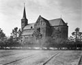
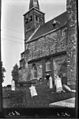
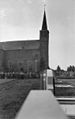
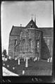
church  | |||||
| Upload media | |||||
| Instance of | |||||
|---|---|---|---|---|---|
| Dedicated to | |||||
| Location | Burgum, Friesland, Netherlands | ||||
| Street address |
| ||||
| Located on street |
| ||||
| Heritage designation |
| ||||
| Inception |
| ||||
 | |||||
Nederlands: Kruiskerk Burgum - Anno 13de eeuw
|
This is a category about rijksmonument number 35634
|
| Address |
|
Subcategories
This category has only the following subcategory.
I
Media in category "Kruiskerk (Burgum)"
The following 46 files are in this category, out of 46 total.
-
 20210609 Kruiskerk1 Burgum.jpg 5,184 × 3,456; 3.77 MB
-
 20210609 Kruiskerk2 Burgum.jpg 3,456 × 5,184; 3.71 MB
-
 Burgum kerk in de sneeuw.JPG 3,072 × 2,304; 2.66 MB
-
 Burgum, de Kruiskerk RM35634 foto2 2015-05-10 11.36.jpg 3,264 × 4,352; 11.16 MB
-
 Burgum, Krústsjerke.jpg 2,212 × 2,278; 2.21 MB
-
 Church of Burgum.jpg 3,264 × 2,448; 3.84 MB
-
 De Kruiskerk Bergum..JPG 4,608 × 3,456; 1.66 MB
-
 Exterieur - Bergum - 20033770 - RCE.jpg 963 × 1,200; 276 KB
-
 Exterieur - Bergum - 20033771 - RCE.jpg 1,200 × 950; 270 KB
-
 Exterieur - Bergum - 20033800 - RCE.jpg 794 × 1,200; 254 KB
-
 Exterieur en details exterieur - Bergum - 20033783 - RCE.jpg 765 × 1,200; 153 KB
-
 Exterieur en details exterieur - Bergum - 20033784 - RCE.jpg 755 × 1,200; 144 KB
-
 Exterieur en details exterieur - Bergum - 20033785 - RCE.jpg 749 × 1,200; 161 KB
-
 Exterieur en details exterieur - Bergum - 20033786 - RCE.jpg 757 × 1,200; 150 KB
-
 Exterieur en details exterieur - Bergum - 20033787 - RCE.jpg 768 × 1,200; 194 KB
-
 Exterieur en details exterieur - Bergum - 20033788 - RCE.jpg 751 × 1,200; 196 KB
-
 Exterieur en details exterieur - Bergum - 20033789 - RCE.jpg 1,200 × 747; 151 KB
-
 Exterieur en details exterieur - Bergum - 20033790 - RCE.jpg 1,200 × 734; 188 KB
-
 Exterieur en details exterieur - Bergum - 20033791 - RCE.jpg 1,200 × 741; 227 KB
-
 Exterieur en details exterieur - Bergum - 20033792 - RCE.jpg 756 × 1,200; 127 KB
-
 Exterieur en details exterieur - Bergum - 20033793 - RCE.jpg 764 × 1,200; 217 KB
-
 Exterieur en details exterieur - Bergum - 20033794 - RCE.jpg 1,200 × 749; 139 KB
-
 Exterieur en details exterieur - Bergum - 20033795 - RCE.jpg 1,200 × 744; 174 KB
-
 Exterieur en details exterieur - Bergum - 20033796 - RCE.jpg 1,200 × 740; 134 KB
-
 Exterieur en details exterieur - Bergum - 20033797 - RCE.jpg 1,200 × 747; 208 KB
-
 Exterieur en details exterieur - Bergum - 20033798 - RCE.jpg 756 × 1,200; 129 KB
-
 Exterieur koor - Bergum - 20033801 - RCE.jpg 786 × 1,200; 248 KB
-
 Exterieur koor - Bergum - 20033802 - RCE.jpg 795 × 1,200; 253 KB
-
 Exterieur TEKENING VAN PLATTEGROND - Bergum - 20260813 - RCE.jpg 1,200 × 1,150; 129 KB
-
 Exterieur vanuit het zuid-oosten - Bergum - 20033768 - RCE.jpg 1,200 × 867; 234 KB
-

-

-
 Exterieur vanuit het zuid-westen - Bergum - 20033769 - RCE.jpg 890 × 1,200; 217 KB
-
 Kerk, exterieur - Bergum - 20033763 - RCE.jpg 1,200 × 944; 290 KB
-
 Kerk, exterieur - Bergum - 20033764 - RCE.jpg 1,200 × 942; 221 KB
-
 Kerk, exterieur - Bergum - 20033765 - RCE.jpg 1,200 × 945; 272 KB
-
 Kruiskerk Burgum.jpg 2,682 × 2,013; 1.41 MB
-
 Overzicht zuidwestgevel met kerktoren en kerkhof - Bergum - 20345871 - RCE.jpg 952 × 1,200; 219 KB
-
 Plattegrond - Bergum - 20033760 - RCE.jpg 1,200 × 894; 246 KB
-
 Plattegrond - Bergum - 20033799 - RCE.jpg 923 × 1,200; 179 KB
-
 Schildering in het 2e gewelf van de toren - Bergum - 20033782 - RCE.jpg 924 × 1,200; 358 KB
-
 Toren van de Kruiskerk Bergum..JPG 3,456 × 4,608; 1.8 MB
-
 Toren, detail - Bergum - 20033761 - RCE.jpg 1,197 × 1,200; 348 KB
-
 Voormalige venster in Toren - Bergum - 20033762 - RCE.jpg 729 × 1,200; 273 KB
-
 Zicht vanuit het oosten - Bergum - 20326211 - RCE.jpg 858 × 1,200; 177 KB
-
 Zicht vanuit het zuiden - Bergum - 20326293 - RCE.jpg 854 × 1,200; 161 KB


