Category:Kruisstraat 10, 's-Hertogenbosch
Jump to navigation
Jump to search
| Object location | | View all coordinates using: OpenStreetMap |
|---|
 | |||||
| Upload media | |||||
| Instance of |
| ||||
|---|---|---|---|---|---|
| Location | 's-Hertogenbosch, North Brabant, Netherlands | ||||
| Street address |
| ||||
| Heritage designation |
| ||||
 | |||||
|
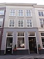
This is a category about rijksmonument number 21699
|
| Address |
|
Media in category "Kruisstraat 10, 's-Hertogenbosch"
The following 4 files are in this category, out of 4 total.
-
 's-Hertogenbosch Rijksmonument 21699 Kruisstraat 10.JPG 2,736 × 3,648; 3.16 MB
-
 Overzicht - 's-Hertogenbosch - 20110279 - RCE.jpg 832 × 1,200; 211 KB
-
 Overzicht - 's-Hertogenbosch - 20110282 - RCE.jpg 824 × 1,200; 193 KB
-
 Overzicht - 's-Hertogenbosch - 20110283 - RCE.jpg 829 × 1,200; 192 KB


