Category:Kumaon Division
Vai alla navigazione
Vai alla ricerca
administrative division of Uttarakhand, India | |||||
| Carica un file multimediale | |||||
| Istanza di |
| ||||
|---|---|---|---|---|---|
| Luogo |
| ||||
| Capitale | |||||
| Commissionato da |
| ||||
| Consiste di | |||||
| Popolazione |
| ||||
| Superficie |
| ||||
| sito web ufficiale | |||||
 | |||||
Sottocategorie
Questa categoria contiene le 6 sottocategorie indicate di seguito, su un totale di 6.
File nella categoria "Kumaon Division"
Questa categoria contiene 41 file, indicati di seguito, su un totale di 41.
-
 AlmoraQuartz Mica SchistStructure- Asymmetric Recumbent Fold.jpg 1 080 × 765; 167 KB
-
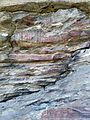
 Ancient Cave Paintings at Lakhudiyar, Almora District, Uttarakhand India - 1.jpeg 3 200 × 2 400; 3,95 MB
-
 Ancient Cave Paintings at Lakhudiyar, Almora District, Uttarakhand India - 2.jpeg 3 200 × 2 400; 3,89 MB
-
 Ancient Cave Paintings at Lakhudiyar, Almora District, Uttarakhand India - 3.jpeg 3 200 × 2 400; 3,47 MB
-
 Ancient Cave Paintings at Lakhudiyar, Almora District, Uttarakhand India - 4.jpeg 3 200 × 2 400; 3,62 MB
-
 Ancient Cave Paintings at Lakhudiyar, Almora District, Uttarakhand India - 5.jpeg 3 200 × 2 400; 3,82 MB
-
 Ancient Cave Paintings at Lakhudiyar, Almora District, Uttarakhand India - 6.jpeg 2 400 × 3 200; 4,6 MB
-
 Artistic Road map of Nainital.jpg 3 555 × 2 341; 3,46 MB
-
 At the break of dawn (19168975402).jpg 4 288 × 2 848; 2,93 MB
-
 Bara bazar, Nainital.jpg 4 032 × 2 704; 4,16 MB
-
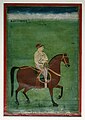 Brooklyn Museum - Baj Bahadur of Kumaon.jpg 545 × 768; 95 KB
-
 Ceiling yantra hut.jpg 871 × 653; 272 KB
-

-
 DSC 0114 Original.jpg 856 × 1 280; 363 KB
-
 Fruiting Barberry (Berberis aristata) bush, Uttarakhand India .jpg 3 200 × 2 400; 3,12 MB
-
 Himalaya, Indian Atlas, sheet 66 (15219000).jpg 28 674 × 20 246; 267,59 MB
-
 Himalayas in the morning light.jpg 1 500 × 465; 167 KB
-
 India Kumaon.png 1 500 × 1 615; 685 KB
-
 Kumaon Garhwal.jpg 650 × 572; 92 KB
-
 Kumaoni people.jpg 960 × 924; 112 KB
-
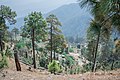 Kumoan village(binsar wild life sanctury).jpg 6 000 × 4 000; 7,55 MB
-
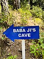 Mahavatar Babaji's Cave Sign.jpg 3 024 × 4 032; 3,05 MB
-
 Mountains in Kumaon, Uttarakhand, India.jpg 9 867 × 3 346; 18,19 MB
-
 Mt.Nandabhanar base camp.jpg 640 × 480; 140 KB
-
 Mule Carrying packed fruit cases, Uttarakhand India .jpg 2 400 × 3 200; 4,1 MB
-
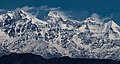 Nanda Devi Peak from Ranikhet.jpg 1 500 × 804; 699 KB
-
 Nath graves.jpg 871 × 655; 235 KB
-
 Northern Bageshwar city.jpg 1 500 × 642; 438 KB
-
 Panorama of Kumaon Peaks as seen from Brahmatal .jpg 7 712 × 2 168; 1,68 MB
-

-
 Parts of Kumaun, N.W. Provinces, and Nepal, Indian Atlas, quarter sheet 66 S.E. (15218000).jpg 16 747 × 12 550; 81,17 MB
-
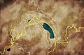
 PINDARI GLACIERMAPENGLISH made by Sumita Roy.png 745 × 1 053; 123 KB
-
 Resin Collection from Chir Pine trees in Uttarakhand, India .jpg 3 200 × 2 400; 4,84 MB
-
 Resin Extraction from Chir Pine .jpg 2 400 × 3 200; 3,78 MB
-
 Roadside shrines along the way to Jageshwar (6133315755).jpg 1 536 × 2 048; 1,46 MB
-
 Roadside shrines along the way to Jageshwar (6133316911).jpg 1 536 × 2 048; 1,42 MB
-
 Roadside shrines along the way to Jageshwar (6133860292).jpg 1 536 × 2 048; 1,41 MB
-
 Roadside shrines along the way to Jageshwar (6133864356).jpg 1 536 × 2 048; 1,62 MB
-
 Time lapse shot of Trishul peak.jpg 2 400 × 1 381; 526 KB
-
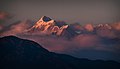
 Trishul peak in the golden hour.jpg 996 × 1 300; 150 KB
-
 कुमाऊँ मण्डल के जिले.png 1 058 × 1 007; 95 KB


.jpg)


_bush,_Uttarakhand_India_.jpg)
.jpg)


.jpg)


.jpg)
.jpg)


.jpg)
.jpg)
.jpg)
.jpg)


