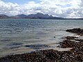
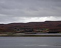
Category:Kyle of Tongue
Zur Navigation springen
Zur Suche springen
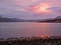
sea loch in Highland, Scotland, UK .jpg) | |||||
| Medium hochladen | |||||
| Ist ein(e) | |||||
|---|---|---|---|---|---|
| Ort | Sutherland, Schottland | ||||
 | |||||
Unterkategorien
Diese Kategorie enthält folgende Unterkategorie:
In Klammern die Anzahl der enthaltenen Kategorien (K), Seiten (S), Dateien (D)
L
- Loch an Dherue (10 D)
Medien in der Kategorie „Kyle of Tongue“
Folgende 102 Dateien sind in dieser Kategorie, von 102 insgesamt.
-
 2011 Schotland Ben Loyal aan Kyle of Tongue 3-06-2011 19-25-02.png 2.914 × 1.821; 8,4 MB
-
 2011 Schotland Hert bij Kyle of Tongue 4-06-2011 16-40-38.png 2.914 × 1.821; 10,36 MB
-
 2011 Schotland Kyle of Tongue Ben Loyal 4-06-2011 16-50-20.png 4.288 × 2.848; 18,53 MB
-
 2011 Schotland Kyle of Tongue brug vanaf Achuvoldrach 4-06-2011 17-02-58.png 4.151 × 2.756; 17 MB
-
 2011 Schotland Kyle of Tongue vanaf het zuiden 4-06-2011 16-42-10.png 4.110 × 2.730; 17,83 MB
-
 2011 Schotland Kyle of Tongue, Melness House 4-06-2011 17-02-07.png 2.914 × 1.821; 7,38 MB
-
 2011 Sutherland Ben Loyal aan Kyle of Tongue 3-06-2011 19-25-02.jpg 2.914 × 1.821; 991 KB
-
 2011 Sutherland Hert bij Kyle of Tongue 4-06-2011 16-40-38.jpg 2.914 × 1.821; 1,77 MB
-
 2011 Sutherland Kyle of Tongue Ben Loyal 4-06-2011 16-50-20.jpg 4.288 × 2.848; 2,1 MB
-
 2011 Sutherland Kyle of Tongue causeway by Achuvoldrach 4-06-2011 17-02-58.jpg 4.151 × 2.756; 1,95 MB
-
 2011 Sutherland Kyle of Tongue vanaf het zuiden 4-06-2011 16-42-10.jpg 4.110 × 2.730; 2,25 MB
-
 2011 Sutherland Kyle of Tongue, Melness House 4-06-2011 17-02-07.jpg 2.914 × 1.821; 794 KB
-
 A bird's view of the Kyle of Tongue causeway - geograph.org.uk - 6356437.jpg 1.600 × 1.069; 932 KB
-
 A view across the Kyle of Tongue - geograph.org.uk - 6284499.jpg 640 × 360; 97 KB
-

-
 Admiralty Chart No 1954 Thurso Bay to the North Minch, Scotland, Published 1896.jpg 15.014 × 8.532; 11,09 MB
-
 Bei Tongue an der nördlichen schottischen Küste - panoramio.jpg 4.320 × 3.240; 1,76 MB
-

-
 Ben Loyal - geograph.org.uk - 394080.jpg 640 × 531; 139 KB
-
 Ben Loyal and the Kyle of Tongue - geograph.org.uk - 54106.jpg 480 × 640; 47 KB
-
 Ben Loyal and the Kyle of Tongue, Sutherland (3-06-2011, 19-25-02).jpg 2.914 × 1.821; 975 KB
-
 Ben Loyal from the Kyle of Tongue - geograph.org.uk - 61115.jpg 640 × 393; 22 KB
-
 Beside the Kyle of Tongue - geograph.org.uk - 2050039.jpg 640 × 480; 76 KB
-
 Breezy weather Achininver beach - geograph.org.uk - 3382115.jpg 1.024 × 577; 110 KB
-

-
 Caisteal Bharraich, Tongue, Scotland - geograph.org.uk - 102467.jpg 640 × 480; 84 KB
-

-
 Castle varrich.JPG 848 × 666; 76 KB
-

-
 Causeway over the Kyle of Tongue - geograph.org.uk - 6356431.jpg 1.600 × 1.067; 1,17 MB
-
 Cemetery on Kyle of Tongue - geograph.org.uk - 1071753.jpg 640 × 427; 50 KB
-
 Coldbackie beach - Kyle of Tongue - geograph.org.uk - 3614937.jpg 1.024 × 768; 97 KB
-
 Disused jetties at Achuvoldrach - geograph.org.uk - 25669.jpg 640 × 480; 76 KB
-
 Disused jetty - Kyle of Tongue. - geograph.org.uk - 1106932.jpg 640 × 427; 58 KB
-

-
 Fields, Tongue - geograph.org.uk - 158660.jpg 640 × 527; 109 KB
-
 Footsteps in the sand - geograph.org.uk - 632175.jpg 640 × 480; 51 KB
-
 Jetty and tidal rocks by Kyle of Tongue - geograph.org.uk - 2403799.jpg 1.000 × 750; 150 KB
-
 Kyle causeway - geograph.org.uk - 94570.jpg 640 × 480; 104 KB
-
 Kyle from bridge - geograph.org.uk - 486017.jpg 640 × 480; 53 KB
-
 Kyle of Tongue - geograph.org.uk - 1146345.jpg 640 × 480; 42 KB
-
 Kyle of Tongue - geograph.org.uk - 1146354.jpg 640 × 480; 52 KB
-
 Kyle of Tongue - geograph.org.uk - 1736043.jpg 2.048 × 1.536; 166 KB
-
 Kyle Of Tongue - geograph.org.uk - 2256266.jpg 1.600 × 1.200; 359 KB
-
 Kyle of Tongue - geograph.org.uk - 2560741.jpg 640 × 480; 75 KB
-
 Kyle of Tongue - geograph.org.uk - 3252011.jpg 2.053 × 1.373; 626 KB
-
 Kyle of Tongue - geograph.org.uk - 4668624.jpg 1.024 × 683; 242 KB
-
 Kyle of Tongue - geograph.org.uk - 6209478.jpg 640 × 427; 81 KB
-
 Kyle of Tongue - geograph.org.uk - 931641.jpg 640 × 480; 57 KB
-
 Kyle of Tongue - geograph.org.uk - 94556.jpg 640 × 480; 74 KB
-
 Kyle of Tongue - geograph.org.uk - 94560.jpg 640 × 480; 99 KB
-
 Kyle of Tongue - geograph.org.uk - 951829.jpg 640 × 203; 19 KB
-
 Kyle of Tongue - Scotland, UK - May 28, 1989 01.jpg 5.273 × 7.910; 25,19 MB
-
 Kyle of Tongue - Scotland, UK - May 28, 1989.jpg 2.900 × 1.859; 1,51 MB
-

-
 Kyle of Tongue and Rabbit Islands - geograph.org.uk - 1809188.jpg 720 × 403; 78 KB
-
 Kyle of Tongue bridge (geograph 5006734) (cropped).jpg 2.128 × 1.601; 968 KB
-
 Kyle of Tongue bridge (geograph 5006734).jpg 3.264 × 2.448; 2,04 MB
-
 Kyle of Tongue causeway before A838 was built (geograph 7110136).jpg 1.024 × 687; 127 KB
-
 Kyle of Tongue Coast - geograph.org.uk - 908237.jpg 640 × 480; 81 KB
-
-
 Kyle of Tongue crossing (7955426098).jpg 1.600 × 739; 669 KB
-
 Kyle of Tongue from road by Ard Thunga - geograph.org.uk - 5174997.jpg 800 × 734; 100 KB
-
 Kyle of Tongue picnic area - geograph.org.uk - 2403807.jpg 1.000 × 750; 180 KB
-
 Kyle of Tongue Shore - geograph.org.uk - 956126.jpg 640 × 480; 99 KB
-

-
 Looking down on the causeway - geograph.org.uk - 9893.jpg 431 × 576; 67 KB
-
 Looking down the Kyle of Tongue - geograph.org.uk - 9892.jpg 576 × 432; 29 KB
-
 Low tide and mudflats - geograph.org.uk - 2403442.jpg 1.000 × 750; 174 KB
-
 Melness burial ground (geograph 4668643).jpg 1.024 × 683; 244 KB
-
 Melness Burial Ground (geograph 5882677).jpg 1.024 × 679; 168 KB
-
 Ordnance Survey One-Inch Sheet 10 Tongue, Published 1947.jpg 12.236 × 11.264; 12,75 MB
-
 Ordnance Survey One-Inch Sheet 10 Tongue, Published 1959.jpg 8.232 × 9.912; 7,9 MB
-
 Ordnance Survey Sheet NC 45 55 Loch Hope, Published 1964.jpg 16.306 × 8.480; 38,18 MB
-
 Seaweed in Kyle of Tongue - geograph.org.uk - 5760238.jpg 648 × 484; 295 KB
-
 Seaweed-covered Rocks in Kyle of Tongue - geograph.org.uk - 5760252.jpg 1.152 × 864; 909 KB
-
 Slipway on the Kyle of Tongue Causeway - geograph.org.uk - 2403449.jpg 1.000 × 750; 216 KB
-
 The Causeway - geograph.org.uk - 3411143.jpg 1.536 × 1.024; 546 KB
-
 The Kyle of Tongue - geograph.org.uk - 1817795.jpg 800 × 544; 102 KB
-
 The Kyle of Tongue - geograph.org.uk - 3575095.jpg 640 × 480; 60 KB
-
 The Kyle of Tongue - geograph.org.uk - 997053.jpg 640 × 412; 54 KB
-
 The Kyle of Tongue - geograph.org.uk - 997057.jpg 640 × 432; 59 KB
-
 The Kyle of Tongue at low tide - geograph.org.uk - 4556687.jpg 2.589 × 1.890; 1,06 MB
-
 The Kyle of Tongue Bridge - geograph.org.uk - 1561531.jpg 640 × 508; 41 KB
-
 The Kyle of Tongue Bridge - geograph.org.uk - 84268 (cropped).jpg 560 × 381; 39 KB
-
 The Kyle of Tongue Bridge - geograph.org.uk - 84268.jpg 640 × 512; 61 KB
-
 The Kyle of Tongue Causeway - geograph.org.uk - 997049.jpg 640 × 417; 62 KB
-
 The Rabbit Islands in Tongue Bay - geograph-5670416.jpg 1.024 × 670; 119 KB
-
 Tongue Youth Hostel. - panoramio.jpg 5.760 × 3.840; 19,07 MB
-
 View across the Kyle of Tongue.jpg 4.320 × 3.240; 4,88 MB
-
 View down Kyle of Tongue - geograph.org.uk - 596789.jpg 640 × 480; 50 KB
-
 View from the road, Kyle of Tongue - geograph.org.uk - 1334.jpg 640 × 480; 226 KB
-
 A view across Tongue - geograph.org.uk - 526610.jpg 640 × 482; 88 KB
-
 Cemetery, Kyle of Tongue - geograph.org.uk - 161213.jpg 640 × 480; 98 KB
-
 Coldbackie - geograph.org.uk - 47575.jpg 640 × 354; 61 KB
-
 Kyle of Tongue bridge - geograph.org.uk - 163704 (cropped).jpg 640 × 306; 36 KB
-
 Kyle of Tongue bridge - geograph.org.uk - 163704.jpg 640 × 480; 72 KB
-
 Kyles of Tongue - geograph.org.uk - 28263.jpg 640 × 480; 54 KB
-
 Slipway - geograph.org.uk - 230557.jpg 640 × 480; 59 KB
-
 Tongue House and Kyle of Tongue - geograph.org.uk - 261522.jpg 640 × 452; 40 KB
-
 Tongue House Pier - geograph.org.uk - 19472.jpg 640 × 480; 81 KB
-
 View from Castle Varrich - geograph.org.uk - 1672.jpg 553 × 414; 37 KB


_(cropped).jpg)
.jpg)
.jpg)


.jpg)


.jpg)
.jpg)


.jpg)


.jpg)


